
MyTopo
Maple Hill SW North Carolina US Topo Map
Couldn't load pickup availability
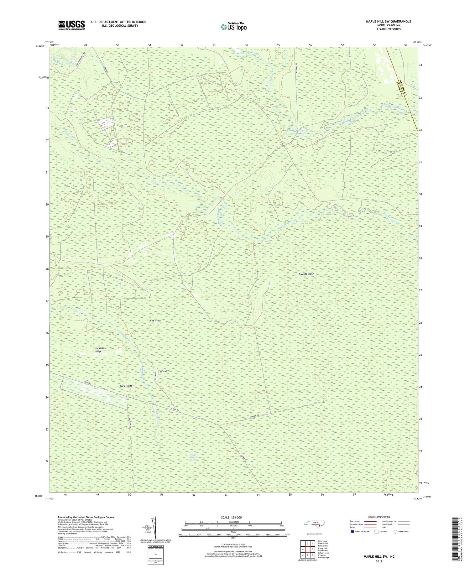
2019 topographic map quadrangle Maple Hill SW in the state of North Carolina. Scale: 1:24000. Based on the newly updated USGS 7.5' US Topo map series, this map is in the following counties: Pender, Onslow. The map contains contour data, water features, and other items you are used to seeing on USGS maps, but also has updated roads and other features. This is the next generation of topographic maps. Printed on high-quality waterproof paper with UV fade-resistant inks.
Quads adjacent to this one:
West: Stag Park
Northwest: Pin Hook
North: Maple Hill
Northeast: Haws Run
East: Folkstone
Southeast: Holly Ridge
South: Topsail
Southwest: Mooretown
Contains the following named places: Back Island, Big Lake, Bryants Ridge, Herring Lake, Juniper Creek, Juniper Swamp, Pine Island, Sandy Run Swamp, Shelter Swamp Creek, Southwest Lake, Southwest Ridge, T Island


