MyTopo
Stag Park North Carolina US Topo Map
Couldn't load pickup availability
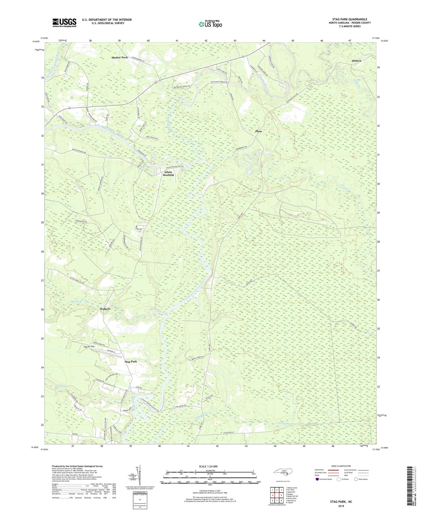
2022 topographic map quadrangle Stag Park in the state of North Carolina. Scale: 1:24000. Based on the newly updated USGS 7.5' US Topo map series, this map is in the following counties: Pender. The map contains contour data, water features, and other items you are used to seeing on USGS maps, but also has updated roads and other features. This is the next generation of topographic maps. Printed on high-quality waterproof paper with UV fade-resistant inks.
Quads adjacent to this one:
West: Burgaw
Northwest: Wallace East
North: Pin Hook
Northeast: Maple Hill
East: Maple Hill SW
Southeast: Topsail
South: Mooretown
Southwest: Rocky Point
This map covers the same area as the classic USGS quad with code o34077e7.
Contains the following named places: Ashes Creek, Bannerman Fire Tower, Burgaw Creek, Came Branch, Cypress Creek, Exeter, Holly Shelter Creek, Jordans Church, Kings Church, Lillington Creek, Mill Pond, Pikes Creek Church, Players, Plear, Sand Hill Church, Shaken, Shaken Creek, Shelter Neck, Stag Air Park, Stag Park, Township of Holly, Walkers, Walkers Store, White Stocking