MyTopo
Topsail North Carolina US Topo Map
Couldn't load pickup availability
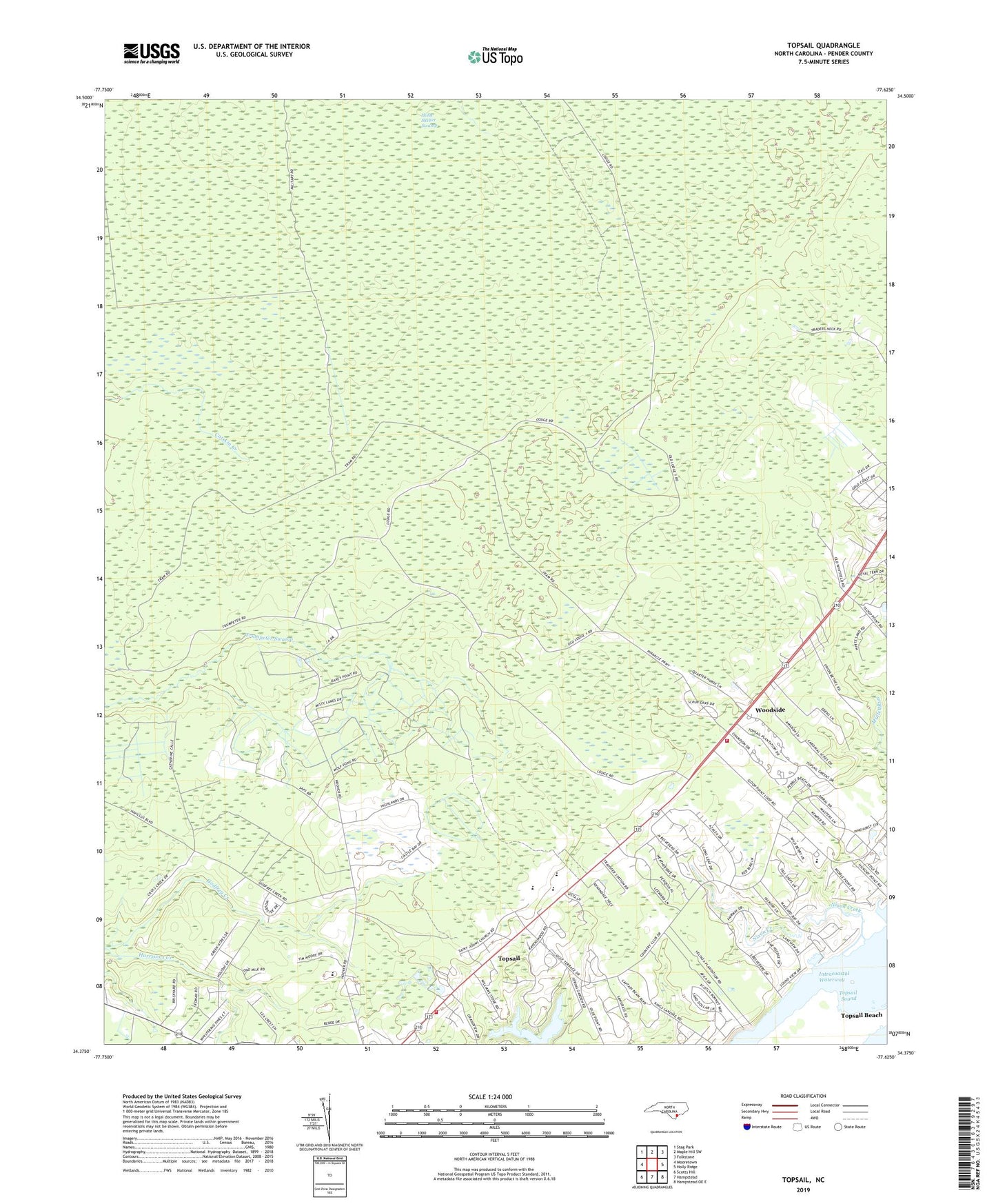
2022 topographic map quadrangle Topsail in the state of North Carolina. Scale: 1:24000. Based on the newly updated USGS 7.5' US Topo map series, this map is in the following counties: Pender. The map contains contour data, water features, and other items you are used to seeing on USGS maps, but also has updated roads and other features. This is the next generation of topographic maps. Printed on high-quality waterproof paper with UV fade-resistant inks.
Quads adjacent to this one:
West: Mooretown
Northwest: Stag Park
North: Maple Hill SW
Northeast: Folkstone
East: Holly Ridge
Southeast: Hampstead OE E
South: Hampstead
Southwest: Scotts Hill
This map covers the same area as the classic USGS quad with code o34077d6.
Contains the following named places: Annandale, Belvedere Golf and Country Club, Blakes Chapel, Godfrey Creek, Hampstead United Methodist Church, Hampstead Volunteer Fire Department, Holly Shelter Game Land, Holly Shelter Swamp, Livingstones Tabernacle, Love Grove Church, Nixon Creek, Nixon Landing, Pender Volunteer Emergency Medical Services and Rescue Station 2, Saint Johns Church, Saint Jude Apostle Catholic Church, Sloop Point Fire Department, Topsail, Topsail Baptist Church, Topsail Elementary School, Topsail High School, Topsail Presbyterian Church, Township of Topsail, Twin Cedar Mobile Home Park, Union Bethel Church, Woodbury Wellness Center, Woodside, ZIP Code: 28443