
MyTopo
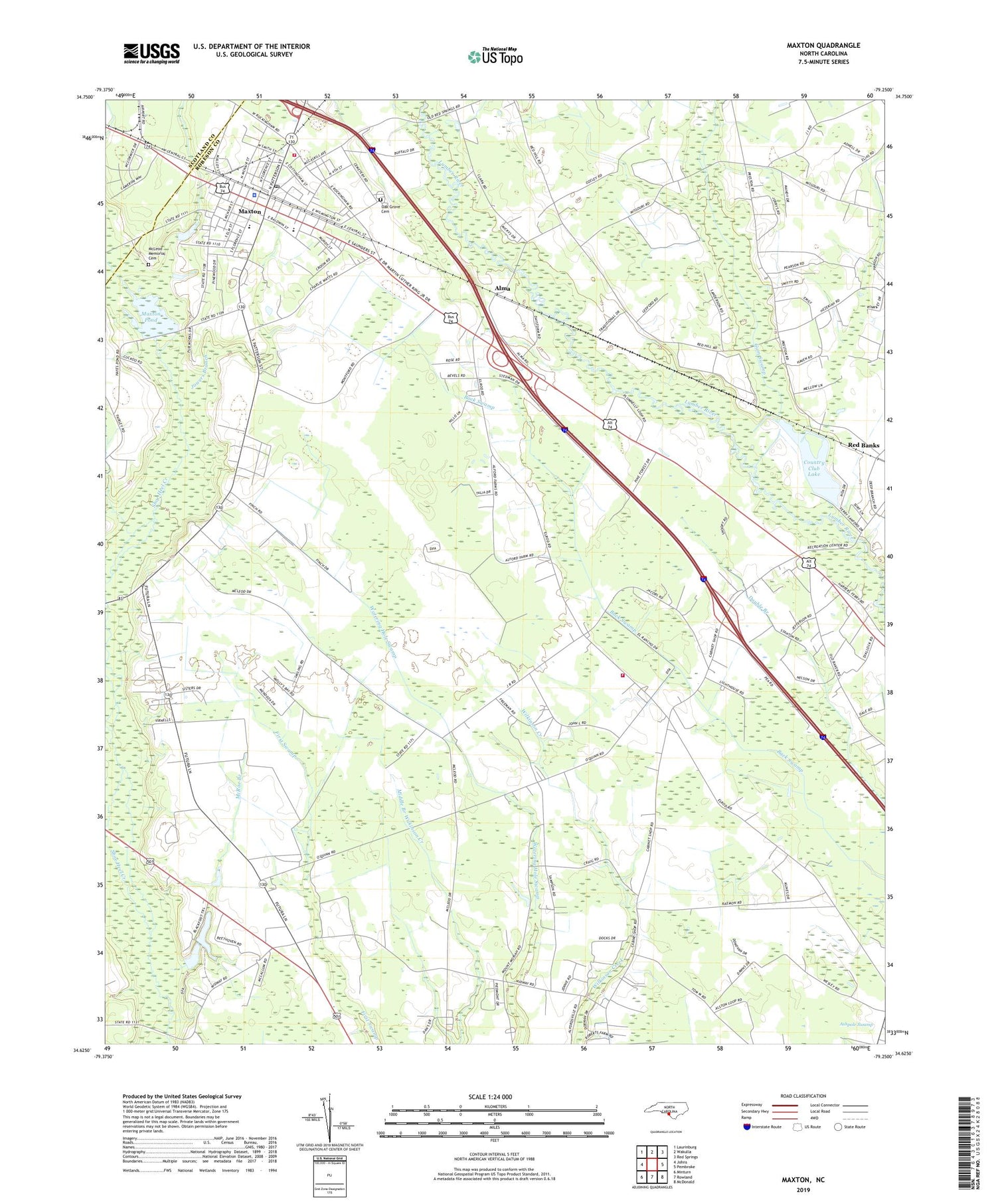
Maxton North Carolina US Topo Map
Couldn't load pickup availability
2019 topographic map quadrangle Maxton in the state of North Carolina. Scale: 1:24000. Based on the newly updated USGS 7.5' US Topo map series, this map is in the following counties: Robeson, Scotland. The map contains contour data, water features, and other items you are used to seeing on USGS maps, but also has updated roads and other features. This is the next generation of topographic maps. Printed on high-quality waterproof paper with UV fade-resistant inks.
Quads adjacent to this one:
West: Johns
Northwest: Laurinburg
North: Wakulla
Northeast: Red Springs
East: Pembroke
Southeast: McDonald
South: Rowland
Southwest: Minturn
Contains the following named places: Alma, Amos Chapel, Antioch Mission, Beulah Church, Carolina Military Academy, Country Club Lake, Country Club Lake Dam, Dean School, Dothan Church, Evans Crossroads Volunteer Fire Department, Gilbert Patterson Memorial Public Library, Gospel Tabernacle, Gum Swamp, Jowers Branch, Little Juniper Branch, Little Zion Church, Lumbee Recreation Center, Maxton, Maxton Medical Center, Maxton Police Department, Maxton Pond, Maxton Pond Dam, Maxton Post Office, Maxton Rescue Squad, McLeod Memorial Cemetery, McRae Branch, Midway Church, Mount Hebron Church, Mount Moriah Church, Oak Grove Cemetery, Preston Gospel Chapel, Queheel Fire Department, Raemon, Red Banks, Saint Matthews Church, Saint Pauls Church, Seven Bridges, Town of Maxton, Townsend Middle School, Township of Alfordsville, Township of Maxton, Union Light Church, West Robeson Senior High School, White Hill Church, Williams Chapel, ZIP Code: 28364


