MyTopo
Red Springs North Carolina US Topo Map
Couldn't load pickup availability
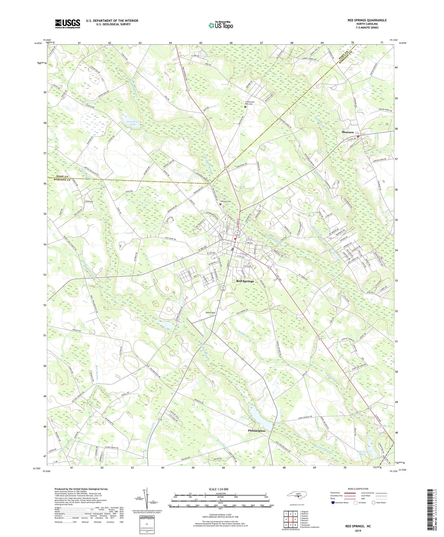
2022 topographic map quadrangle Red Springs in the state of North Carolina. Scale: 1:24000. Based on the newly updated USGS 7.5' US Topo map series, this map is in the following counties: Robeson, Hoke. The map contains contour data, water features, and other items you are used to seeing on USGS maps, but also has updated roads and other features. This is the next generation of topographic maps. Printed on high-quality waterproof paper with UV fade-resistant inks.
Quads adjacent to this one:
West: Wakulla
Northwest: Wagram
North: Raeford
Northeast: Parkton
East: Rennert
Southeast: Northwest Lumberton
South: Pembroke
Southwest: Maxton
This map covers the same area as the classic USGS quad with code o34079g2.
Contains the following named places: Alloway Cemetery, Antioch Chapel, Big Buie Pond Dam, Buie Field, Buie Pond Big, Buie Pond Dam Small, Buie Pond Small, Community Rest Cemetery, Galilee Church, Greenbrier Lake, Hoke County Church, Island Grove Church, Johnsons Chapel, Jones Chapel, Juniper Branch, Long Swamp, Macks Chapel, McLeans Branch, McNeil Pond Dam, Mount Elam Church, Peterson School, Philadelphus, Philadelphus Church, Pilgrim Grove Church, Prospect Church, Red Springs, Red Springs Fire Department, Red Springs High School, Red Springs Industrial Park, Red Springs Middle School, Red Springs Police Department, Red Springs Post Office, Red Springs Rescue Squad, Red Springs Wastewater Treatment Plant, Rhyne Memorial Church, Saint James Church, Saint Stephens Church, Shannon, Shannon Census Designated Place, Shannon Church, Shannon Post Office, Shannon Volunteer Fire Department, Town of Red Springs, Township of Red Springs, Township of Shannon, Trinity Church, Vardell Hall, Westside Church, WSTS-FM (Laurinburg), WYRU-AM (Red Springs), ZIP Codes: 28377, 28386