MyTopo
Wakulla North Carolina US Topo Map
Couldn't load pickup availability
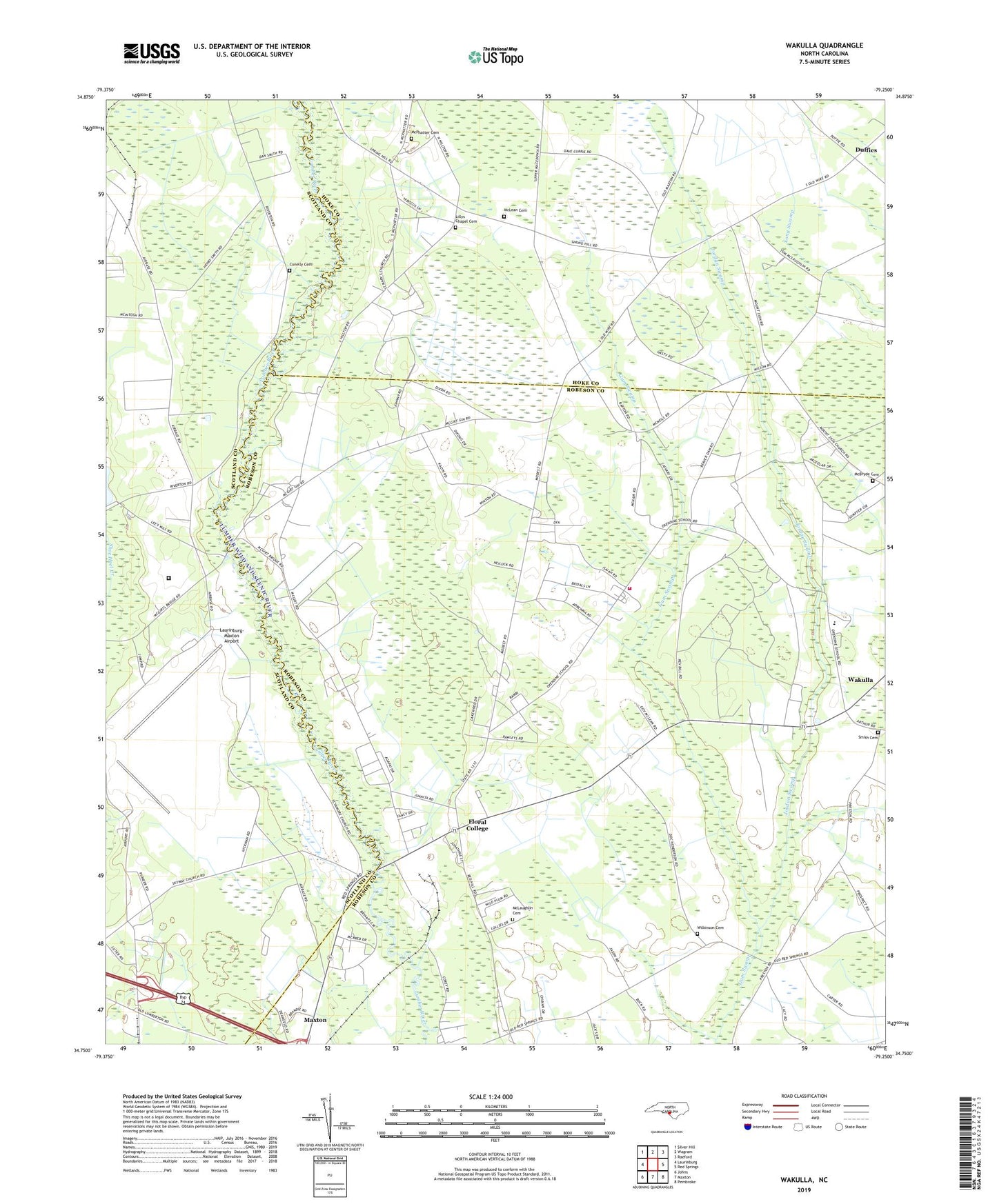
2022 topographic map quadrangle Wakulla in the state of North Carolina. Scale: 1:24000. Based on the newly updated USGS 7.5' US Topo map series, this map is in the following counties: Robeson, Scotland, Hoke. The map contains contour data, water features, and other items you are used to seeing on USGS maps, but also has updated roads and other features. This is the next generation of topographic maps. Printed on high-quality waterproof paper with UV fade-resistant inks.
Quads adjacent to this one:
West: Laurinburg
Northwest: Silver Hill
North: Wagram
Northeast: Raeford
East: Red Springs
Southeast: Pembroke
South: Maxton
Southwest: Johns
This map covers the same area as the classic USGS quad with code o34079g3.
Contains the following named places: Burlington School, Centre Church, Cherokee Elementary School, Conelly Cemetery, Duffies, Floral College, Island Grove Church, Island Grove School, Jordan Swamp, Laurinburg-Maxton Air Force Base, Laurinburg-Maxton Airport, Laurinburg-Maxton Army Air Base, Lees Mill Pond Dam, Lillys Chapel Cemetery, Lillys Chapel School, Little Church, McBryde Cemetery, McCormack Chapel, McLaughlin Cemetery, McLean Cemetery, McPhatter Cemetery, Mount Zion School, Saint Peters Church, Sandy Grove Church, Scotland Correctional Institution, Smith Cemetery, Smiths Volunteer Fire Department, Spring Branch Church, Sycamore Hill Church, Thunder Park, Township of Allendale, Township of Smiths, Wakulla, Wakulla Census Designated Place, Wilkinson Cemetery, Wilson School