MyTopo
Midland North Carolina US Topo Map
Couldn't load pickup availability
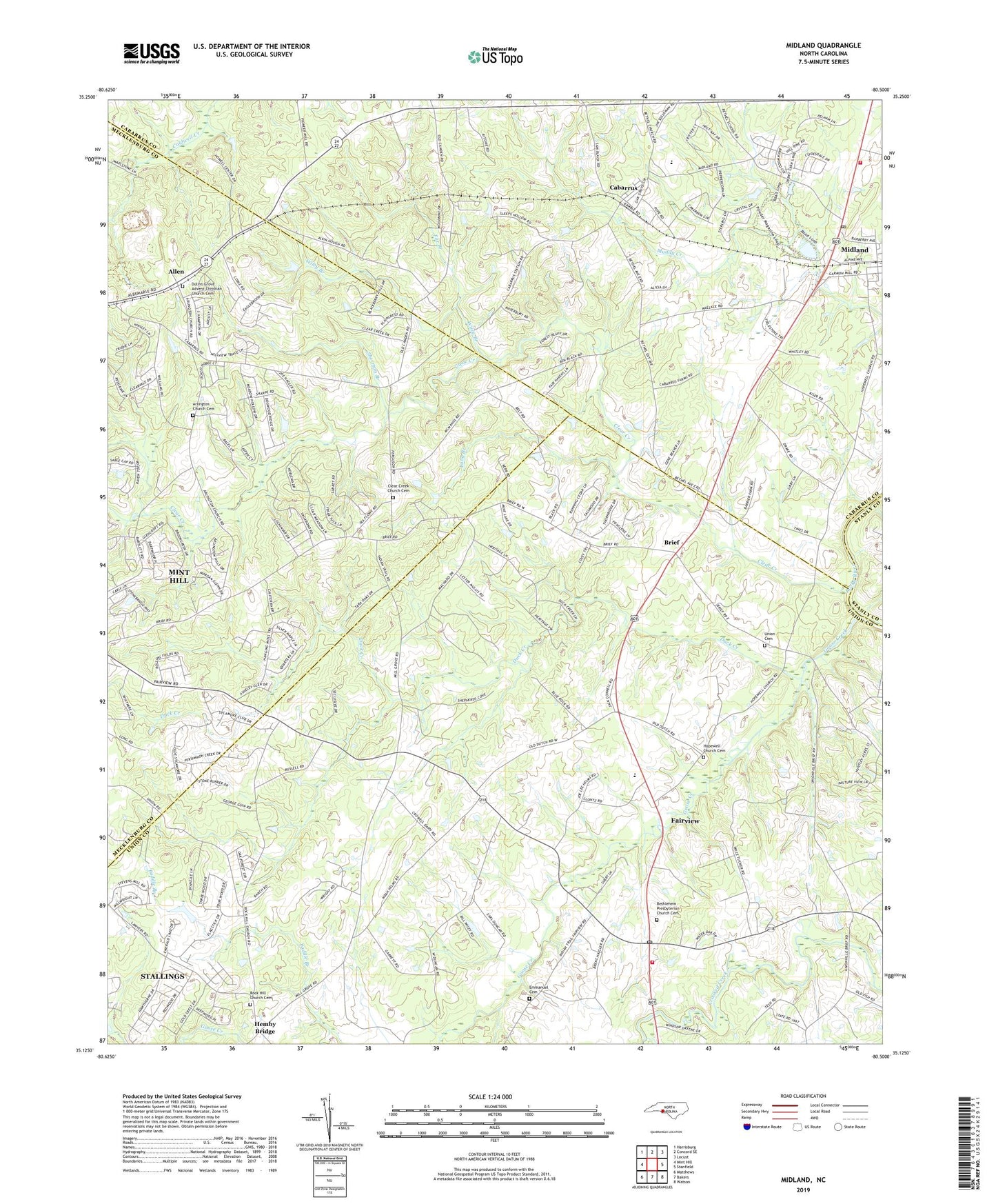
2019 topographic map quadrangle Midland in the state of North Carolina. Scale: 1:24000. Based on the newly updated USGS 7.5' US Topo map series, this map is in the following counties: Union, Cabarrus, Mecklenburg, Stanly. The map contains contour data, water features, and other items you are used to seeing on USGS maps, but also has updated roads and other features. This is the next generation of topographic maps. Printed on high-quality waterproof paper with UV fade-resistant inks.
Quads adjacent to this one:
West: Mint Hill
Northwest: Harrisburg
North: Concord SE
Northeast: Locust
East: Stanfield
Southeast: Watson
South: Bakers
Southwest: Matthews
Contains the following named places: Allen, Arlington Baptist Church, Arlington Church Cemetery, Bethel Church, Bethel School, Bethlehem Church, Bethlehem Presbyterian Church Cemetery, Black & Phillips American Legion Midland Post 433, Brief, Cabarrus, Clear Creek, Clear Creek Church, Clear Creek Church Cemetery, Cockburns Post Office, Duck Creek, Dulins Grove Advent Christian Church Cemetery, Emmanuel Cemetery, Fairview, Fairview Fire and Rescue Association Station 3, Fairview School, Far Branch, Goose Creek, Hopewell Church, Hopewell Church Cemetery, Hornets Nest, Long Branch, Macedonia Church, Midland, Midland Fire and Rescue Station 1, Midland Post Office, Midland Speedway, Mill Grove Church, Mitchells Lake, Mitchells Lake Dam, Rock Hill Church, Rock Hill Church Cemetery, Rockhill School, Sherman Branch, Town of Fairview, Town of Midland, Township 6-Clear Creek, Union Cemetery, Wayside Church, Wiley Branch