MyTopo
Millersville North Carolina US Topo Map
Couldn't load pickup availability
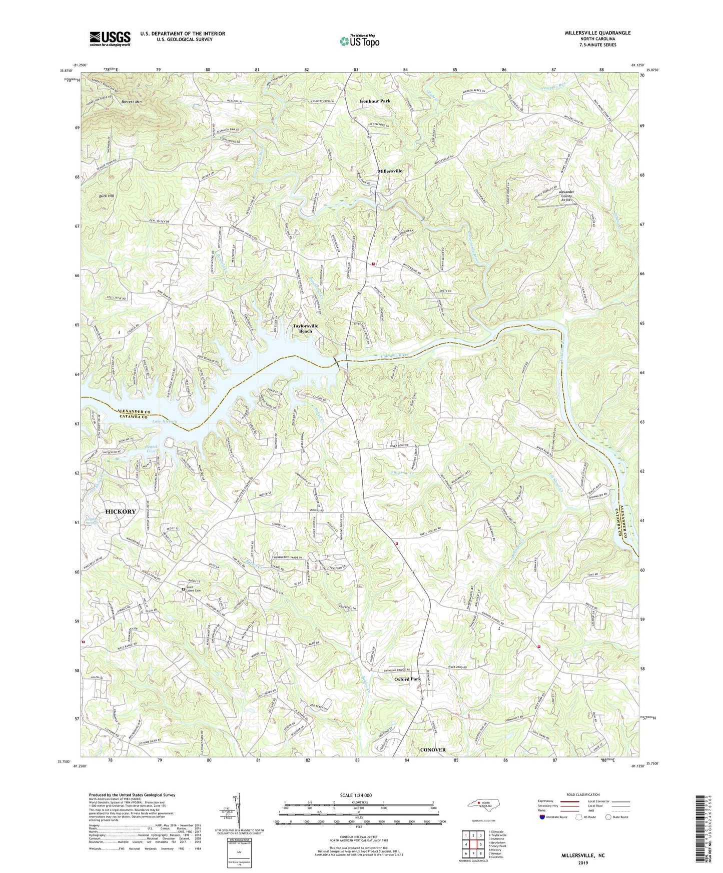
2019 topographic map quadrangle Millersville in the state of North Carolina. Scale: 1:24000. Based on the newly updated USGS 7.5' US Topo map series, this map is in the following counties: Catawba, Alexander. The map contains contour data, water features, and other items you are used to seeing on USGS maps, but also has updated roads and other features. This is the next generation of topographic maps. Printed on high-quality waterproof paper with UV fade-resistant inks.
Quads adjacent to this one:
West: Bethlehem
Northwest: Ellendale
North: Taylorsville
Northeast: Hiddenite
East: Stony Point
Southeast: Catawba
South: Newton
Southwest: Hickory
Contains the following named places: Alexander County Airport, Barrett Mountain, Benfield Creek, Bethel Church, Buck Hill, Dellinger Creek, Elk Shoal Creek, Friendship Church, Glade Creek, Grace and Truth Bible Camp, Isenhour Park, Island Creek, Jumping Run, Long Shoal Creek, Lower Little River, Millersville, Mount Zion Church, Naked Creek, North State Dam, North State Lake, Oxford Church, Oxford Dam, Oxford Elementary School, Oxford Fire Department Station 2 Catfish Fire District, Oxford Park, Oxford Volunteer Fire Department - Catfish District, Paynes Store, Punchbowl Creek, Ralph Flowers Dam, Ralph Flowers Lake, Reitzel Cove, Saint Johns Church, Saint Lukes Cemetery, Saint Peters Church, Saint Stephens, Saint Stephens Fire Department Station 4 Base 2, Smyrna Church, Sulphur Springs, Taylorsville Beach, Township of Clines, Wayside Church, Wittenburg School, Wittenburg Volunteer Fire Department