MyTopo
Hiddenite North Carolina US Topo Map
Couldn't load pickup availability
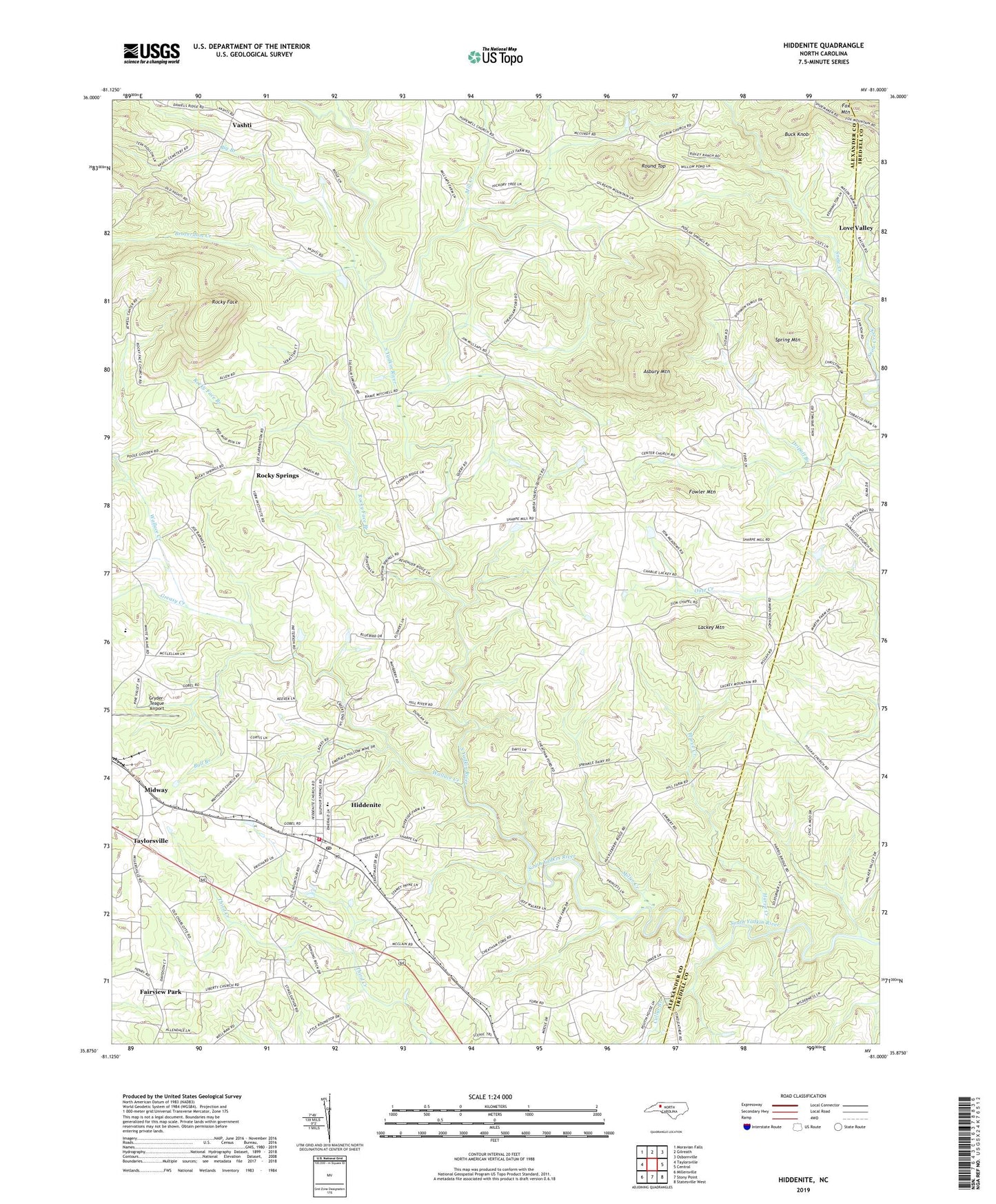
2022 topographic map quadrangle Hiddenite in the state of North Carolina. Scale: 1:24000. Based on the newly updated USGS 7.5' US Topo map series, this map is in the following counties: Alexander, Iredell. The map contains contour data, water features, and other items you are used to seeing on USGS maps, but also has updated roads and other features. This is the next generation of topographic maps. Printed on high-quality waterproof paper with UV fade-resistant inks.
Quads adjacent to this one:
West: Taylorsville
Northwest: Moravian Falls
North: Gilreath
Northeast: Osbornville
East: Central
Southeast: Statesville West
South: Stony Point
Southwest: Millersville
This map covers the same area as the classic USGS quad with code o35081h1.
Contains the following named places: Asbury Mountain, Beaverdam Creek, Berea Church, Big Branch, Buck Knob, Bull Branch, Center Church, Cullys Branch, East Junior High School, Fairview Church, Fairview Park, Faith Temple, Fowler Mountain, Greasy Creek, Gryder-Teague Airport, Harve Creek, Hiddenite, Hiddenite Census Designated Place, Hiddenite Elementary School, Hiddenite Fire Department, Hiddenite Post Office, Hopewell Church, Lackey Mountain, Liberty Church, Linneys Grove Church, Midway, Mill Creek, Miller Creek, New Hope, Pisgah Church, Poplar Springs Church, Rocky Face, Rocky Face Branch, Rocky Springs, Round Top, South River Church, Spring Mountain, Sulphur Springs Church, Township of Gwaltneys, Township of Sharpes, Vashti, Wallace Creek, Wayfound Church, Zion Chapel, ZIP Code: 28636