MyTopo
Moncure North Carolina US Topo Map
Couldn't load pickup availability
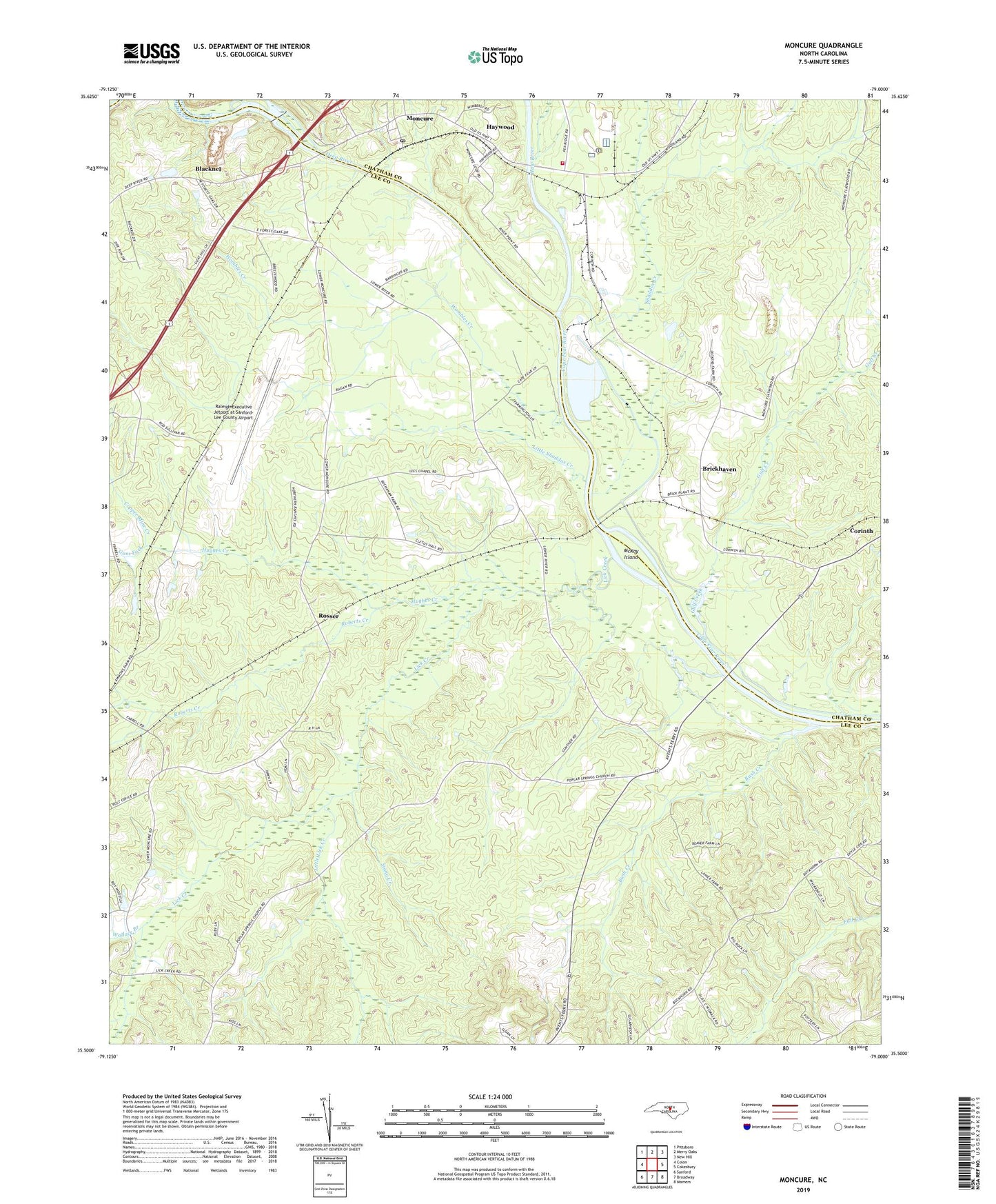
2019 topographic map quadrangle Moncure in the state of North Carolina. Scale: 1:24000. Based on the newly updated USGS 7.5' US Topo map series, this map is in the following counties: Lee, Chatham. The map contains contour data, water features, and other items you are used to seeing on USGS maps, but also has updated roads and other features. This is the next generation of topographic maps. Printed on high-quality waterproof paper with UV fade-resistant inks.
Quads adjacent to this one:
West: Colon
Northwest: Pittsboro
North: Merry Oaks
Northeast: New Hill
East: Cokesbury
Southeast: Mamers
South: Broadway
Southwest: Sanford
Contains the following named places: Blacknel, Brickhaven, Bush Creek, Chestnut Church, Copper Mine Creek, Deep River, Gulf Creek, Gum Fork, Haw River, Haywood, Hughes Creek, Lebanon Church, Lee Chapel, Lick Creek, Little Lick Creek, Little Shaddox Creek, McKay Island, Memphis Church, Moncure, Moncure Census Designated Place, Moncure Post Office, Moncure Quarry, Moncure Volunteer Fire Department, Moore Union Church, New England Church, Raleigh Executive Jetport at Sanford-Lee County, Ramsey Mill Pond, Ramsey Millpond Dam, Roberts Creek, Rose Hill Church, Rosser, Shaddox Creek, Stony Creek, Township 4-Deep River, Township of Cape Fear, Wallace Branch, Ward Memorial Church, Wombles Creek, Zion Church