MyTopo
Meadows of Dan Virginia US Topo Map
Couldn't load pickup availability
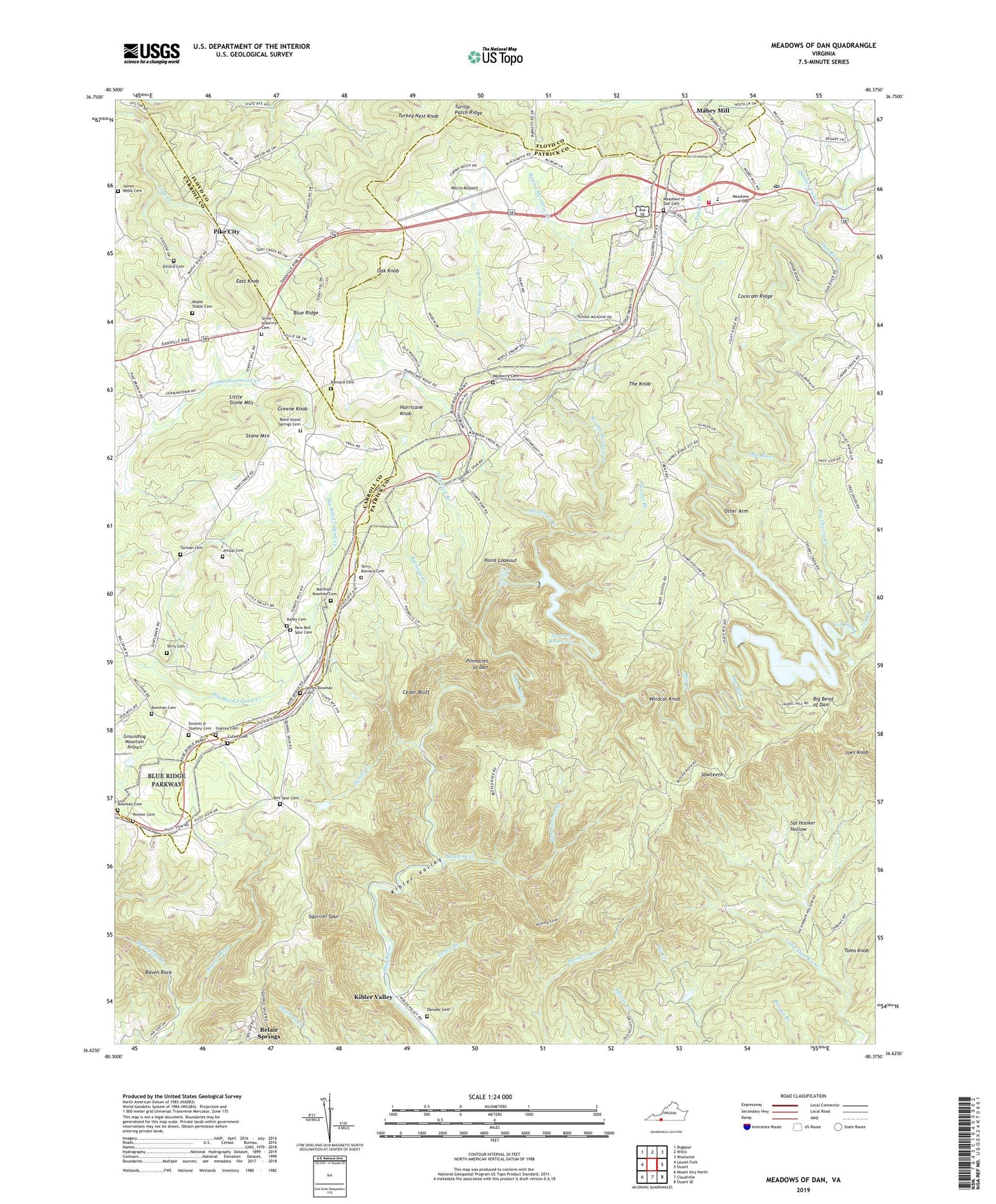
2022 topographic map quadrangle Meadows of Dan in the state of Virginia. Scale: 1:24000. Based on the newly updated USGS 7.5' US Topo map series, this map is in the following counties: Patrick, Carroll, Floyd. The map contains contour data, water features, and other items you are used to seeing on USGS maps, but also has updated roads and other features. This is the next generation of topographic maps. Printed on high-quality waterproof paper with UV fade-resistant inks.
Quads adjacent to this one:
West: Laurel Fork
Northwest: Dugspur
North: Willis
Northeast: Woolwine
East: Stuart
Southeast: Stuart SE
South: Claudville
Southwest: Mount Airy North
This map covers the same area as the classic USGS quad with code o36080f4.
Contains the following named places: Banks Cemetery, Barnard Cemetery, Barnard Creek, Belair Springs, Bell Spur, Bell Spur Cemetery, Bell Spur Church, Bell Spur School, Bent Springs Branch, Big Bend of Dan, Big Cherry Creek, Bowman Cemetery, Buffalo School, Cedar Bluff, Cockram Mill, Cockram Millpond, Cockram Ridge, Cocram Mill Dam, Concord Church, Coxes Branch, Culler Cemetery, Dam on Headwaters of Squall Creek Dam, Danube Cemetery, Danube Church, Dickerson School, Dillard Cemetery, East Knob, Emmitt D Stanley Cemetery, Free Union School, Great Falls of Dan, Greene Knob, Groundhog Mountain Airport, Haunted Branch, Hickory Cove, Hurricane Knob, Ivy Creek, James Bowman Cemetery, James Webb Cemetery, Jessup Cemetery, Joes Knob, Kibler School, Kibler Valley, Little Stone Mountain, Maple Shade Cemetery, Maple Shade Church, Maple Swamp Branch, Marshall-Bowman Cemetery, Mayberry Cemetery, Mayberry Church, Mayberry Creek, Mayberry School, Meadows of Dan, Meadows of Dan Cemetery, Meadows of Dan Census Designated Place, Meadows of Dan Church, Meadows of Dan Elementary School, Meadows of Dan Post Office, Meadows of Dan Volunteer Fire Department, Micro Airport, Mill Creek, New Bell Spur Cemetery, New Bell Spur Church, Oak Knob, Otter Arm, Painter Cemetery, Pike City, Pine Knot School, Pinnacle View School, Pinnacles of Dan, Pinnacles Powerplant, Point Lookout, Quaker Field Branch, Raven Rock, Reed Island Springs Cemetery, Reed Island Springs Church, Roaring Creek, Round Meadow Creek, Round Meadow Overlook, Sal Hooker Hollow, Sawpit Branch, Sawteeth, Silver Valley School, Sollie Alderman Cemetery, Squall Creek, Squall Creek Pond, Squirrel Spur, Stanley Cemetery, Stone Mountain, Talbott Dam, Talbott Reservoir, Terry Cemetery, Terry-Barnard Cemetery, The Knob, Thompson Creek, Tory Creek Church, Townes Dam, Townes Reservoir, Tuggle Creek, Turkey Nest Knob, Turman Cemetery, Turnip Patch Ridge, Vesta Rescue Squad, Wildcat Knob, ZIP Code: 24120