MyTopo
New Lake SE North Carolina US Topo Map
Couldn't load pickup availability
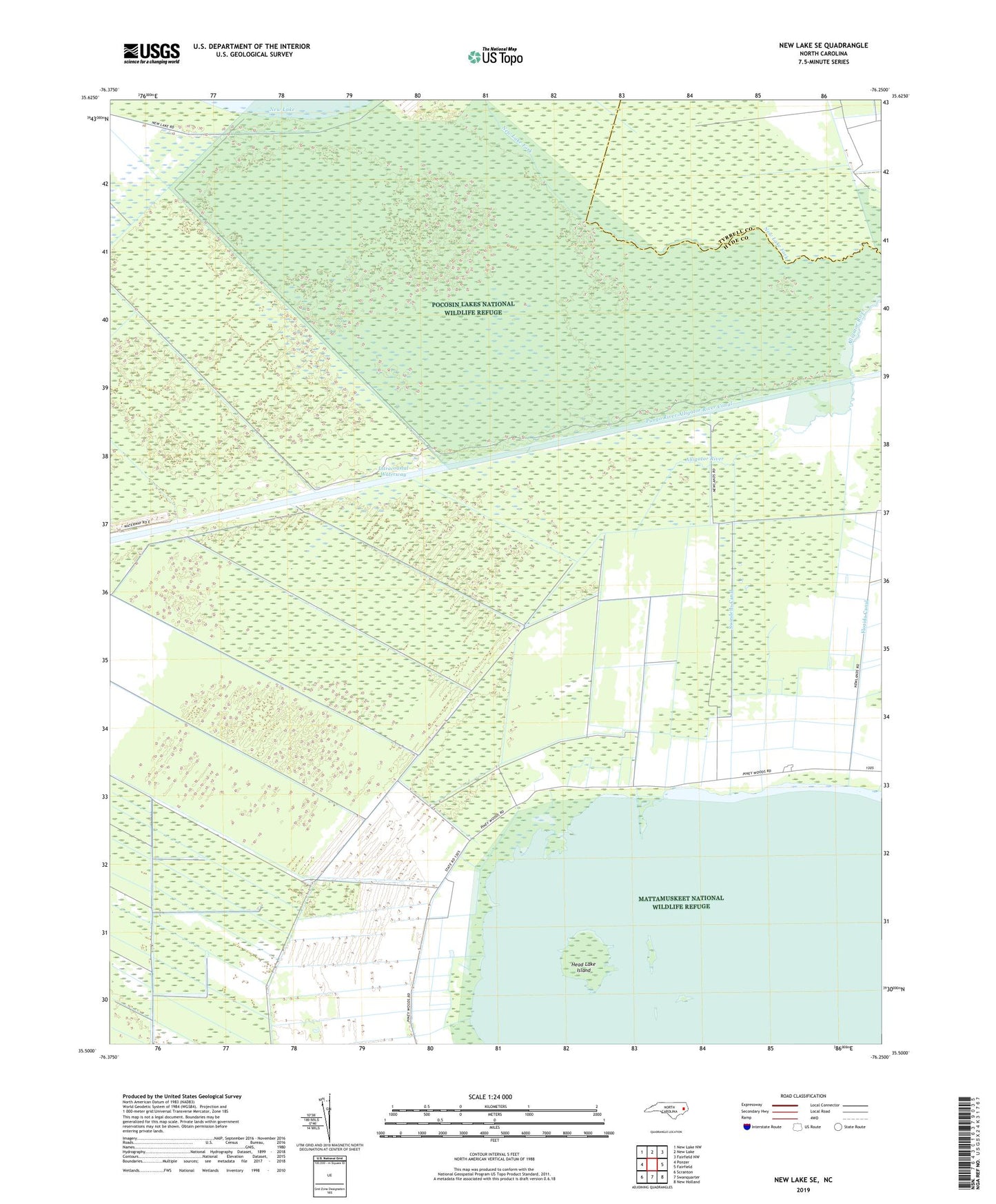
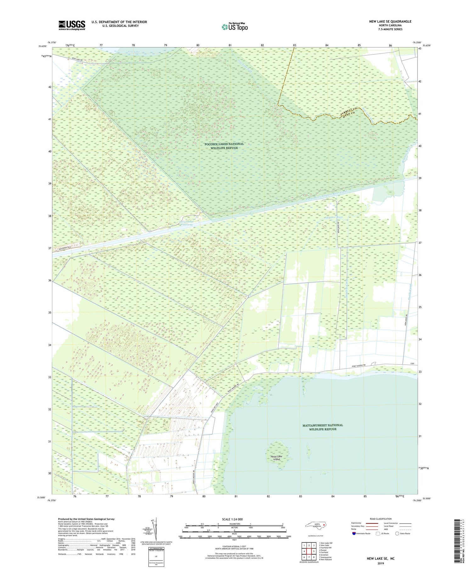
2019 topographic map quadrangle New Lake SE in the state of North Carolina. Scale: 1:24000. Based on the newly updated USGS 7.5' US Topo map series, this map is in the following counties: Hyde, Tyrrell. The map contains contour data, water features, and other items you are used to seeing on USGS maps, but also has updated roads and other features. This is the next generation of topographic maps. Printed on high-quality waterproof paper with UV fade-resistant inks.
Quads adjacent to this one:
West: Ponzer
Northwest: New Lake NW
North: New Lake
Northeast: Fairfield NW
East: Fairfield
Southeast: New Holland
South: Swanquarter
Southwest: Scranton
Contains the following named places: Bath County, Fairfield Water Treatment Plant, Florida Canal, Head Lake Island, Pungo River Alligator River Canal, Swindells Canal, Wickham Precinct