MyTopo
Ponzer North Carolina US Topo Map
Couldn't load pickup availability
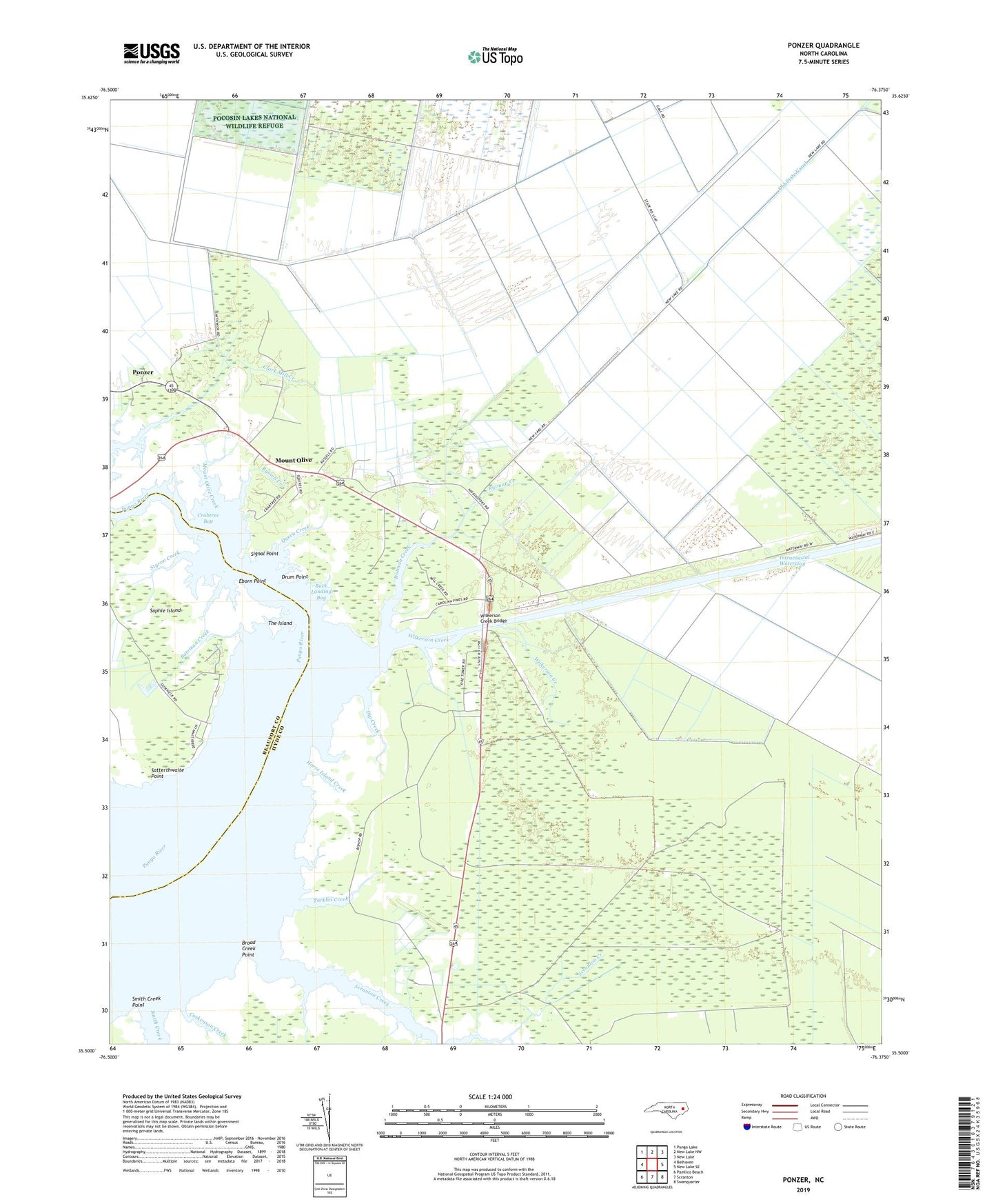
2022 topographic map quadrangle Ponzer in the state of North Carolina. Scale: 1:24000. Based on the newly updated USGS 7.5' US Topo map series, this map is in the following counties: Hyde, Beaufort. The map contains contour data, water features, and other items you are used to seeing on USGS maps, but also has updated roads and other features. This is the next generation of topographic maps. Printed on high-quality waterproof paper with UV fade-resistant inks.
Quads adjacent to this one:
West: Belhaven
Northwest: Pungo Lake
North: New Lake NW
Northeast: New Lake
East: New Lake SE
Southeast: Swanquarter
South: Scranton
Southwest: Pamlico Beach
This map covers the same area as the classic USGS quad with code o35076e4.
Contains the following named places: Back Landing Bay, Bateman Creek, Broad Creek Point, Corkenson Creek, Crabtree Bay, Dip Creek, Drum Point, Eborn Point, Galloway Creek, Horse Island Creek, Mount Olive, Mount Olive Church, Mount Olive Creek, Old State Canal, Ponzer, Poster Creek, Queen Creek, Russell Creek, Rutman Creek, Saint Johns Church, Satterthwaite Point, Scranton Creek, Signal Point, Smith Creek, Smith Creek Point, Sophie Island, Sophie Island Creek, Styron Creek, Tarklin Creek, The Island, Township of Currituck, Wilkerson Creek, Wilkerson Creek Bridge