MyTopo
Olivia North Carolina US Topo Map
Couldn't load pickup availability
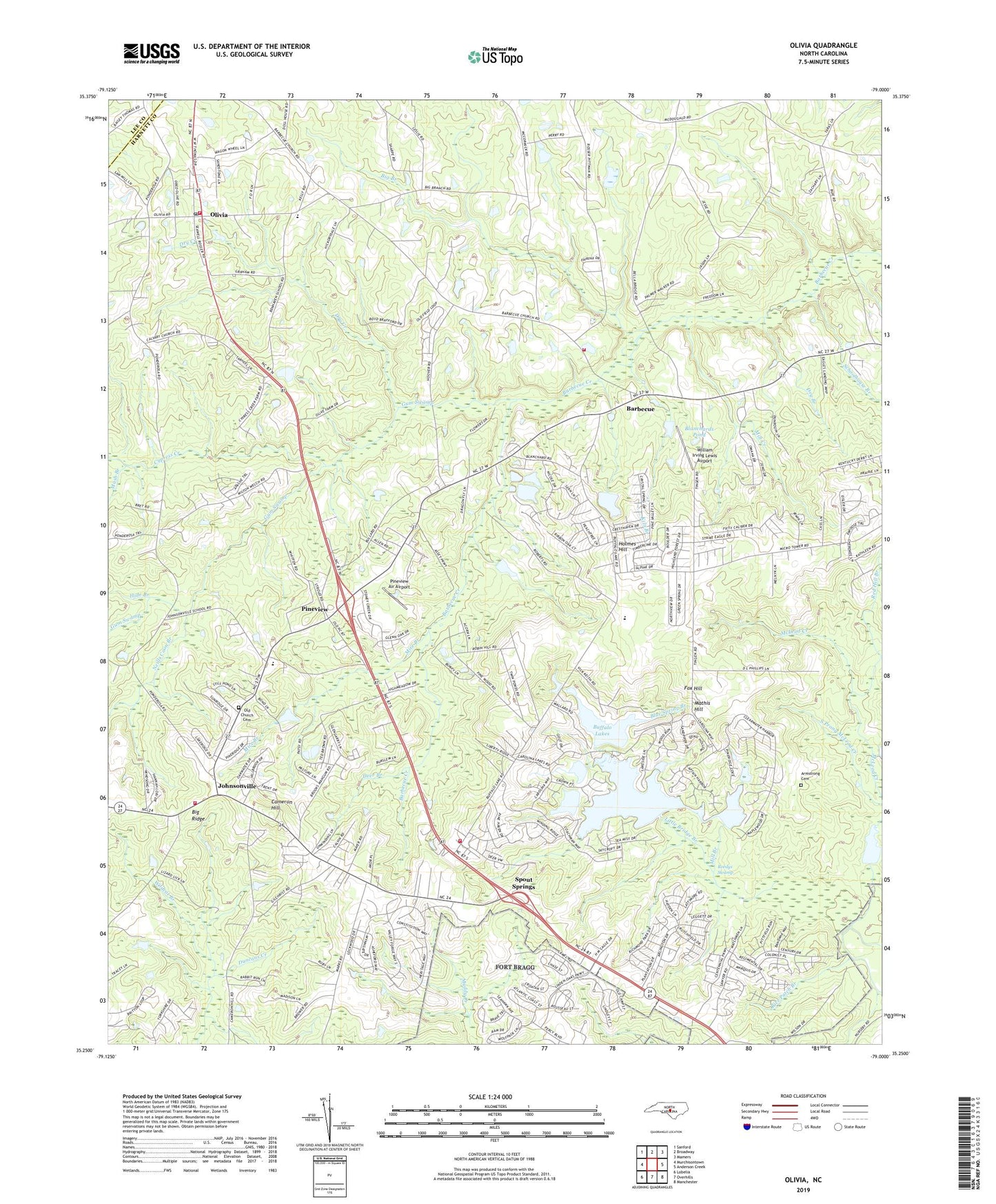
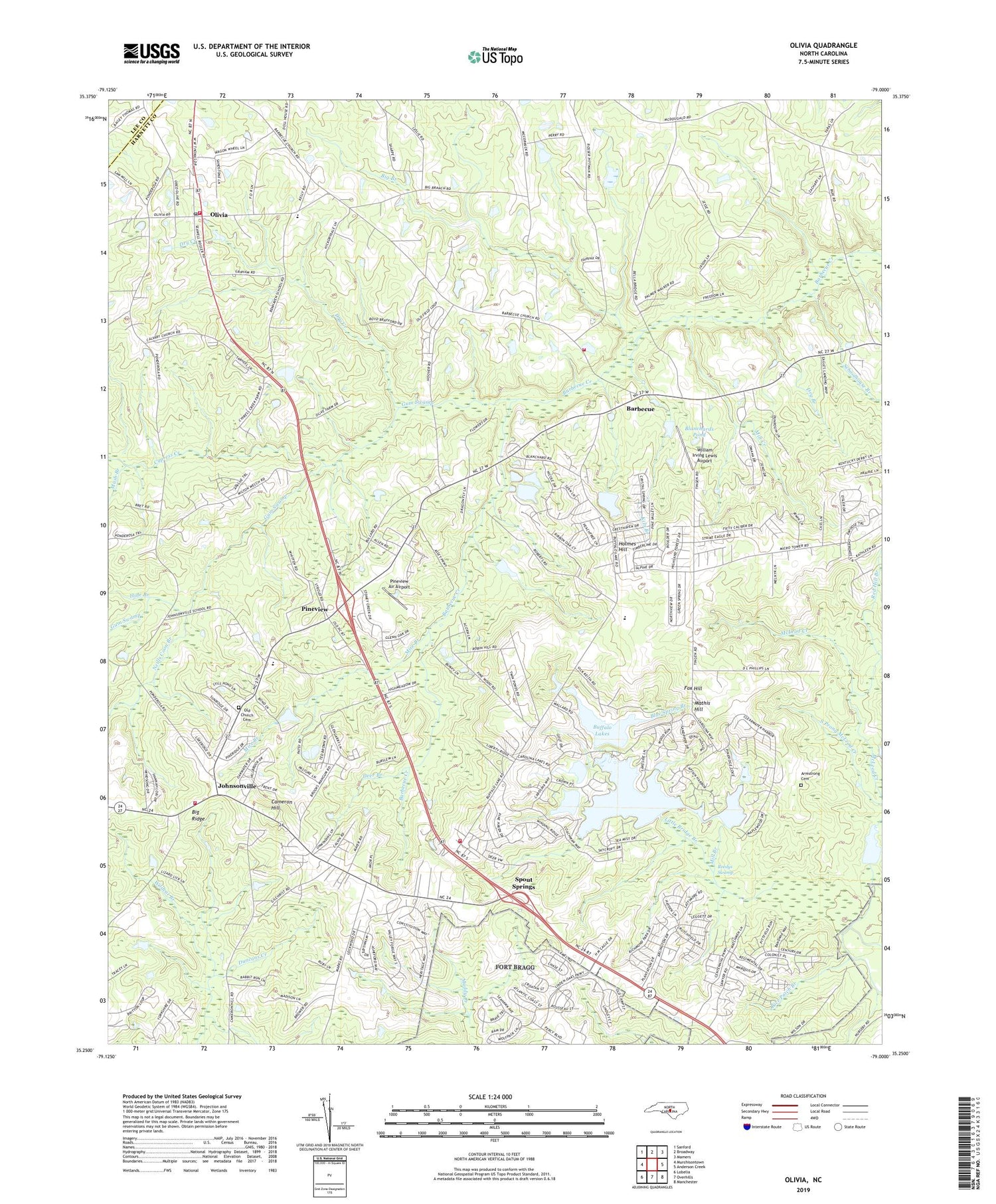
2019 topographic map quadrangle Olivia in the state of North Carolina. Scale: 1:24000. Based on the newly updated USGS 7.5' US Topo map series, this map is in the following counties: Harnett, Lee. The map contains contour data, water features, and other items you are used to seeing on USGS maps, but also has updated roads and other features. This is the next generation of topographic maps. Printed on high-quality waterproof paper with UV fade-resistant inks.
Quads adjacent to this one:
West: Murchisontown
Northwest: Sanford
North: Broadway
Northeast: Mamers
East: Anderson Creek
Southeast: Manchester
South: Overhills
Southwest: Lobelia
Contains the following named places: Armstrong Cemetery, Barbecue, Benhaven Emergency Services Station 1, Benhaven Emergency Services Station 2, Benhaven High School, Big Branch, Blanchards Pond, Blanchards Pond Dam Number One, Blanchards Pond Dam Number Two, Blue Spring Branch, Boyce Olive Dam, Buffalo Lake Dam, Buffalo Lakes, Calvary Church, Cameron Hill, Craven Field, Cypress Creek, Deer Branch, Dry Branch, Dry Creek, F S Blanchards Dam Number Three, Fox Hill, Gum Swamp, Handy Branch, Harnett County Emergency Medical Service Quick Response Vehicle - Spout Spring Station, Hide Branch, Hillmons Grove Church, Holmes Hill, Johnsonville, Johnsonville Church, Johnsonville Elementary School, Kiln Branch, Little Bridge Branch, Mash Branch, Mathis Hill, McLeod Creek, Meadow Branch, Memorial Church, Middle Prong Little Bridge Branch, Mill Branch, Mill Creek, Mire Branch, Neills Coon Branch, Oak Branch, Old Church Cemetery, Olivia, Olivia Post Office, Pineview, Pineview Air Airport, R E Roberts Dam, Red Hill Branch, Reedys Swamp, Schoolhouse Branch, Silver Run Lake, Silver Run Lake Dam, Spout Springs, Spout Springs Census Designated Place, Spout Springs Emergency Services Station 1, Spout Springs Emergency Services Station 2, Township of Barbecue, Township of Johnsonville, Township School, Wildcat Branch, William Irving Lewis Airport, Williams Chapel, Williams Pond, Williams Pond Dam