MyTopo
Pinebluff North Carolina US Topo Map
Couldn't load pickup availability
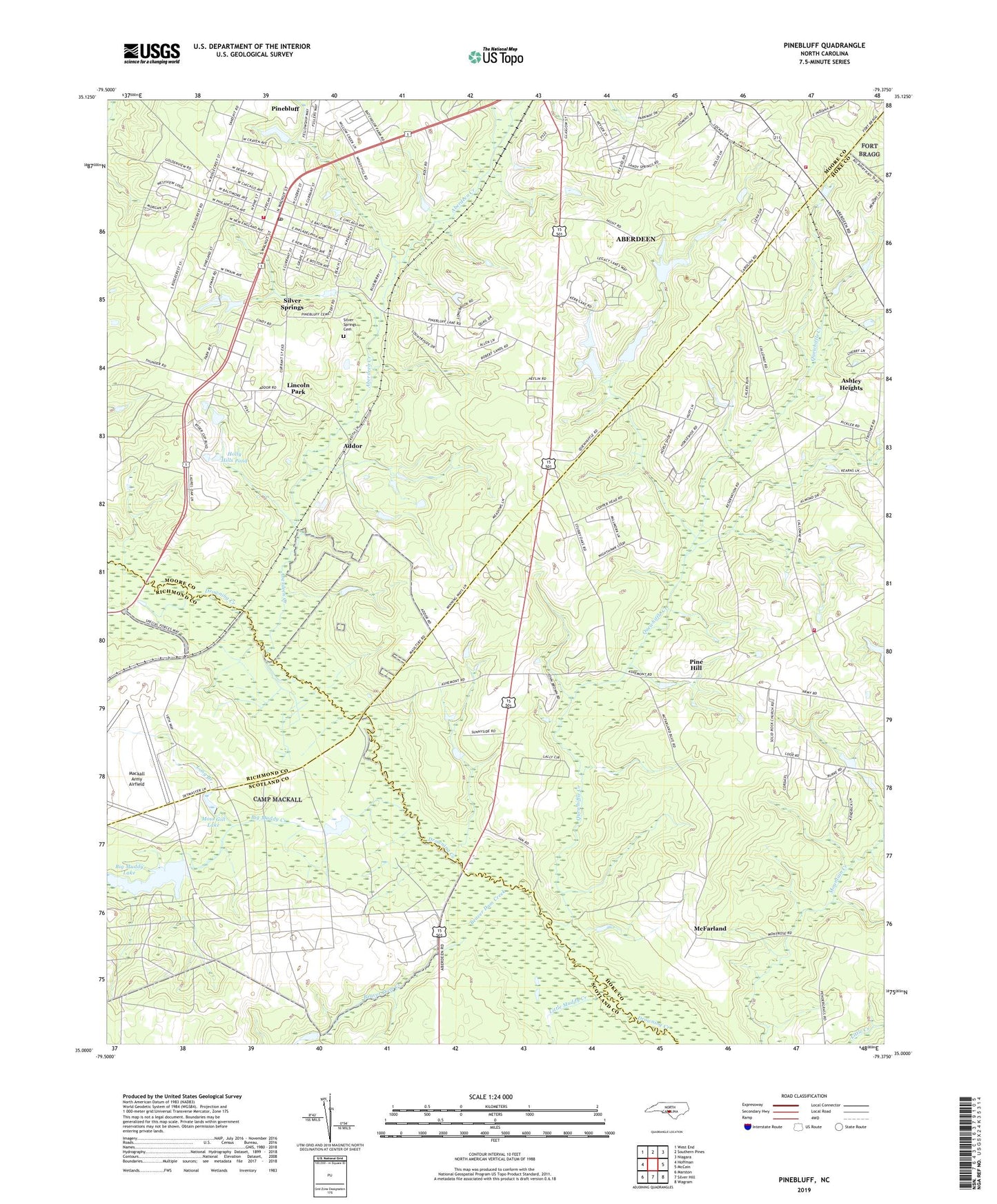
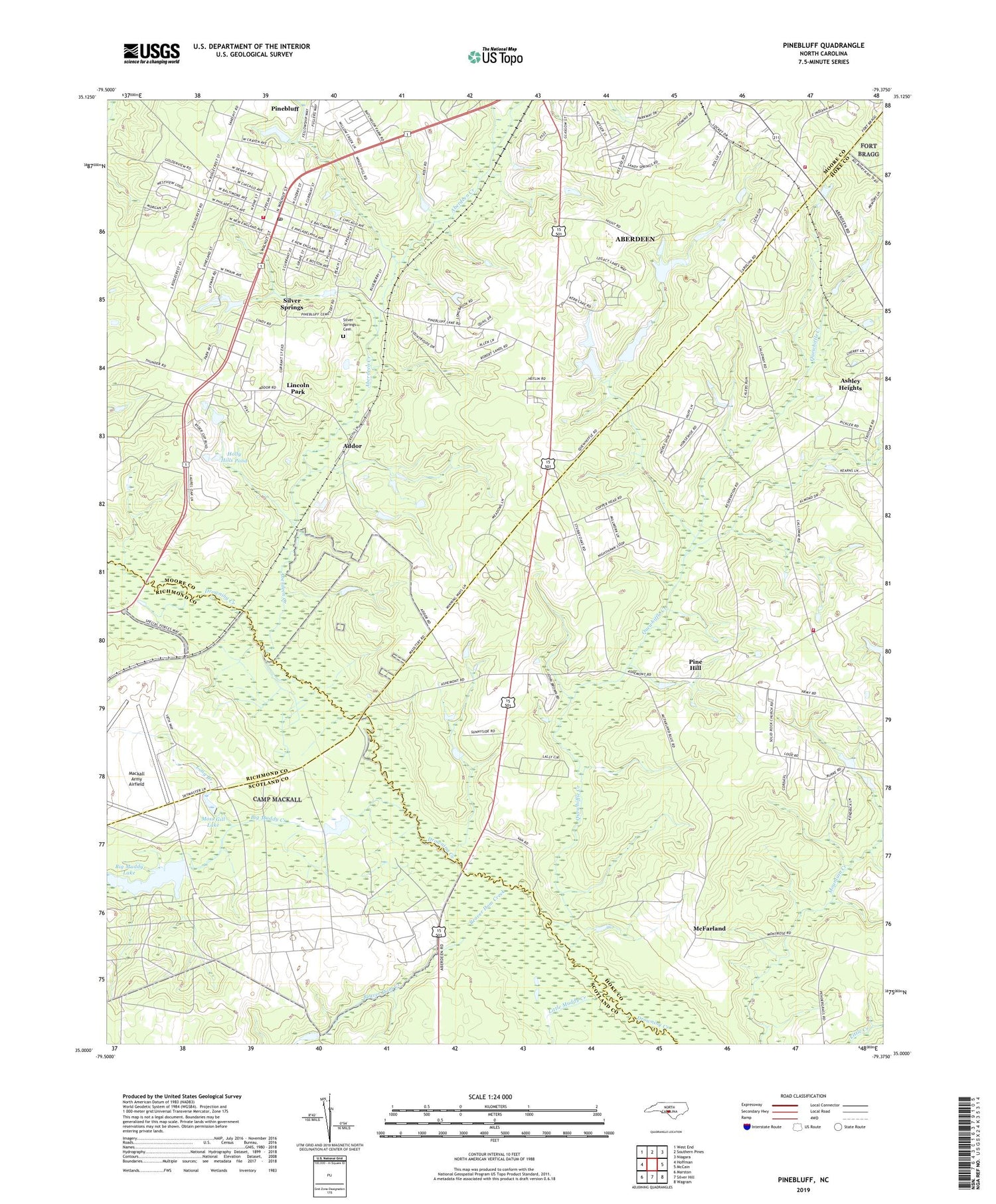
2019 topographic map quadrangle Pinebluff in the state of North Carolina. Scale: 1:24000. Based on the newly updated USGS 7.5' US Topo map series, this map is in the following counties: Moore, Hoke, Scotland, Richmond. The map contains contour data, water features, and other items you are used to seeing on USGS maps, but also has updated roads and other features. This is the next generation of topographic maps. Printed on high-quality waterproof paper with UV fade-resistant inks.
Quads adjacent to this one:
West: Hoffman
Northwest: West End
North: Southern Pines
Northeast: Niagara
East: McCain
Southeast: Wagram
South: Silver Hill
Southwest: Marston
Contains the following named places: Aberdeen Creek, Aberdeen Elementary School, Addor, Beaver Dam Creek, Big Muddy Creek, Big Muddy Lake, Big Muddy Lake Dam, Camp Mackall, Crestline Volunteer Fire Department, Hoke County Rescue Squad Substation, Holly Hills Pond, Holly Hills Pond Dam, Lincoln Park, Little Muddy Creek, Little Muddy Lake, McFarland, McFarland School, Moss Gill Lake, NC Noname Thirty-Eight Dam, Pine Bluff Sanatorium, Pine Hill, Pinebluff, Pinebluff Fire Department, Pinebluff Post Office, Pinehill Fire Department Station 7, Poplar Springs Church, Quewhiffle Creek, Silver Springs, Silver Springs Cemetery, Town of Pinebluff, Township 8-Sandhills, W C Steinback Dam, WANC-AM (Aberdeen), ZIP Codes: 28315, 28373