MyTopo
Wagram North Carolina US Topo Map
Couldn't load pickup availability
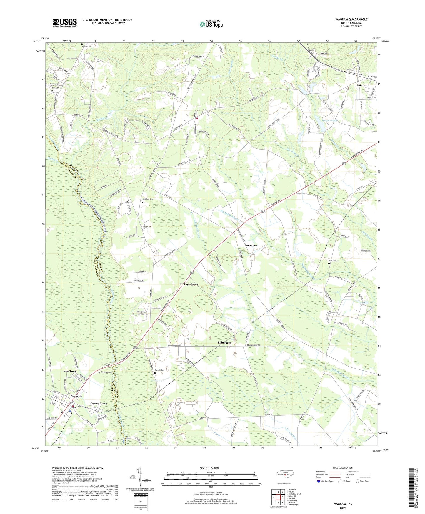
2022 topographic map quadrangle Wagram in the state of North Carolina. Scale: 1:24000. Based on the newly updated USGS 7.5' US Topo map series, this map is in the following counties: Hoke, Scotland. The map contains contour data, water features, and other items you are used to seeing on USGS maps, but also has updated roads and other features. This is the next generation of topographic maps. Printed on high-quality waterproof paper with UV fade-resistant inks.
Quads adjacent to this one:
West: Silver Hill
Northwest: Pinebluff
North: McCain
Northeast: Nicholson Creek
East: Raeford
Southeast: Red Springs
South: Wakulla
Southwest: Laurinburg
This map covers the same area as the classic USGS quad with code o34079h3.
Contains the following named places: Bethel Church, Bethel School, Blue Cemetery, Bowmore, Bowmore Census Designated Place, Bowmore School, Brown Cemetery, Buffalo Creek, Buffalo Springs School, Crump Town, Drowning Creek, Earl Hendrix Dam, Edenburg School, Edinburgh, Freedom School, Gaineys Place, Gilchrist Cemetery, Hendrix Farms, Hickory Grove, Hoke Livestock Farms, Love Cemetery, Macedonia School, McMillan Cemetery, McNeill Cemetery, Mountain Grove Church, New Town, North Scotland Volunteer Fire Department, Purcell Cemetery, Raeford Livestock Farms, Shady Grove Church, South Hoke Elementary School, Town of Wagram, Township of Blue Springs, Wagram, Wagram Police Department, Wagram Post Office, Wagram School, Watery Branch, West Hoke Elementary School, West Hoke Fire Department, Wrights Pond, Wrights Pond Dam