MyTopo
Plymouth East North Carolina US Topo Map
Couldn't load pickup availability
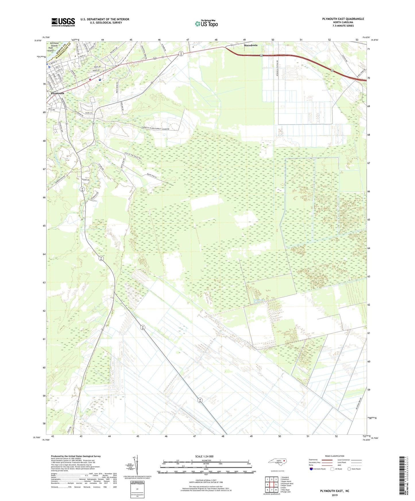
2019 topographic map quadrangle Plymouth East in the state of North Carolina. Scale: 1:24000. Based on the newly updated USGS 7.5' US Topo map series, this map is in the following counties: Washington, Bertie. The map contains contour data, water features, and other items you are used to seeing on USGS maps, but also has updated roads and other features. This is the next generation of topographic maps. Printed on high-quality waterproof paper with UV fade-resistant inks.
Quads adjacent to this one:
West: Plymouth West
Northwest: Woodard
North: Westover
Northeast: Roper North
East: Roper South
Southeast: Pungo Lake
South: Pike Road
Southwest: Hoke
Contains the following named places: Fourth Street Elementary School, Green Hill, Hopkins Mobile Home Park, Lily Valley Church, Monticello, Morattock Church, Pettigrew Regional Library and Washington County Library, Pineridge, Plumblee Nursing Center, Plymouth, Plymouth Fire Department Station 2, Plymouth High School, Plymouth Methodist Church, Plymouth Police Department, Plymouth Shopping Center, Sawyers Mobile Home Park, Skinners Canal, Tide Water Experimental Station, Town of Plymouth, Township of Lees Mill, Township of Plymouth, Union Chapel, Washington County Courthouse, Washington County Emergency Medical Services, Washington County Hospital, Washington County Sheriff's Office, Washington Street Elementary School, ZIP Codes: 27962, 27970