MyTopo
Roper North North Carolina US Topo Map
Couldn't load pickup availability
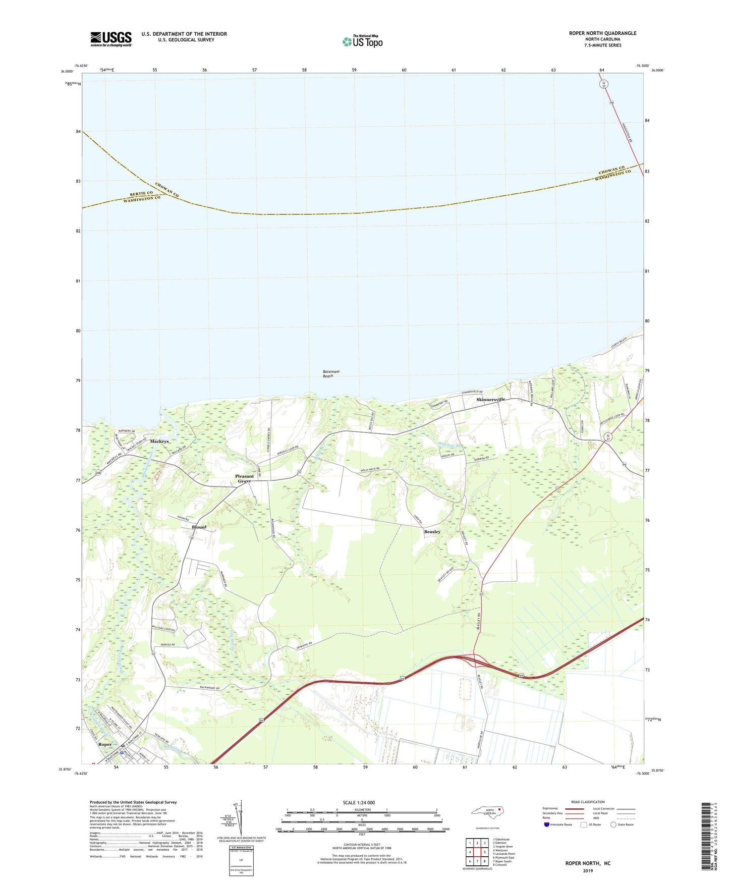
2022 topographic map quadrangle Roper North in the state of North Carolina. Scale: 1:24000. Based on the newly updated USGS 7.5' US Topo map series, this map is in the following counties: Washington, Chowan, Bertie. The map contains contour data, water features, and other items you are used to seeing on USGS maps, but also has updated roads and other features. This is the next generation of topographic maps. Printed on high-quality waterproof paper with UV fade-resistant inks.
Quads adjacent to this one:
West: Westover
Northwest: Edenhouse
North: Edenton
Northeast: Yeopim River
East: Leonards Point
Southeast: Creswell
South: Roper South
Southwest: Plymouth East
This map covers the same area as the classic USGS quad with code o35076h5.
Contains the following named places: Bakers Swamp, Batemans Beach, Beasley, Beaver Dam Branch, Blount, Chapel Swamp, Hawkins Branch, Holly Neck Church, Kendrick Creek, Mackeys, Mackeys Creek, Mackeys Methodist Church, Mill Creek, Oak Grove Church, Old Court House, Old Mill Creek, Pleasant Grove, Pleasant Grove Methodist Church, Roper, Roper Methodist Church, Roper Police Department, Roper Post Office, S Lees Saw Mills, Shiloh Wonder Church, Skinnersville, Town of Roper, Whites Creek