MyTopo
Pungo Lake North Carolina US Topo Map
Couldn't load pickup availability
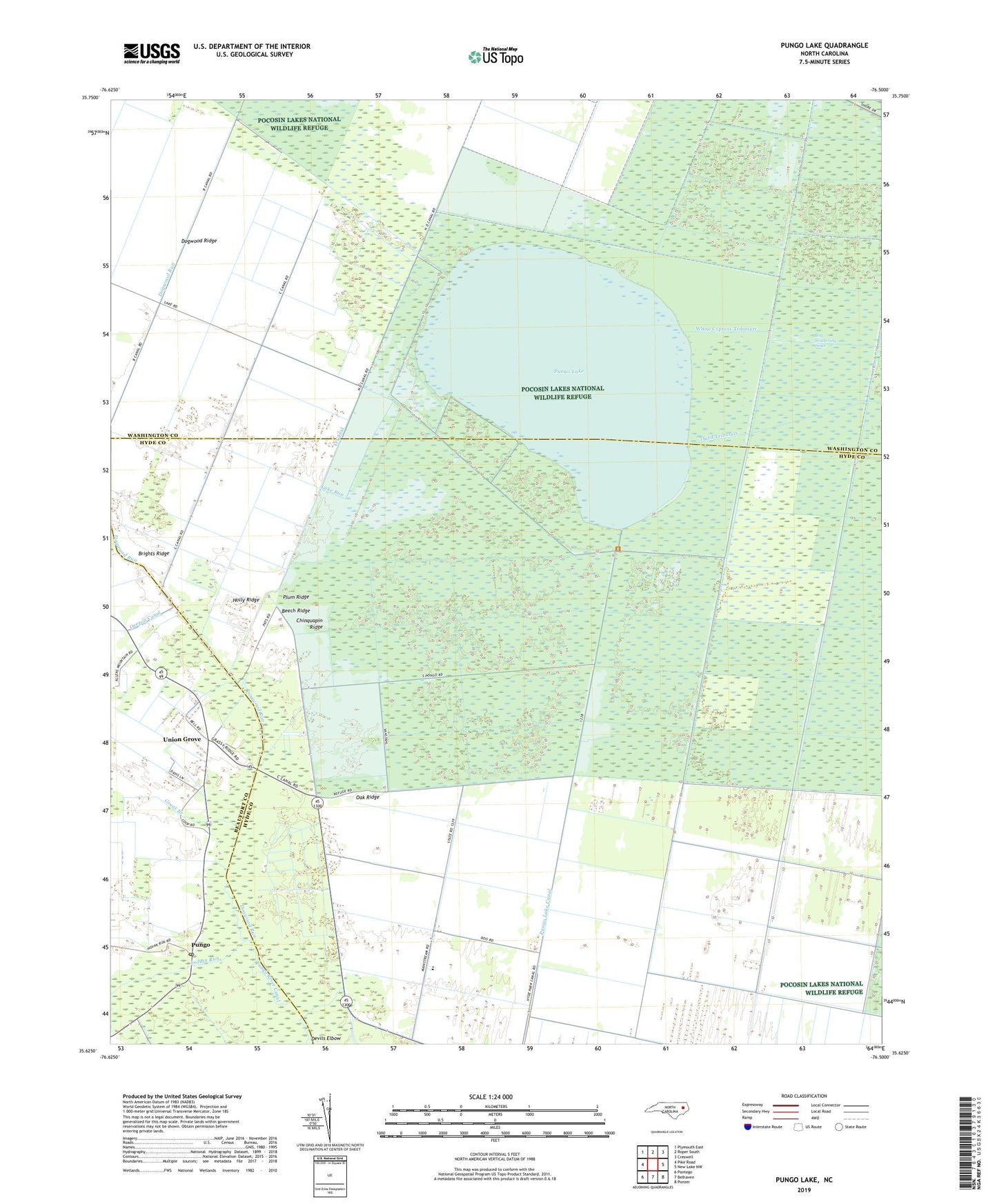
2022 topographic map quadrangle Pungo Lake in the state of North Carolina. Scale: 1:24000. Based on the newly updated USGS 7.5' US Topo map series, this map is in the following counties: Hyde, Washington, Beaufort. The map contains contour data, water features, and other items you are used to seeing on USGS maps, but also has updated roads and other features. This is the next generation of topographic maps. Printed on high-quality waterproof paper with UV fade-resistant inks.
Quads adjacent to this one:
West: Pike Road
Northwest: Plymouth East
North: Roper South
Northeast: Creswell
East: New Lake NW
Southeast: Ponzer
South: Belhaven
Southwest: Pantego
This map covers the same area as the classic USGS quad with code o35076f5.
Contains the following named places: Beech Ridge, Bog Scattering Pines, Brights Ridge, C Canal, Chinquapin Ridge, D Canal, Davis Landing, Devils Elbow, Dogwood Ridge, Dogwood Run, Elbow Landing, Great Branch, Holly Ridge, Indian Landing, Indian Run, Lake Run, Lower Pungo School, Oak Ridge, Plum Ridge, Pungo, Pungo Lake, Pungo Lake Canal, Pungo National Wildlife Refuge, Pungo Post Office, Pungo River Canal, Third Tributary, Union Grove, Union Grove Church, White Cypress Tributary, White Oak Landing