MyTopo
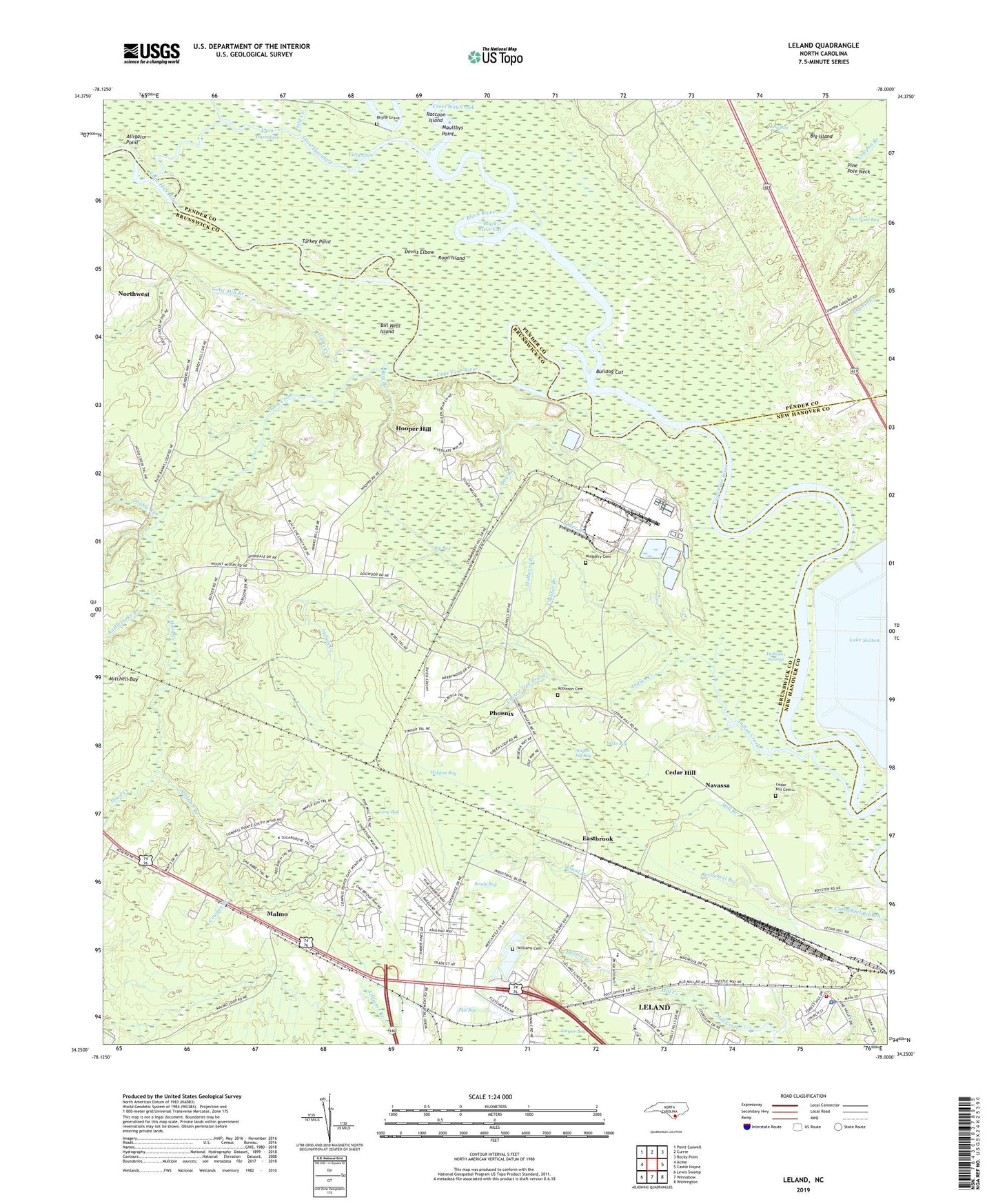
Leland North Carolina US Topo Map
Couldn't load pickup availability
2022 topographic map quadrangle Leland in the state of North Carolina. Scale: 1:24000. Based on the newly updated USGS 7.5' US Topo map series, this map is in the following counties: Brunswick, Pender, New Hanover. The map contains contour data, water features, and other items you are used to seeing on USGS maps, but also has updated roads and other features. This is the next generation of topographic maps. Printed on high-quality waterproof paper with UV fade-resistant inks.
Quads adjacent to this one:
West: Acme
Northwest: Point Caswell
North: Currie
Northeast: Rocky Point
East: Castle Hayne
Southeast: Wilmington
South: Winnabow
Southwest: Lewis Swamp
This map covers the same area as the classic USGS quad with code o34078c1.
Contains the following named places: Alligator Branch, Alligator Point, Banton Branch, Bay Branch, Bethel Church, Big Bay, Big Island, Bill Neal Island, Black River, Black River Cut, Bulldog Cut, Cedar Hill, Cedar Hill Cemetery, Cherry Tree Prong, Clabber Branch, Cowpen Branch, Davis Chapel, Davis Yard, Devils Elbow, Dollisons Landing, Dollisons Swamp, Double Run, Eastbrook, Faith Church, Field Cove, Field Creek, Flat Bay, George Brown Branch, Gibbs Creek, Goshen Church, Grist Mill Branch, Hale Point Landing, Hall Landing, Hood Creek, Hood Creek Landing, Hooper Chapel, Hooper Hill, Indian Creek, Johnson Chapel, Juniper Bay, Lake Sutton, Leland, Leland Industrial Park, Lincoln High School, Line Creek, Long Bay, Lyon Creek, Lyon Thorofare, Machine Creek, Magnolia Landing, Malmo, Maultbys Point, Mill Branch, Mount Calvary Church, Mulberry Branch, Mulberry Cemetery, Navassa, Navassa Police Department, Navassa Post Office, Navassa Volunteer Fire Station 1, Neal Branch, New Hope Church, Otter Branch, Peachtree Landing, Phoenix, Pine Pole Neck, Raccoon Island, Rattlesnake Branch, Ready Bay, Rhyne Grave, Richards Crossing, Roan Island, Roan Landing, Robinson Cemetery, Rowel Branch, Royster, Singed Pig Bay, Skipper Hill Branch, Strawberry Hill Landing, Summersville Chapel, Tar Landing, Town of Navassa, Township of Northwest, Turkey Point, Two Pond Bay, Vines Bay, Wildcat Bay, Williams Cemetery