MyTopo
Point Harbor North Carolina US Topo Map
Couldn't load pickup availability
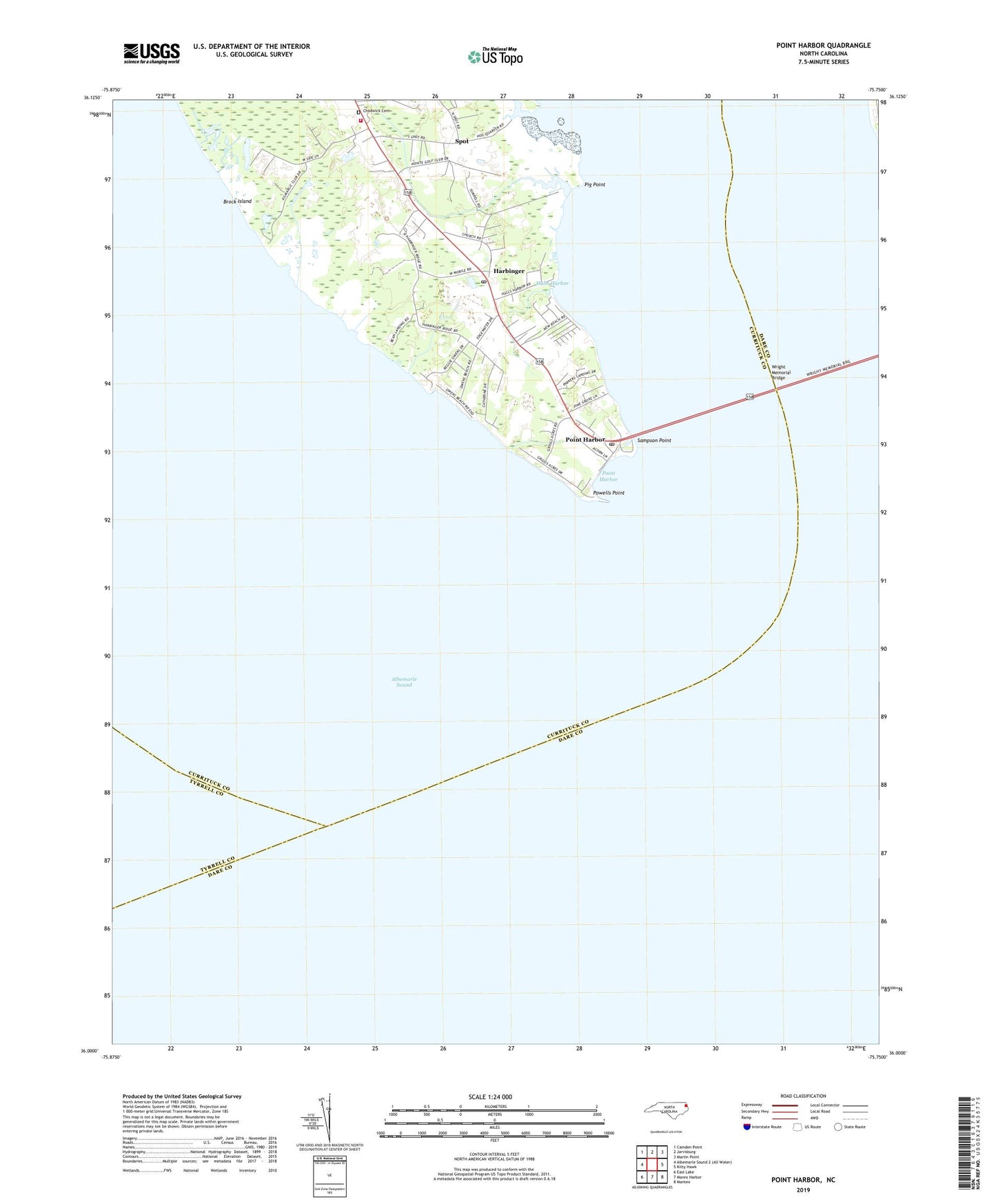
2019 topographic map quadrangle Point Harbor in the state of North Carolina. Scale: 1:24000. Based on the newly updated USGS 7.5' US Topo map series, this map is in the following counties: Currituck, Dare, Tyrrell. The map contains contour data, water features, and other items you are used to seeing on USGS maps, but also has updated roads and other features. This is the next generation of topographic maps. Printed on high-quality waterproof paper with UV fade-resistant inks.
Quads adjacent to this one:
Northwest: Camden Point
North: Jarvisburg
Northeast: Martin Point
East: Kitty Hawk
Southeast: Manteo
South: Manns Harbor
Southwest: East Lake
Contains the following named places: Albemarle Sound, Brock Island, Chadwick Cemetery, Halls Harbor, Harbinger, Harbinger Post Office, Hog Quarter Landing, Lower Currituck Volunteer Fire Department Powells Point Station, Pig Point, Piney Grove Church, Point Harbor, Point Harbor Post Office, Powells Point, Powells Point Church, Sampson Point, Sawyers Lodge, Spot, Wright Memorial Bridge, ZIP Codes: 27941, 27949, 27964