
MyTopo
Reid North Carolina US Topo Map
Couldn't load pickup availability
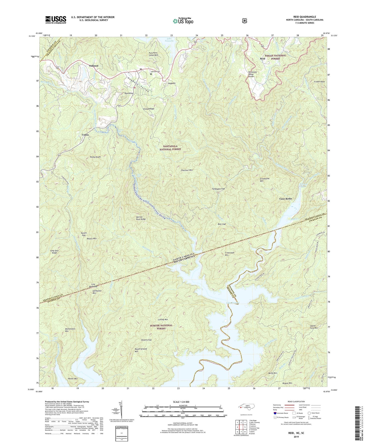
2019 topographic map quadrangle Reid in the states of North Carolina, South Carolina. Scale: 1:24000. Based on the newly updated USGS 7.5' US Topo map series, this map is in the following counties: Transylvania, Oconee, Pickens, Jackson. The map contains contour data, water features, and other items you are used to seeing on USGS maps, but also has updated roads and other features. This is the next generation of topographic maps. Printed on high-quality waterproof paper with UV fade-resistant inks.
Quads adjacent to this one:
West: Cashiers
Northwest: Big Ridge
North: Lake Toxaway
Northeast: Rosman
Southeast: Sunset
South: Salem
Southwest: Tamassee
Contains the following named places: Auger Fork Creek, Bear Creek, Bear Gap, Bear Wallow Hollow, Bear Wallow Springs, Bearcamp Creek, Bearwallow Creek, Bully Mountain, Burlingame Creek, Cane Brake, Chestnut Mountain, Cobb Creek, Coley Creek, Crossroads Mountain, Devils Hole Creek, Eastatoe Ford, Frozen Knob, Gallbuster Mountain, Gorges State Park, Grassy Ridge, Grindstone Mountain, Hester Mountain, Hickory Gap, Hogback, Horse Pasture School, Horsepasture River, Horsepasture Wild and Scenic River, Indian Creek, Jackies Branch, James Creek, Lake Toxaway Church, Lake Toxaway Fire Rescue Station 2, Laurel Fork Creek, Laurel Fork Mountain, Licklog Mountain, Line Rock Gap, Lower Falls, Maple Spring Branch, Mill Creek, Misery Mountain, Morton Creek, Musterground Mountain, Narrow Rock Ridge, Oakland, Oakland Cemetery, Panther Branch, Puncheon Camp Mountain, Rainbow Falls, Reid, Reid Branch, Rock Creek, Rocky Knobs, Roundtop, Sapphire Post Office, Tarkiln Gap, Township of Hogback, Toxaway Creek, Toxaway Falls, Tri-State Club, Turkeypen Gap, Union, Whitewater Falls, Whitewater Mountain, Whitewater Pines, Windy Falls, Wright Creek, ZIP Code: 28774


