MyTopo
Rennert North Carolina US Topo Map
Couldn't load pickup availability
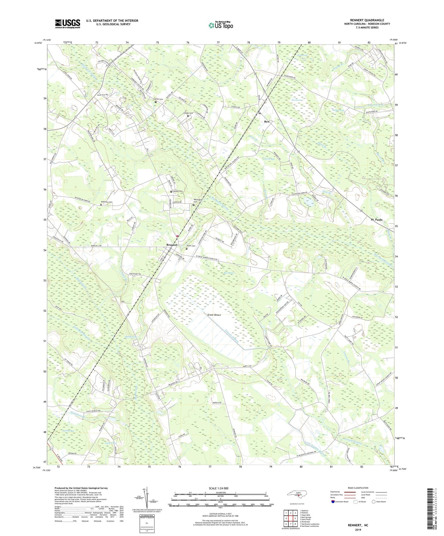
2022 topographic map quadrangle Rennert in the state of North Carolina. Scale: 1:24000. Based on the newly updated USGS 7.5' US Topo map series, this map is in the following counties: Robeson. The map contains contour data, water features, and other items you are used to seeing on USGS maps, but also has updated roads and other features. This is the next generation of topographic maps. Printed on high-quality waterproof paper with UV fade-resistant inks.
Quads adjacent to this one:
West: Red Springs
Northwest: Raeford
North: Parkton
Northeast: Hope Mills
East: Saint Pauls
Southeast: Northeast Lumberton
South: Northwest Lumberton
Southwest: Pembroke
This map covers the same area as the classic USGS quad with code o34079g1.
Contains the following named places: Ausley Cemetery, Black Branch, Blue Desert, Carolina Church, Cedar Grove Church, Collins Cemetery, Condly Cemetery, Cypress Bay, Glass Pond, Great Desert, Gum Branch, Humphrey Branch, Jackson Grove Church, Little Raft Swamp, Lumbee State Designated Tribal Statistical Area, Mathis Pond, McKinsey Cemetery, Mirey Branch, Mount Olive Church, Mount Tabor Church, New Bethel Church, New Zion Church, Panther Bay, Panthersford Church, Redden Branch, Rennert, Rennert School, Rennert Volunteer Fire Department, Rex, Rex Census Designated Place, Rex Post Office, Saint Johns Church, Saint Matthews Church, Sewell Bay, Smith Branch, The Desert, Toller Cemetery, Town of Rennert, Township of Rennert, Wellington Cemetery