MyTopo
Roper South North Carolina US Topo Map
Couldn't load pickup availability
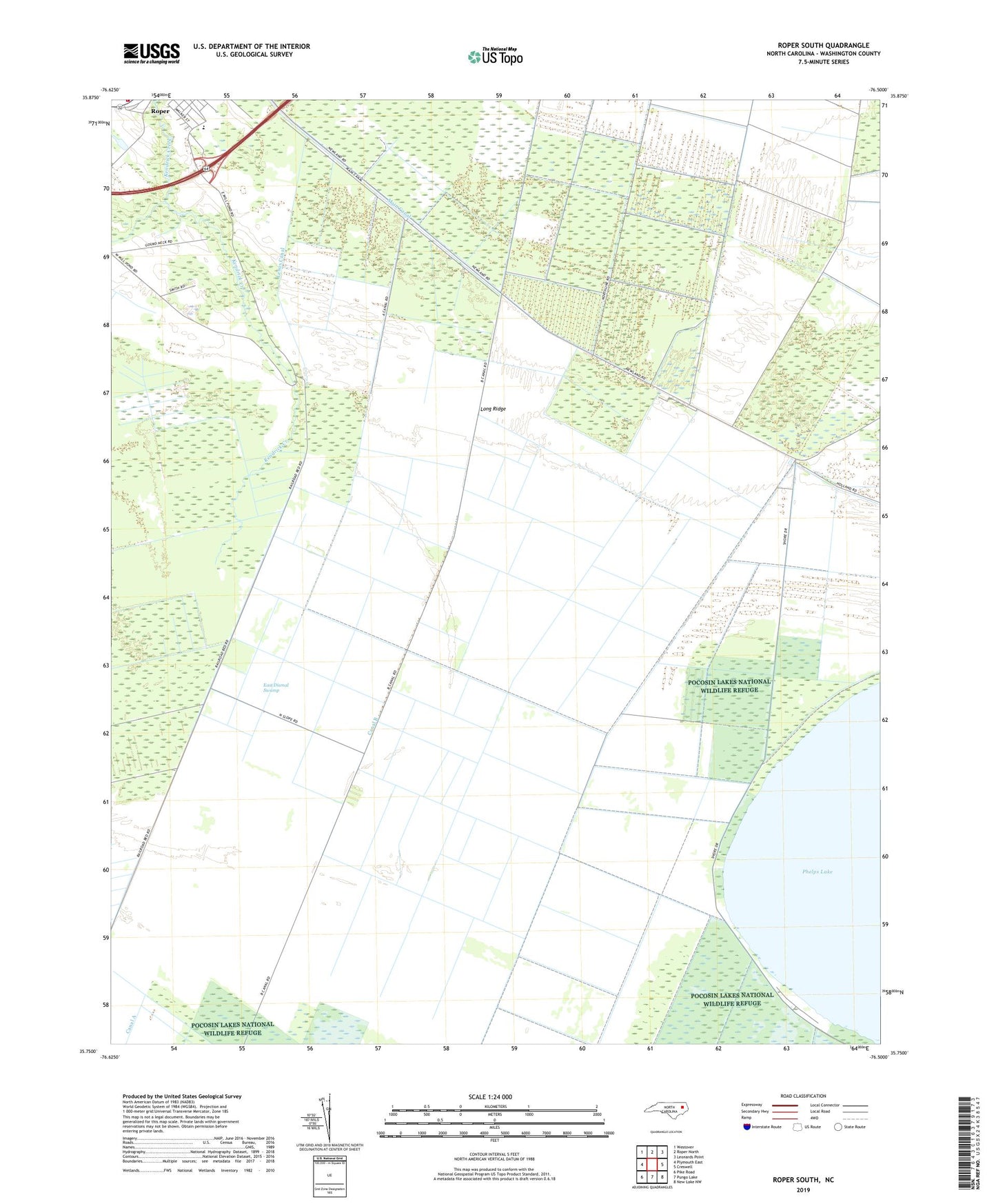
2019 topographic map quadrangle Roper South in the state of North Carolina. Scale: 1:24000. Based on the newly updated USGS 7.5' US Topo map series, this map is in the following counties: Washington. The map contains contour data, water features, and other items you are used to seeing on USGS maps, but also has updated roads and other features. This is the next generation of topographic maps. Printed on high-quality waterproof paper with UV fade-resistant inks.
Quads adjacent to this one:
West: Plymouth East
Northwest: Westover
North: Roper North
Northeast: Leonards Point
East: Creswell
Southeast: New Lake NW
South: Pungo Lake
Southwest: Pike Road
Contains the following named places: Canal A, Canal B, Clemons High School, First Colony Farms Airport, Lewis Canal, Long Ridge, Main Canal, Roper Elementary School, Roper Volunteer Fire Department, Washington County