MyTopo
Leonards Point North Carolina US Topo Map
Couldn't load pickup availability
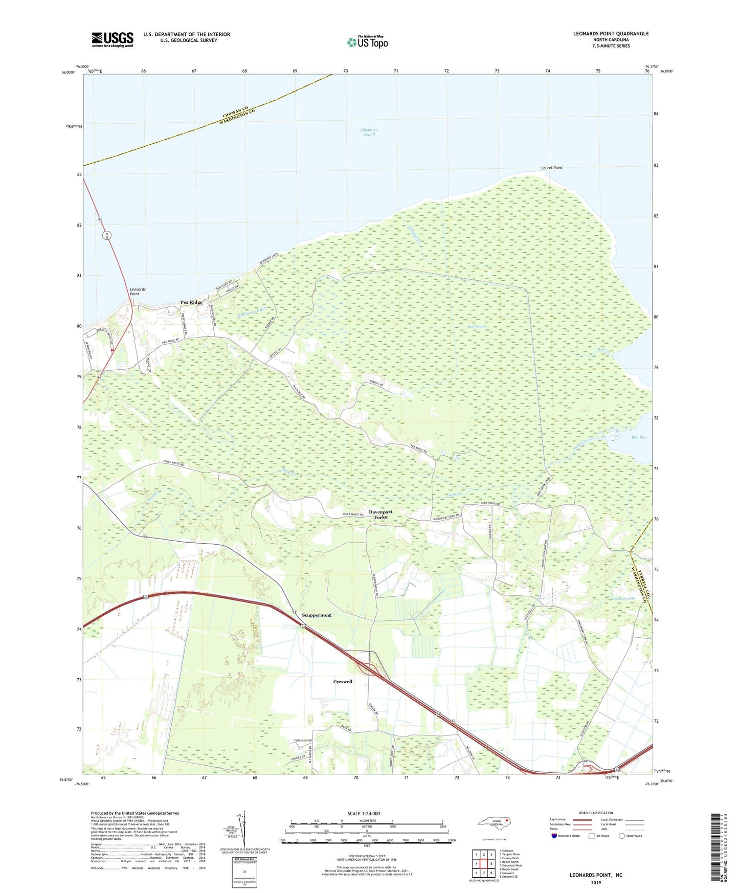
2022 topographic map quadrangle Leonards Point in the state of North Carolina. Scale: 1:24000. Based on the newly updated USGS 7.5' US Topo map series, this map is in the following counties: Washington, Chowan, Tyrrell. The map contains contour data, water features, and other items you are used to seeing on USGS maps, but also has updated roads and other features. This is the next generation of topographic maps. Printed on high-quality waterproof paper with UV fade-resistant inks.
Quads adjacent to this one:
West: Roper North
Northwest: Edenton
North: Yeopim River
Northeast: Harvey Neck
East: Columbia West
Southeast: Creswell SE
South: Creswell
Southwest: Roper South
This map covers the same area as the classic USGS quad with code o35076h4.
Contains the following named places: Big Swamp, Bull Creek, Davenport Forks, Deep Creek, First Landing, Indian Swamp, Laurel Point, Leonards Point, Mid - County Volunteer Fire Department, Mount Pleasant Church, Newberry Ditch, Newberry Landing, Pea Ridge, Piney Grove Church, Scuppernong, Scuppernong Church, Shadberry Landing, Sleights Creek, Sound, Spre Will Chapel, Township of Skinnersville