MyTopo
Autryville North Carolina US Topo Map
Couldn't load pickup availability
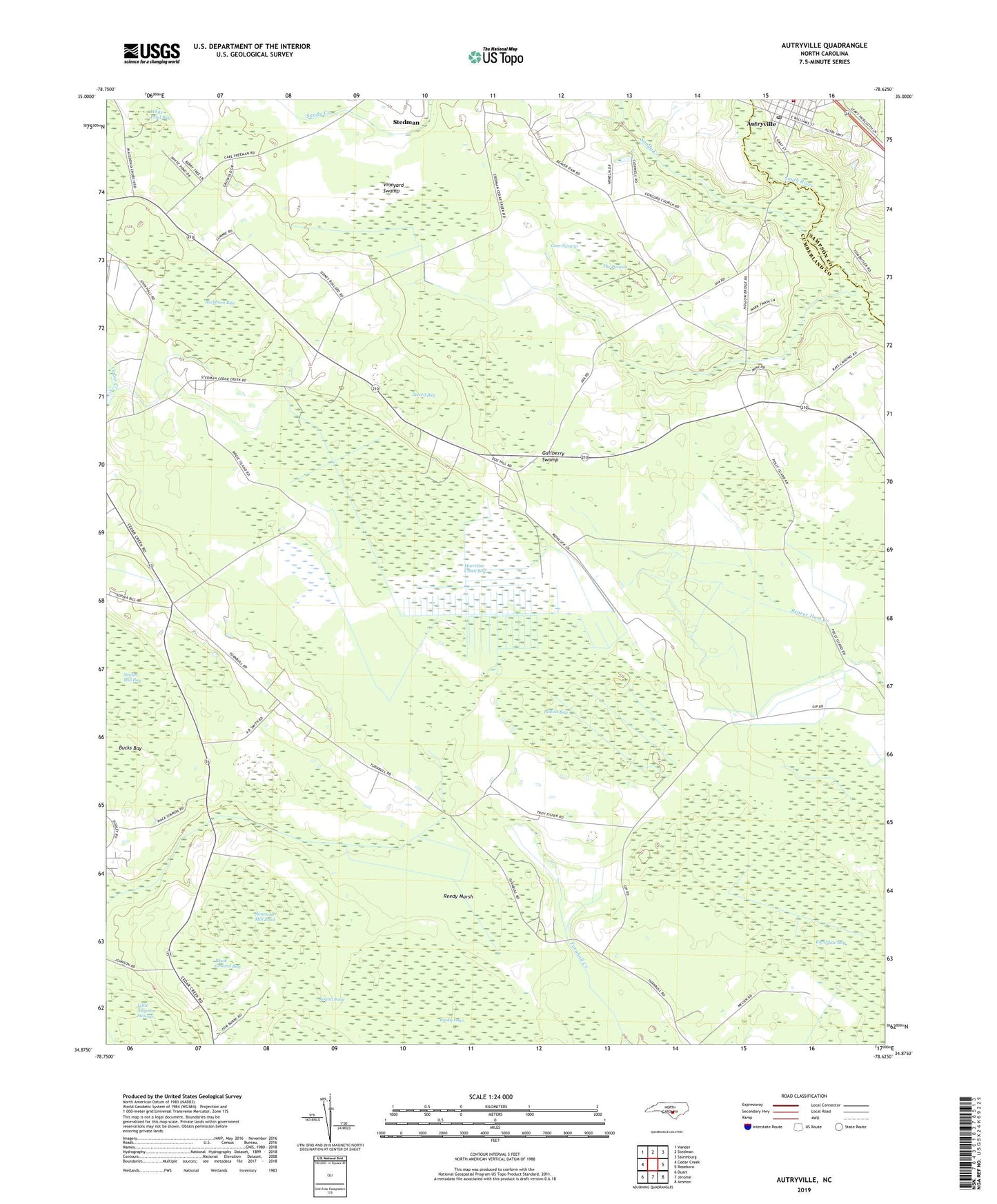
2022 topographic map quadrangle Autryville in the state of North Carolina. Scale: 1:24000. Based on the newly updated USGS 7.5' US Topo map series, this map is in the following counties: Cumberland, Sampson. The map contains contour data, water features, and other items you are used to seeing on USGS maps, but also has updated roads and other features. This is the next generation of topographic maps. Printed on high-quality waterproof paper with UV fade-resistant inks.
Quads adjacent to this one:
West: Cedar Creek
Northwest: Vander
North: Stedman
Northeast: Salemburg
East: Roseboro
Southeast: Ammon
South: Jerome
Southwest: Duart
This map covers the same area as the classic USGS quad with code o34078h6.
Contains the following named places: Autryville, Autryville Area Fire Department, Autryville Post Office, Big White Bay, Black Ground Bay, Buckhorn Bay, Bucks Bay, Bushy Lake, Cedar Creek Lookout Tower, Christian Light Church, Concord Church, Gallberry Swamp, Gum Swamp, Harrison Creek Bay, Macedonia Church, Prophecy Church, Reedy Marsh, Rollins Bay, Round Pond, Saint Johns Church, Saint Marks Church, Sandy Creek, Sewell Bay, Simmons Mill Pond, Smiths Mill Bay, The Pocosin, Town of Autryville, Township of Cedar Creek, Union Hill Church, Vineyard Swamp, White Pond Bay, ZIP Code: 28312