MyTopo
Ruffin North Carolina US Topo Map
Couldn't load pickup availability
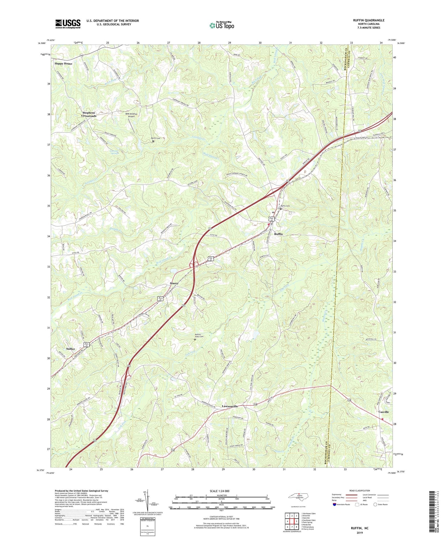
2022 topographic map quadrangle Ruffin in the state of North Carolina. Scale: 1:24000. Based on the newly updated USGS 7.5' US Topo map series, this map is in the following counties: Rockingham, Caswell. The map contains contour data, water features, and other items you are used to seeing on USGS maps, but also has updated roads and other features. This is the next generation of topographic maps. Printed on high-quality waterproof paper with UV fade-resistant inks.
Quads adjacent to this one:
West: Southeast Eden
Northwest: Northeast Eden
North: Brosville
Northeast: Danville
East: Park Spring
Southeast: Cherry Grove
South: Williamsburg
Southwest: Reidsville
This map covers the same area as the classic USGS quad with code o36079d5.
Contains the following named places: BHH Aviation Airport, Birch Fork, Casville, Casville Volunteer Fire Department Station 3, Guerrant - Martin Family Cemetery, Guerrant Springs, Jones Creek, Lawsonville, Leviva, Lick Fork, Lick Fork Primitive Baptist Church, Lively Stones Baptist Church, Lovelace Creek, Mount Hermon Baptist Church, Mullins - Stacy Cemetery, Narrow Gauge Church, Oak Grove Primitive Baptist Church, Oakhaven Farms, Peniel Methodist Church, Poteat School, Quaqua Creek, Rocky Ridge Baptist Church, Ruffin, Ruffin Cemetery, Ruffin Census Designated Place, Ruffin High School, Ruffin Post Office, Ruffin Volunteer Fire Department, Sadler, Sadler Elementary School, Shiloh Church, Stacey, Stephens Crossroads, Township of Ruffin, Wolf Island Church, ZIP Code: 27326