MyTopo
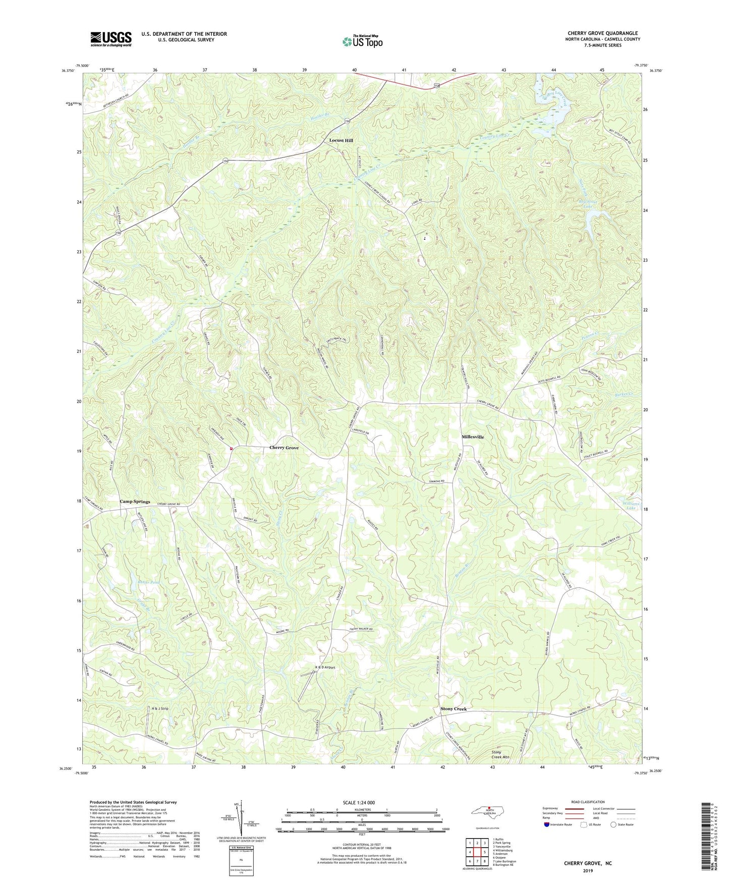
Cherry Grove North Carolina US Topo Map
Couldn't load pickup availability
2022 topographic map quadrangle Cherry Grove in the state of North Carolina. Scale: 1:24000. Based on the newly updated USGS 7.5' US Topo map series, this map is in the following counties: Caswell. The map contains contour data, water features, and other items you are used to seeing on USGS maps, but also has updated roads and other features. This is the next generation of topographic maps. Printed on high-quality waterproof paper with UV fade-resistant inks.
Quads adjacent to this one:
West: Williamsburg
Northwest: Ruffin
North: Park Spring
Northeast: Yanceyville
East: Anderson
Southeast: Burlington NE
South: Lake Burlington
Southwest: Ossipee
This map covers the same area as the classic USGS quad with code o36079c4.
Contains the following named places: Benton Branch, Boy Scout Lake, Boy Scout Lake Dam, Butler Pond, Butler Pond Dam, Camp Springs, Cherokee Scout Reservation, Cherry Grove, Cherry Grove Volunteer Fire Department, Concord Church, Grays Branch, H & J Strip, Hostler Branch, K & D Airport, Kerrs Chapel, Locust Hill, Millesville, Nats Fork, Stony Creek, Stony Creek School, Township of Stoney Creek, Trinity Church, Trinity Missionary Church