
MyTopo
Siler City NE North Carolina US Topo Map
Couldn't load pickup availability
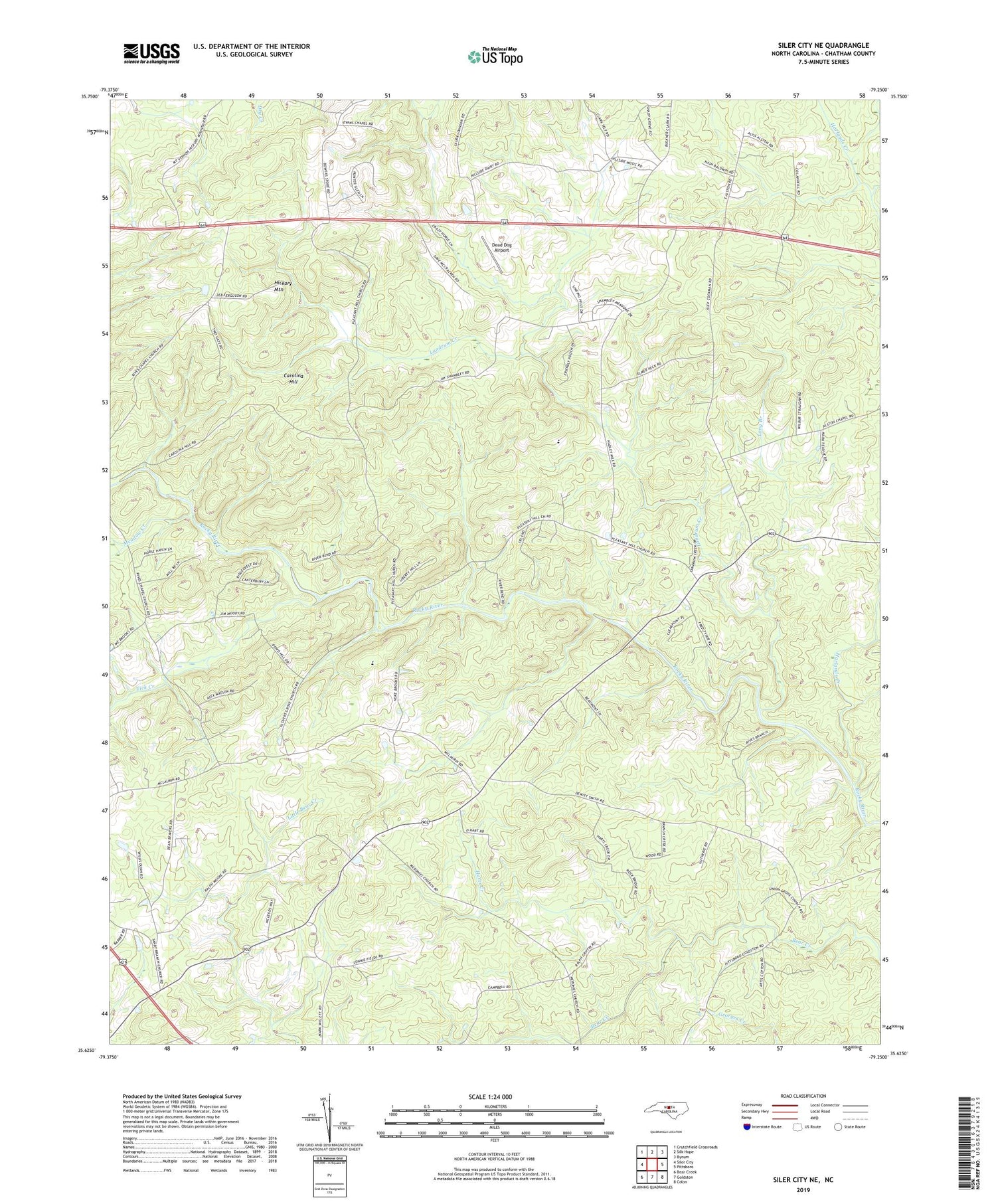
2019 topographic map quadrangle Siler City NE in the state of North Carolina. Scale: 1:24000. Based on the newly updated USGS 7.5' US Topo map series, this map is in the following counties: Chatham. The map contains contour data, water features, and other items you are used to seeing on USGS maps, but also has updated roads and other features. This is the next generation of topographic maps. Printed on high-quality waterproof paper with UV fade-resistant inks.
Quads adjacent to this one:
West: Siler City
Northwest: Crutchfield Crossroads
North: Silk Hope
Northeast: Bynum
East: Pittsboro
Southeast: Colon
South: Goldston
Southwest: Bear Creek
Contains the following named places: Cameron Pond, Cameron Pond Dam, Carolina Hill, Chatham County, Dead Dog Airport, Etchison Farms, Evans Chapel, Glovers Grove Church, Hadley Millpond Dam, Hadleys Mill Pond, Harlands Creek, Harts Creek, Hickory Mountain, Hickory Mountain Church, Landrum Creek, Long Branch, Meadow Creek, Meronies Church, Pleasant Hill Church, Rives Chapel, Sandy Branch Church, Tick Creek, Township of Hickory Mountain, Union Grove Church


