MyTopo
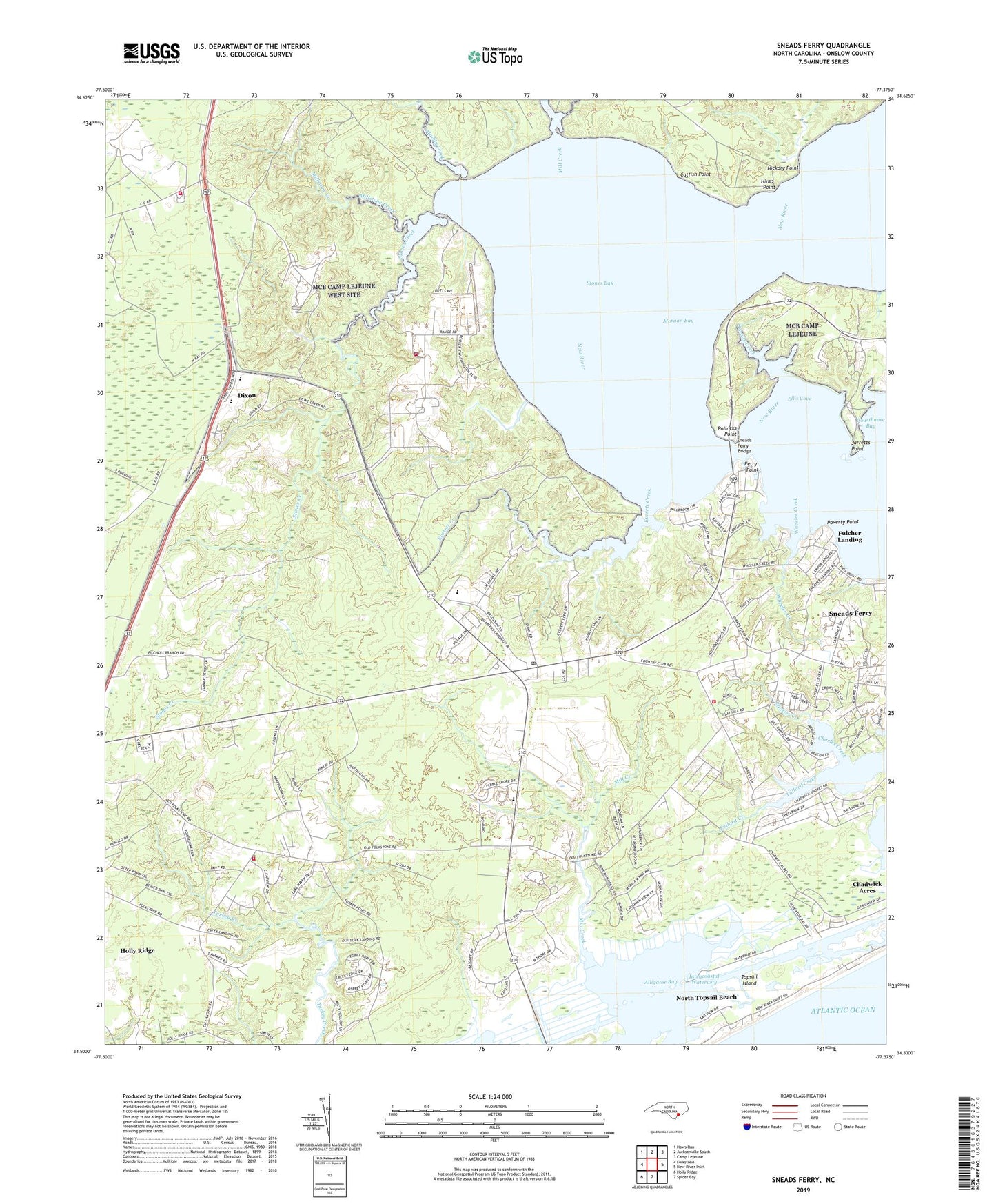
Sneads Ferry North Carolina US Topo Map
Couldn't load pickup availability
2022 topographic map quadrangle Sneads Ferry in the state of North Carolina. Scale: 1:24000. Based on the newly updated USGS 7.5' US Topo map series, this map is in the following counties: Onslow. The map contains contour data, water features, and other items you are used to seeing on USGS maps, but also has updated roads and other features. This is the next generation of topographic maps. Printed on high-quality waterproof paper with UV fade-resistant inks.
Quads adjacent to this one:
West: Folkstone
Northwest: Haws Run
North: Jacksonville South
Northeast: Camp Lejeune
East: New River Inlet
South: Spicer Bay
Southwest: Holly Ridge
This map covers the same area as the classic USGS quad with code o34077e4.
Contains the following named places: Alligator Bay, Biglins Creek, Camp Lejeune Fire Department Station 10, Camp Lejeune Fire Department Station 9, Carrel Chapel, Catfish Point, Charles Creek, Davis Mobile Home Park, Dixon, Dixon Elementary School, Dixon Senior High School, Ellis Cove, Everett Creek, Fannie Creek, Ferry Point, First United Methodist Church of Sneads Ferry, Foys Landing, Fulcher Landing, Hickory Point, Hines Point, Jarretts Point, Little Zion Church, Marine Corps Base Camp Lejeune, Mill Creek, Millstone Creek, Muddy Creek, Onslow County Emergency Medical Services Station 6, Onslow County Public Library - Sneads Ferry Branch, Pollocks Point, Poverty Point, Sandford Landing, Sneads Creek, Sneads Ferry, Sneads Ferry Bridge, Sneads Ferry Census Designated Place, Sneads Ferry Post Office, Stones Bay, Stones Creek, Stones Landing, Township of Stump Sound, Turkey Creek Fire and Rescue Station 1, Turkey Creek Fire and Rescue Station 2, Turkey Creek Fire and Rescue Station 3, Turkey Creek Mobile Home Park, Unorganized Territory of Camp Lejeune, Wheeler Creek, Whitewood Forest Airport, Winding Creek Airport, Yopps Church, ZIP Code: 28460