MyTopo
Southport North Carolina US Topo Map
Couldn't load pickup availability
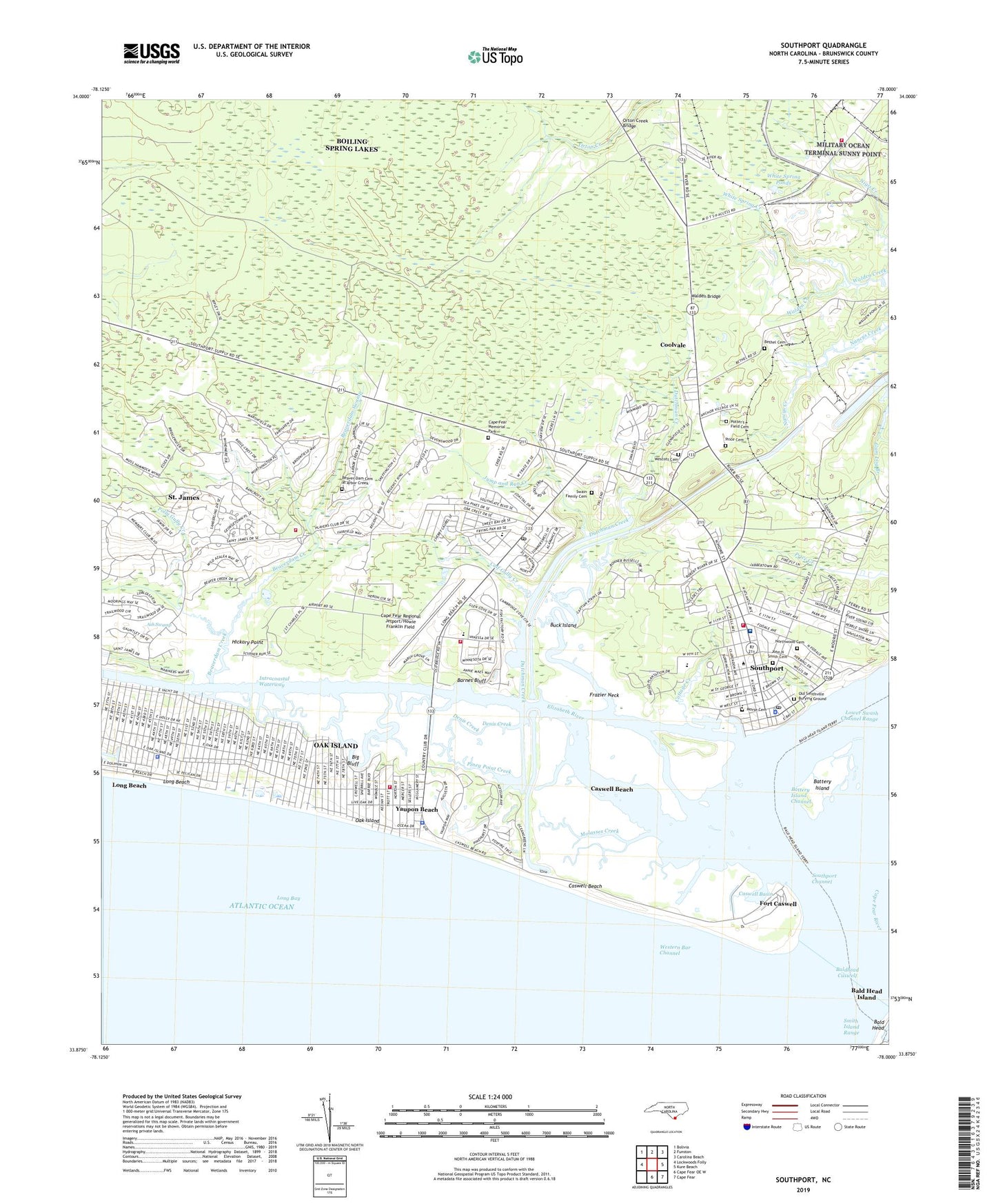
2019 topographic map quadrangle Southport in the state of North Carolina. Scale: 1:24000. Based on the newly updated USGS 7.5' US Topo map series, this map is in the following counties: Brunswick. The map contains contour data, water features, and other items you are used to seeing on USGS maps, but also has updated roads and other features. This is the next generation of topographic maps. Printed on high-quality waterproof paper with UV fade-resistant inks.
Quads adjacent to this one:
West: Lockwoods Folly
Northwest: Bolivia
North: Funston
Northeast: Carolina Beach
East: Kure Beach
Southeast: Cape Fear
South: Cape Fear OE W
Contains the following named places: Baldhead Caswell, Barnes Bluff, Battery Island, Battery Island Channel, Beaver Dam Cemetery at Arbor Creek, Beaverdam Creek, Beaverdam Swamp, Bethel, Bethel Cemetery, Big Bluff, Boathouse Creek, Browns Chapel, Brunswick County Home, Buck Island, Calf Gully Creek, Cape Fear Memorial Park, Cape Fear Regional Jetport/Howie Franklin Field, Cape Fear River, Caswell Basin, Caswell Beach, Caswell Beach Police Department, City of Southport, Coolvale, Cottage Creek, Coward Creek, Denis Creek, Dosher Memorial Hospital, Doshers Creek, Dutchman Creek, Elizabeth River, Fort Caswell, Frazier Neck, Generations Church, Hickory Point, Indigo Plantation Marina, Jay Bird Shoals, John N Smith Cemetery, Joy Assembly, Jump and Run Creek, Light Fourteen, Long Beach, Long Beach Post Office, Lower Swash Channel Range, Midway Church, Molasses Creek, Morse Cemetery, North Carolina Maritime Museum at Southport, Northwood Cemetery, Oak Island, Oak Island Fire and Rescue Station 2 - Yaupon Beach Fire Department, Oak Island Fire and Rescue Station 3, Oak Island Lighthouse, Oak Island Police Department, Oak Island Water Rescue Team, Ocean Trail Convalescent Center, Old Smithville Burying Ground, Orton Creek Bridge, Piney Point Creek, Polly Gully Creek, Potter's Field Cemetery, Price Cemetery, Saint James, Saint James Church, Saint James Fire Department, SFC Edward C. Kramer Fire Station, Smith Island Front Range, Smith Island Range, Smith Island Rear Range, Smithville Township District Park, Smokehouse Creek, South Harbour Village Marina, Southport, Southport Annex Post Office, Southport Channel, Southport Fire Department, Southport Light One, Southport Marina, Southport Police Department, Southport Post Office, Southport Primary School, Southport Rescue Squad, Stevens Park, Swain Family Cemetery, Town of Caswell Beach, Town of Long Beach, Town of Saint James, Town of Yaupon Beach, Township of Smithville, Walden Bridge, Wescott Cemetery, Western Bar Channel, White Spring Creek, White Spring Ponds, WLCF-FM (Southport), Yaupon Beach, Yaupon Police Department, ZIP Codes: 28461, 28465