MyTopo
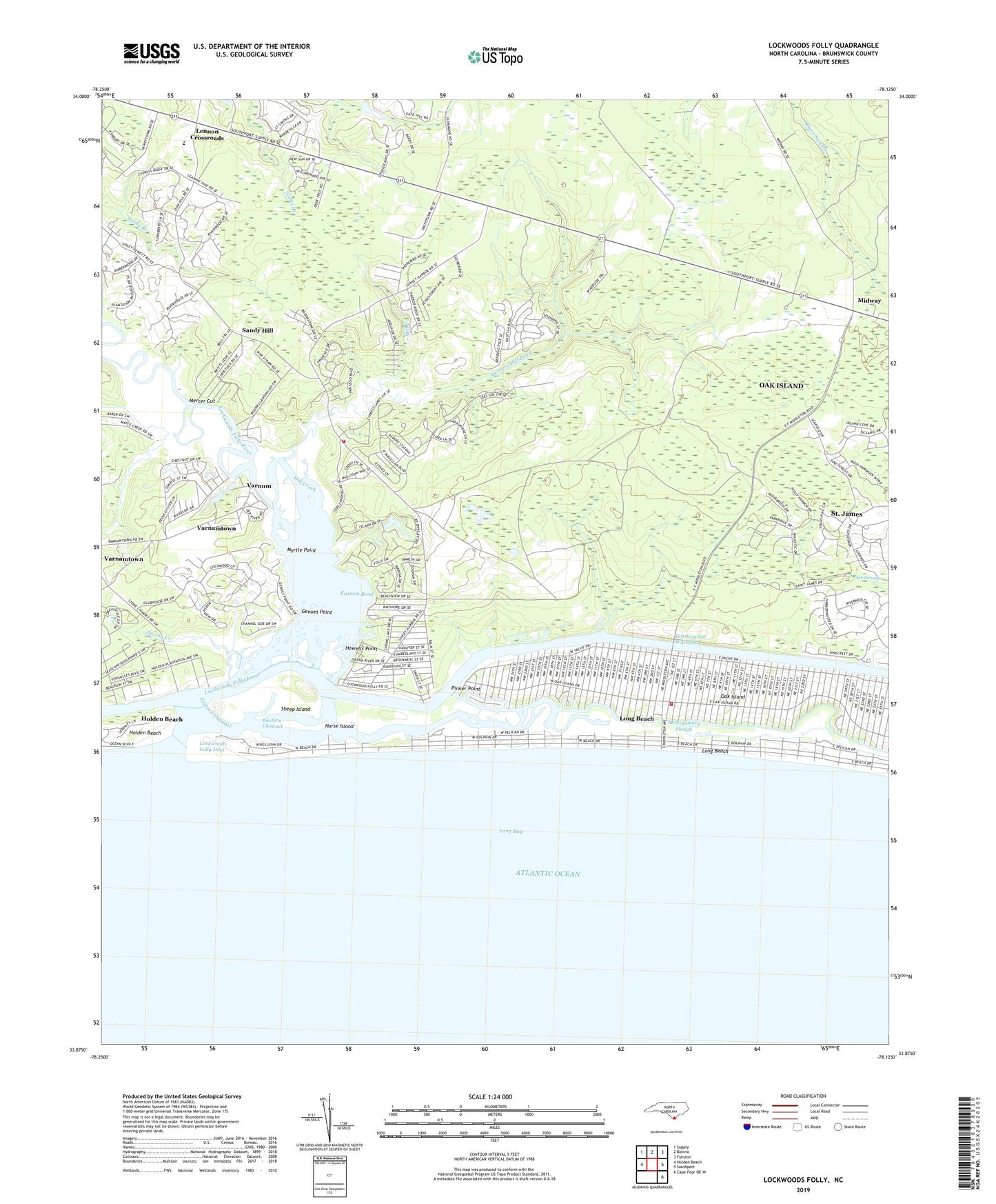
Lockwoods Folly North Carolina US Topo Map
Couldn't load pickup availability
2022 topographic map quadrangle Lockwoods Folly in the state of North Carolina. Scale: 1:24000. Based on the newly updated USGS 7.5' US Topo map series, this map is in the following counties: Brunswick. The map contains contour data, water features, and other items you are used to seeing on USGS maps, but also has updated roads and other features. This is the next generation of topographic maps. Printed on high-quality waterproof paper with UV fade-resistant inks.
Quads adjacent to this one:
West: Holden Beach
Northwest: Supply
North: Bolivia
Northeast: Funston
East: Southport
Southeast: Cape Fear OE W
This map covers the same area as the classic USGS quad with code o33078h2.
Contains the following named places: Ash Swamp, Blue Water Point Marina, Cudge Branch, Dixon Chapel, Dixon Landing, Eastern Bend, Eastern Channel, Galloway, Genoes Point, Gores Landing, Gospel Church, Horse Island, Howells Point, Kingdom Hall, Lennon Crossroads, Lockwoods Creek, Lockwoods Folly Inlet, Lockwoods Folly River, Long Beach, Maple Creek, Mercer Cut, Mercer Landing, Mercers Mill Pond, Midway, Midway Church, Mill Creek, Montgomery Slough, Mullet Creek, Myrtle Point, Oak Island, Oak Island Fire and Rescue Station 1, Paris, Pinner Point, Robin Schusta Park, Saint James Church, Sandy Hill, Sheep Island, Spring Creek, Stanbury Creek, Sunset Harbor, Sunset Harbor and Zion Hill Volunteer Fire Department, Town of Oak Island, Town of Varnamtown, Varnams Landing, Varnamtown, Varnum, Wildcat Creek, Wildcat Landing, Zion Hill Church