MyTopo
Sunbury North Carolina US Topo Map
Couldn't load pickup availability
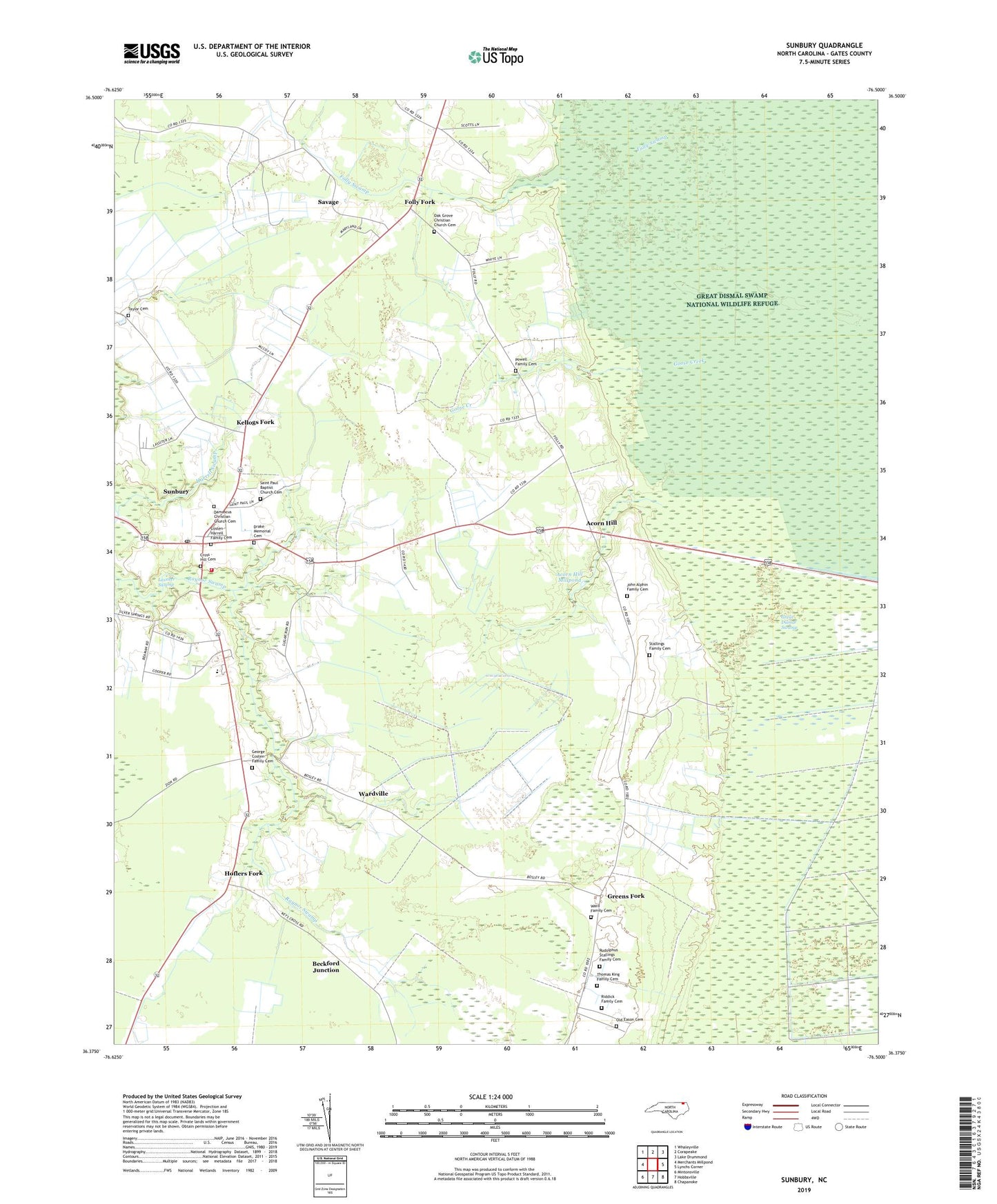
2019 topographic map quadrangle Sunbury in the state of North Carolina. Scale: 1:24000. Based on the newly updated USGS 7.5' US Topo map series, this map is in the following counties: Gates. The map contains contour data, water features, and other items you are used to seeing on USGS maps, but also has updated roads and other features. This is the next generation of topographic maps. Printed on high-quality waterproof paper with UV fade-resistant inks.
Quads adjacent to this one:
West: Merchants Millpond
Northwest: Whaleyville
North: Corapeake
Northeast: Lake Drummond
East: Lynchs Corner
Southeast: Chapanoke
South: Hobbsville
Southwest: Mintonsville
Contains the following named places: Acorn Hill, Acorn Hill Millpond, Beckford Junction, Costen - Harrell Family Cemetery, Cross - Hill Cemetery, Damascus Christian Church Cemetery, Drake Memorial Cemetery, Folly Fork, Folly Swamp, George Costen Family Cemetery, Goose Creek, Greens Fork, Harrell Swamp, Hoflers Fork, Hunters Millpond, John Alphin Family Cemetery, Kellogs Fork, Oak Grove Christian Church Cemetery, Oak Grove Church, Old Eason Cemetery, Powell Family Cemetery, Riddick Family Cemetery, Rudolphus Stallings Family Cemetery, Saint Johns Zion Church, Saint Paul Baptist Church Cemetery, Savage, Stallings Family Cemetery, Sunbury, Sunbury Census Designated Place, Sunbury Elementary School, Sunbury Post Office, Sunbury Volunteer Fire Department Station 40, T S Cooper Elementary School, Taylor Cemetery, Thomas King Family Cemetery, Township of Holly Grove, Township of Hunters Mill, Ward Family Cemetery, Wardville, ZIP Code: 27979