MyTopo
Whaleyville Virginia US Topo Map
Couldn't load pickup availability
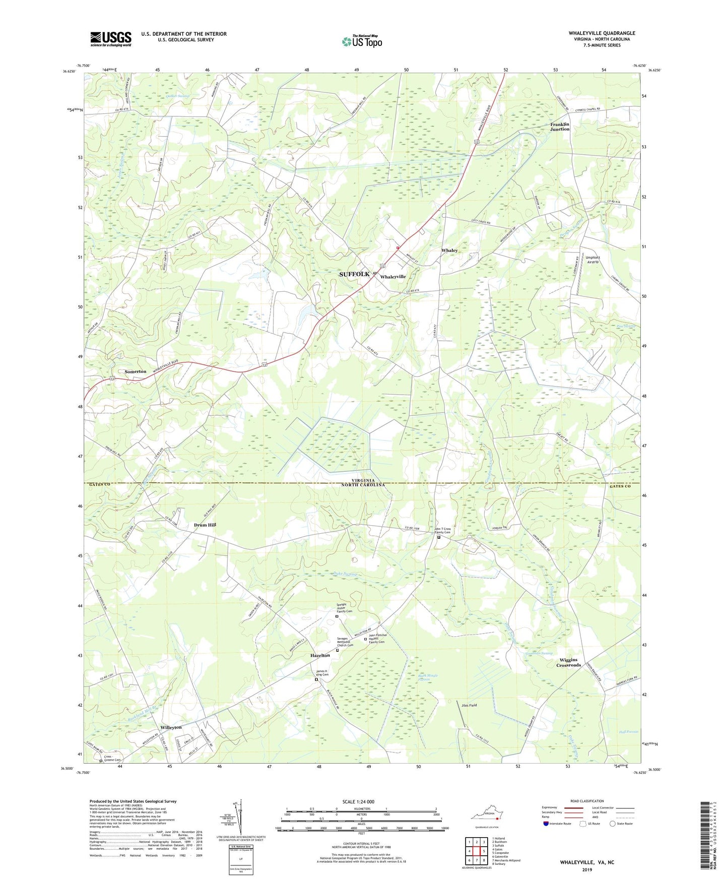
2022 topographic map quadrangle Whaleyville in the states of Virginia, North Carolina. Scale: 1:24000. Based on the newly updated USGS 7.5' US Topo map series, this map is in the following counties: Suffolk (city), Gates. The map contains contour data, water features, and other items you are used to seeing on USGS maps, but also has updated roads and other features. This is the next generation of topographic maps. Printed on high-quality waterproof paper with UV fade-resistant inks.
Quads adjacent to this one:
West: Gates
Northwest: Holland
North: Buckhorn
Northeast: Suffolk
East: Corapeake
Southeast: Sunbury
South: Merchants Millpond
Southwest: Gatesville
This map covers the same area as the classic USGS quad with code o36076e6.
Contains the following named places: Black Mingle Pocosin, Cherry Grove School, Cross - Greene Cemetery, Drum Hill, Franklin Junction, Goodman Swamp, Great Fork Church, Harrell Siding, Hazelton, James H King Cemetery, Jiles Field, John Fletcher Haslett Family Cemetery, John T Cross Family Cemetery, Jones School, Jones Swamp, Palm Tree Church, Parker Pocoson, Pierce School, Pine Swamp, Piney Grove School, Piney Wood Chapel, Robertson Elementary School, Saint Marys Church, Savages Church, Savages Methodist Church Cemetery, Speight Josher Family Cemetery, Spivey Swamp, Suffolk Department of Fire and Rescue Station 8 Whaleyville Volunteer Fire Department, Sumnersville, Township of Haslett, Umphlett Airstrip, Union Branch Church, Whaley, Whaleyville, Whaleyville Community Center, Whaleyville Post Office, Wiggins Crossroads, Willeyton, ZIP Code: 23438