MyTopo
Corapeake North Carolina US Topo Map
Couldn't load pickup availability
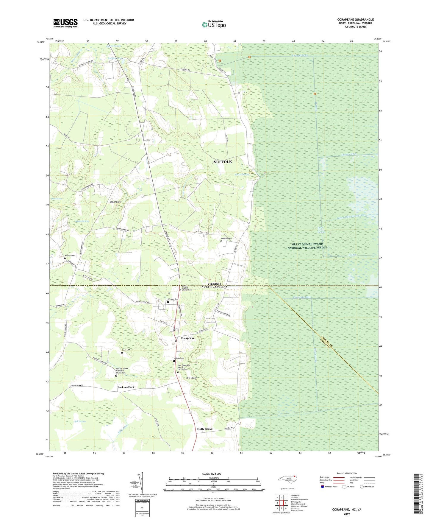
2022 topographic map quadrangle Corapeake in the states of Virginia, North Carolina. Scale: 1:24000. Based on the newly updated USGS 7.5' US Topo map series, this map is in the following counties: Gates, Suffolk (city), Camden. The map contains contour data, water features, and other items you are used to seeing on USGS maps, but also has updated roads and other features. This is the next generation of topographic maps. Printed on high-quality waterproof paper with UV fade-resistant inks.
Quads adjacent to this one:
West: Whaleyville
Northwest: Buckhorn
North: Suffolk
Northeast: Lake Drummond NW
East: Lake Drummond
Southeast: Lynchs Corner
South: Sunbury
Southwest: Merchants Millpond
Contains the following named places: Adams Swamp, Baines Hill, Baines Hill School, Brinkley Cemetery, Corapeake, Corapeake Post Office, Corapeake Swamp, Cypress Chapel, Dragon Swamp, Eureka Baptist Church Cemetery, Eureka Church, Folly Ditch, Franklin Grove School, Hall Pocosin, Holly Grove, Interior Ditch, Jones Cemetery, Jones Millpond, Mathias Cemetery, Moss Swamp, Parker Church, Parkers Fork, Parker's United Methodist Church Cemetery, Raby Pocoson, Railroad Ditch, Riddick Cemetery, Riddick Pond, Sherrill Ditch, Taylor Swamp, Ure Island, West Ditch, Winslow Cemetery, Zion Church, Zion Tabernacle Baptist Church Cemetery, ZIP Code: 27926