MyTopo
Lake Drummond Virginia US Topo Map
Couldn't load pickup availability
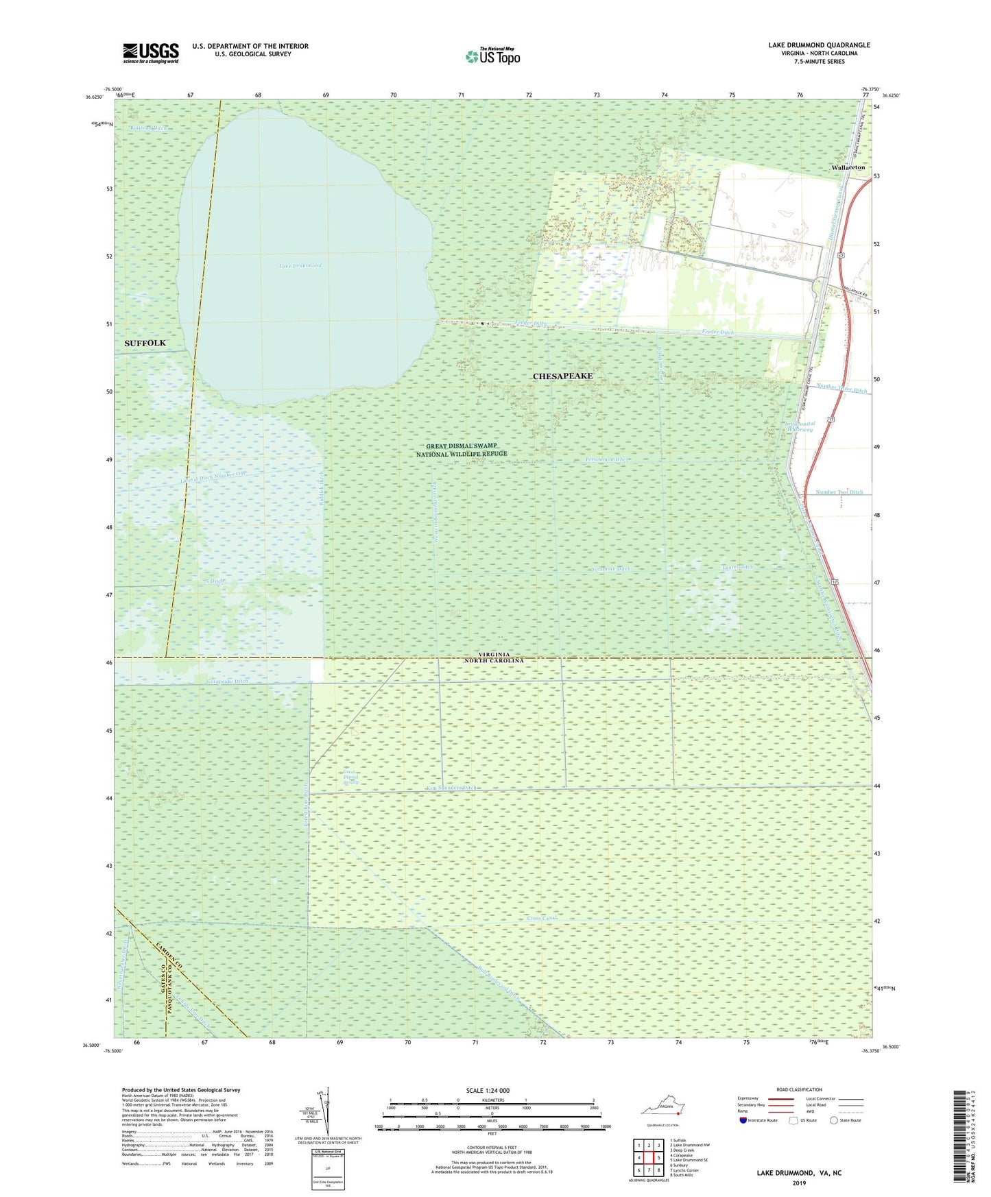
2022 topographic map quadrangle Lake Drummond in the states of Virginia, North Carolina. Scale: 1:24000. Based on the newly updated USGS 7.5' US Topo map series, this map is in the following counties: Chesapeake (city), Camden, Suffolk (city), Gates, Pasquotank. The map contains contour data, water features, and other items you are used to seeing on USGS maps, but also has updated roads and other features. This is the next generation of topographic maps. Printed on high-quality waterproof paper with UV fade-resistant inks.
Quads adjacent to this one:
West: Corapeake
Northwest: Suffolk
North: Lake Drummond NW
Northeast: Deep Creek
East: Lake Drummond SE
Southeast: South Mills
South: Lynchs Corner
Southwest: Sunbury
This map covers the same area as the classic USGS quad with code o36076e4.
Contains the following named places: Angle Siding, Arbuckle Landing, Bull Boulevard Ditch, Corapeake Ditch, County Line Ditch, Cross Canal, Dismal Swamp Canal, Dismal Swamp State Park, Feeder Ditch, Forest Line Ditch, Great Dismal Swamp, Great Dismal Swamp National Wildlife Refuge, Jacks Camp, Kim Saunders Ditch, Lake Drummond, Lake Drummond Dam, Lateral Ditch Number One, Laurel Ditch, Myrtle Ditch, Paw-paw Ditch, Persimmon Ditch, Reddick Ditch, Riddick Ditch, South Ditch, South Martha Washington Ditch, Sycamore Ditch, Wallaceton, Western Boundary Ditch, Weyerhaeuser Ditch