MyTopo
Swanquarter North Carolina US Topo Map
Couldn't load pickup availability
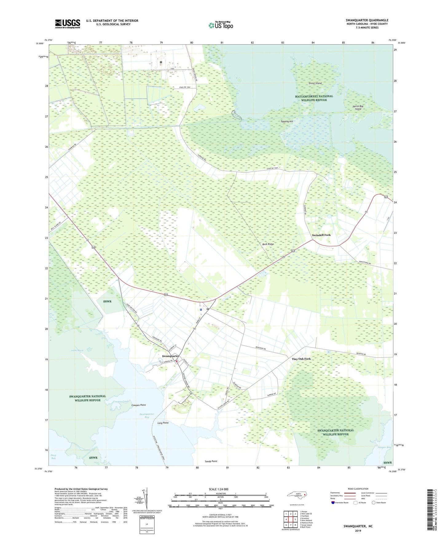
2019 topographic map quadrangle Swanquarter in the state of North Carolina. Scale: 1:24000. Based on the newly updated USGS 7.5' US Topo map series, this map is in the following counties: Hyde. The map contains contour data, water features, and other items you are used to seeing on USGS maps, but also has updated roads and other features. This is the next generation of topographic maps. Printed on high-quality waterproof paper with UV fade-resistant inks.
Quads adjacent to this one:
West: Scranton
Northwest: Ponzer
North: New Lake SE
Northeast: Fairfield
East: New Holland
Southeast: Bluff Point
South: Great Island
Southwest: Pamlico Point
Contains the following named places: Bell Island, Buck Ridge, Calvary Church, Cowpen Creek, Cowpen Point, Great Island, Heron Bay Island, Hyde Correctional Institution, Hyde County Emergency Medical Services, Hyde County Schools Administrative Central Office, Hyde County Sheriff's Office, Jobs Chapel, Judith Marsh, Long Point, Oyster Church, Oyster Creek Landing, Piney Grove Church, Rattlesnake Creek, Rose Bay Canal, Rose Bay School, Sandy Point, Shingle Creek, Swan Quarter Census Designated Place, Swan Quarter Volunteer Fire Department, Swanquarter, Swanquarter Post Office, Swanquarter School, Swindell Fork, Tapping Hill, The Haulover, Tiny Oak Fork, Tiny Oak School, ZIP Code: 27885