MyTopo
Pamlico Point North Carolina US Topo Map
Couldn't load pickup availability
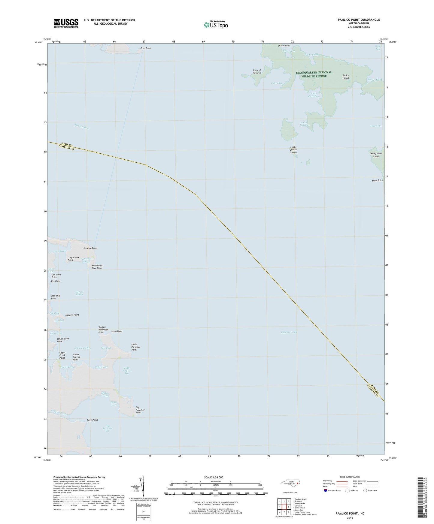
2022 topographic map quadrangle Pamlico Point in the state of North Carolina. Scale: 1:24000. Based on the newly updated USGS 7.5' US Topo map series, this map is in the following counties: Hyde, Pamlico. The map contains contour data, water features, and other items you are used to seeing on USGS maps, but also has updated roads and other features. This is the next generation of topographic maps. Printed on high-quality waterproof paper with UV fade-resistant inks.
Quads adjacent to this one:
West: Lowland
Northwest: Pamlico Beach
North: Scranton
Northeast: Swanquarter
East: Great Island
South: Little Fishing Point
Southwest: Jones Bay
This map covers the same area as the classic USGS quad with code o35076c4.
Contains the following named places: Bernice Creek, Big Porpoise Bay, Big Porpoise Point, Cedar Creek, Cedar Creek Point, Deep Bay, Deep Cove, Drum Cove, Fate Cove, Flat Cove, Hog Cove, Hogpen Point, House Cove, House Cove Point, Island Creeks, Island Creeks Point, Jenkins Cove, Judith Island, Judith Narrows, Kirk Point, Lighthouse Creek, Little Judith Islands, Little Porpoise Bay, Little Porpoise Point, Long Creek, Long Creek Point, Middle Creek, Mouse Harbor, North Cove, Oak Cove, Oak Cove Point, Pamlico Point, Pamlico River, Persimmon Tree Point, Point of Narrows, Porpoise Creek, Roos Point, Sage Point, Shell Hill Point, Sound Point, Southward Bay, The Blowout, Tolers Bay, Voliva Cove, White Perch Bay, Yaupon Hammock Point