MyTopo
Thurmond North Carolina US Topo Map
Couldn't load pickup availability
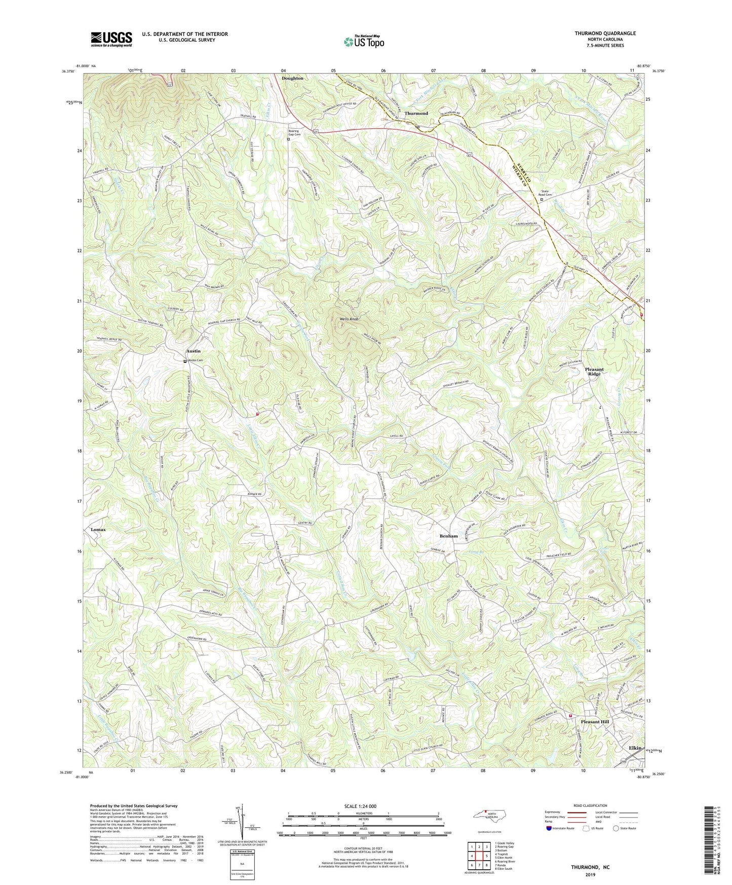
2019 topographic map quadrangle Thurmond in the state of North Carolina. Scale: 1:24000. Based on the newly updated USGS 7.5' US Topo map series, this map is in the following counties: Wilkes, Surry. The map contains contour data, water features, and other items you are used to seeing on USGS maps, but also has updated roads and other features. This is the next generation of topographic maps. Printed on high-quality waterproof paper with UV fade-resistant inks.
Quads adjacent to this one:
West: Traphill
Northwest: Glade Valley
North: Roaring Gap
Northeast: Bottom
East: Elkin North
Southeast: Elkin South
South: Ronda
Southwest: Roaring River
Contains the following named places: Austin, Austin Volunteer Fire Department, Benham, Benham Church, Brewers Store, Carter Falls, Charity Church, Cool Springs Baptist Church, Doughton, Eller School, Grassy Fork, Hoots Mill, Knobs Baptist Church, Knobs Cemetery, Little Elkin Church, Long Branch, Miners Ridge School, Mining Ridge Church, North Prong South Fork Mitchell River, Oak Level Church, Pleasant Grove Church, Pleasant Hill, Pleasant Hill Census Designated Place, Pleasant Hill Volunteer Fire Department, Pleasant Home Church, Pleasant Ridge, Roaring Gap Cemetery, Roaring Gap Church, Sandy Creek Church, Shoaly Branch Baptist Church, State Road Cemetery, State Road Church, State Road Primitive Baptist Church, State Road Volunteer Fire Department, Thurmond, Thurmond Post Office, Township of Edwards, Union Church, Wells Knob, White Rock Church, ZIP Code: 28621