MyTopo
Elkin North North Carolina US Topo Map
Couldn't load pickup availability
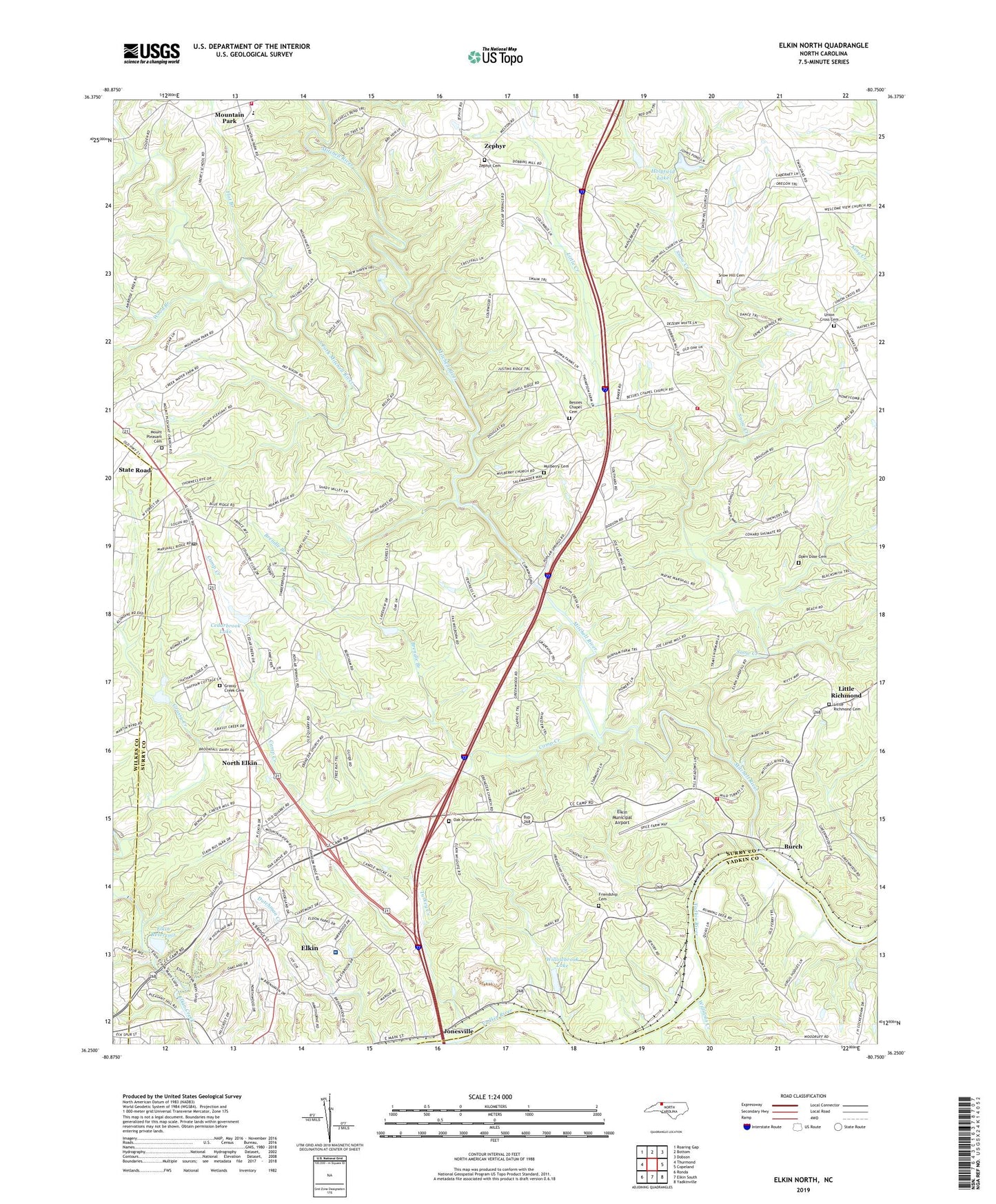
2022 topographic map quadrangle Elkin North in the state of North Carolina. Scale: 1:24000. Based on the newly updated USGS 7.5' US Topo map series, this map is in the following counties: Surry, Yadkin, Wilkes. The map contains contour data, water features, and other items you are used to seeing on USGS maps, but also has updated roads and other features. This is the next generation of topographic maps. Printed on high-quality waterproof paper with UV fade-resistant inks.
Quads adjacent to this one:
West: Thurmond
Northwest: Roaring Gap
North: Bottom
Northeast: Dobson
East: Copeland
Southeast: Yadkinville
South: Elkin South
Southwest: Ronda
This map covers the same area as the classic USGS quad with code o36080c7.
Contains the following named places: Allens Iron Works, Bakers Mill, Bessies Chapel Baptist Church, Bessies Chapel Cemetery, Bradley Mill, Brendle Branch, Burch, Camp Creek, Cc Camp Volunteer Fire Department, Cedarbrook Country Club, Cedarbrook Lake, Cedarbrook Lake Dam, Crestwood Memorial Park, Elkin Municipal Airport, Elkin Quarry, Elkin Rescue Squad, Elkin Reservoir, Elkin Valley, Elkin Valley Church, Flat Branch, Friendship Baptist Church, Friendship Cemetery, Full Gospel Church, Grassy Creek, Grassy Creek Cemetery, Grassy Creek Methodist Church, Gum Orchard Baptist Church, Holyfield Lake, Holyfield Lake Dam, Hugh Chatham Memorial Hospital, Jot - Um - Down Volunteer Fire Department, Lineberry Creek, Little Creek, Little Richmond, Little Richmond Baptist Church, Little Richmond Cemetery, Mitchell River, Mount Pleasant Baptist Church, Mount Pleasant Cemetery, Mountain Park, Mountain Park Baptist Church, Mountain Park Elementary School, Mountain Park Institute, Mountain Park Methodist Church, Mountain Park Rescue Squad and Fire Station, Mulberry, Mulberry Cemetery, Mulberry Primitive Baptist Church, North Elkin, North Elkin Elementary School, Oak Grove Cemetery, Open Door Cemetery, Open Door Missionary Baptist Church, Poplar Springs, Poplar Springs Church, Rusk, Snow Creek, Snow Hill Baptist Church, Snow Hill Cemetery, South Fork Mitchell River, State Road, State Road Post Office, Surry County Emergency Services Station 3, Town of Elkin, Township of Elkin, Township of Marsh, Turkey Creek, Union Cross, Union Cross Baptist Church, Union Cross Cemetery, Valley Church, Williams Creek, Williams Pond, Williams Pond Dam, Willowbrook Lake, Wood Branch, Zephyr, Zephyr Cemetery, Zephyr School, ZIP Code: 28676