MyTopo
Elkin South North Carolina US Topo Map
Couldn't load pickup availability
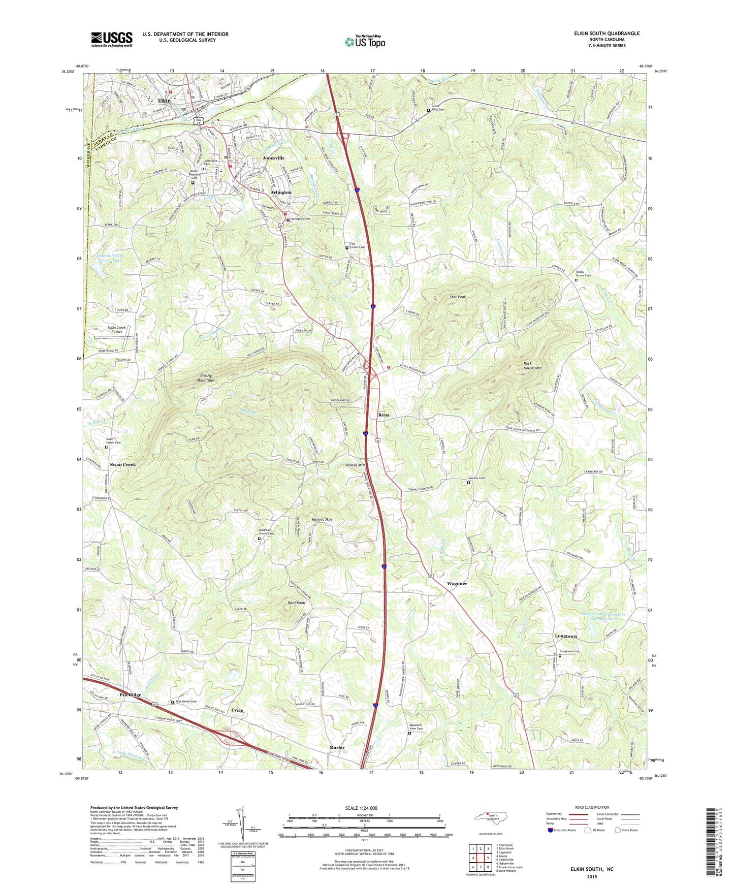
2022 topographic map quadrangle Elkin South in the state of North Carolina. Scale: 1:24000. Based on the newly updated USGS 7.5' US Topo map series, this map is in the following counties: Yadkin, Surry, Wilkes. The map contains contour data, water features, and other items you are used to seeing on USGS maps, but also has updated roads and other features. This is the next generation of topographic maps. Printed on high-quality waterproof paper with UV fade-resistant inks.
Quads adjacent to this one:
West: Ronda
Northwest: Thurmond
North: Elkin North
Northeast: Copeland
East: Yadkinville
Southeast: Lone Hickory
South: Brooks Crossroads
Southwest: Osbornville
This map covers the same area as the classic USGS quad with code o36080b7.
Contains the following named places: Arlington, Arlington Cemetery, Arlington Fire and Rescue Station 1, Arlington First Baptist Church, Arnold Branch, Arnold Mountain, Bald Knob, Beaverdam Creek, Calvary Church, Central School, Cobb Creek, Cycle, Deep Creek W/S Structure Number Six B, Deep Creek W/S Structure Number Six B Dam, Dutchman Creek, Elkin, Elkin City Park, Elkin Creek, Elkin Elementary School, Elkin Fire Department, Elkin High School, Elkin Police Department, Elkin Post Office, Elkin Village Shopping Center, Evans School, Fall Creek, Fall Creek Baptist Church, Fall Creek Cemetery, First Baptist Church, Gross Mill, Haynes School, Hemric Mountain, Highland Orchards, Hollemen School, Howell School, Island Ford Baptist Church, Island Ford Cemetery, Jonesville, Jonesville Cemetery, Jonesville Creek, Jonesville Elementary School, Jonesville Golf Course Lake, Jonesville Golf Course Lake Dam, Jonesville Post Office, Jonesville Volunteer Fire Department, Knobbs School, KnobsTownship, Longtown, Longtown Cemetery, Longtown Methodist Church, Marler, Mount Pleasant Cemetery, Mount Pleasant Church, Mountain Grove Cemetery, Mountain Grove Methodist Church, Mountain View Baptist Church, Mountain View Cemetery, Oak Grove Baptist Church, Oak Grove Cemetery, Pea Ridge, Rena, Rock House Mountain, Sandyberry Creek, Shady Grove Baptist Church, Shady Grove Cemetery, Star Peak, Star Peak School, Starmount High School, Swaims Baptist Church, Swaims Cemetery, Swan Creek, Swan Creek Airport, Swan Creek Baptist Church, Swan Creek Baptist Church Cemetery, Town of Arlington, Town of Jonesville, Township of North Buck Shoals, Township of North Knobs, Township of South Knobs, Wagoner, WIFM-AM (Elkin), WIFM-FM (Elkin), ZIP Code: 28642