MyTopo
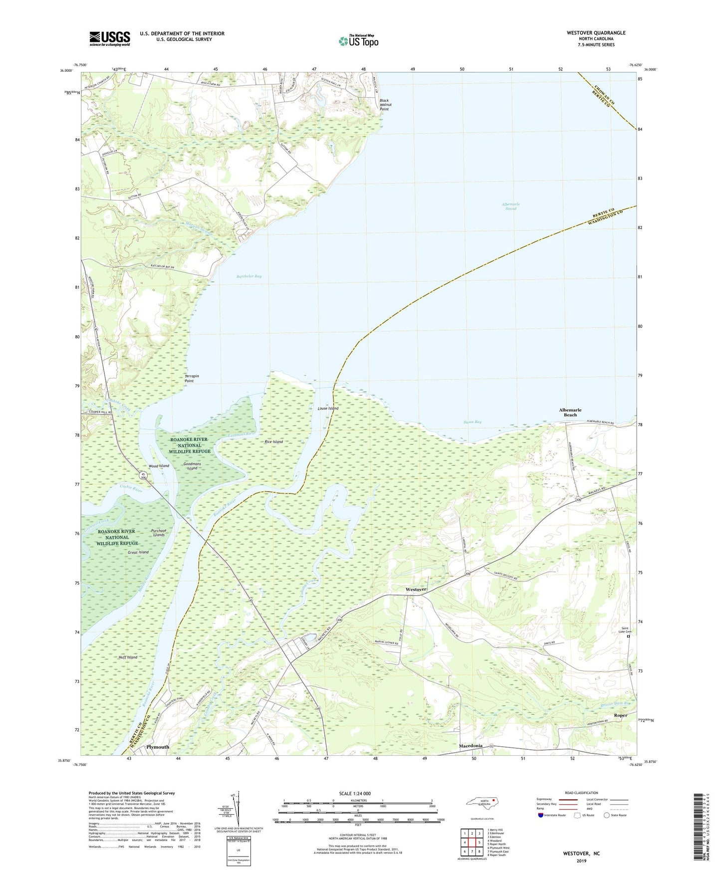
Westover North Carolina US Topo Map
Couldn't load pickup availability
2019 topographic map quadrangle Westover in the state of North Carolina. Scale: 1:24000. Based on the newly updated USGS 7.5' US Topo map series, this map is in the following counties: Washington, Bertie, Chowan. The map contains contour data, water features, and other items you are used to seeing on USGS maps, but also has updated roads and other features. This is the next generation of topographic maps. Printed on high-quality waterproof paper with UV fade-resistant inks.
Quads adjacent to this one:
West: Woodard
Northwest: Merry Hill
North: Edenhouse
Northeast: Edenton
East: Roper North
Southeast: Roper South
South: Plymouth East
Southwest: Plymouth West
Contains the following named places: Albemarle Beach, Batchelor Bay, Black Walnut Point, Buncombe Hall, Cashie River, Cashoke Creek, Cashoke Landing, Conaby Creek, Eastmost River, Elmwood, Freemans Landing, Goodmans Island, Great Island, Grennell Creek, Huff Island, Louse Island, Macedonia, Macedonia Church, Middle River, Morgan Swamp, Mount Delane Church, Peterson, Purchase Islands, Rice Island, Riverside Airport, Roanoke River, Saint Luke Cemetery, Saints Delight Church, Socona Church, Swain, Swan Bay, Terrapin Point, Tidewater Experiment Station, Westover, White Marsh Church, Wood Island, Zion Chapel