MyTopo
Edenhouse North Carolina US Topo Map
Couldn't load pickup availability
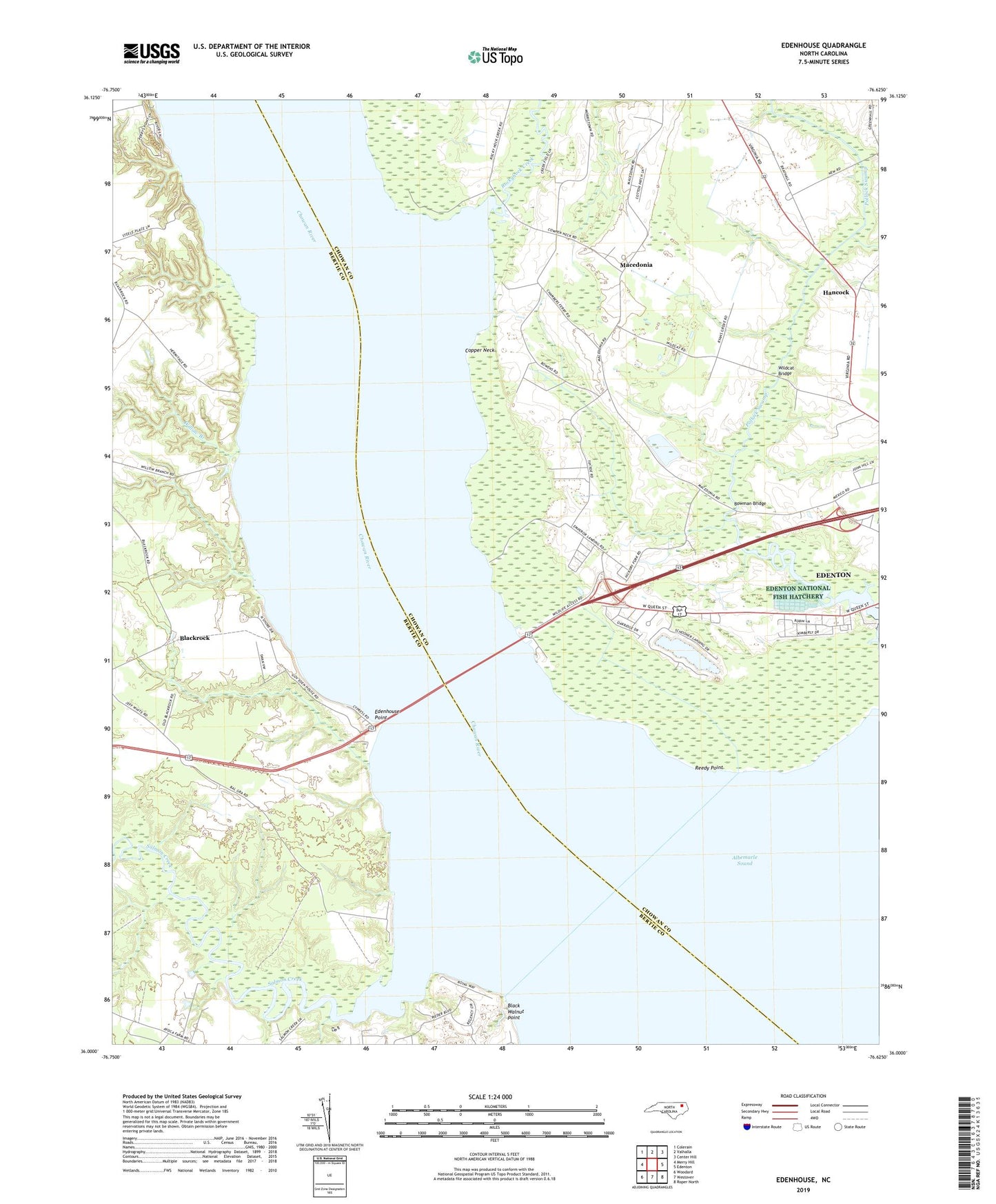
2022 topographic map quadrangle Edenhouse in the state of North Carolina. Scale: 1:24000. Based on the newly updated USGS 7.5' US Topo map series, this map is in the following counties: Chowan, Bertie. The map contains contour data, water features, and other items you are used to seeing on USGS maps, but also has updated roads and other features. This is the next generation of topographic maps. Printed on high-quality waterproof paper with UV fade-resistant inks.
Quads adjacent to this one:
West: Merry Hill
Northwest: Colerain
North: Valhalla
Northeast: Center Hill
East: Edenton
Southeast: Roper North
South: Westover
Southwest: Woodard
This map covers the same area as the classic USGS quad with code o36076a6.
Contains the following named places: Avoca, Ball Grey Landing, Bennett Mill Pond, Bennett Mill Pond Dam, Black Rock Fishery, Blackrock, Bowman Bridge, Capeharts Fishery, Chambers Landing, Chowan River, Copper Neck, Countryside Church of Christ, Edenhouse, Edenhouse Point, Edenton National Fish Hatchery, Emperor Landing, First Assembly of God Church, Freemans Landing, Hancock, Hermitage Wharf, Hoffman Chapel, Lawrence Landing, Littledals Ferry Site, Macedonia, Macedonia Church, Mount Gould Landing, Oxley Hill Church, Peterson Church, Pollock Swamp, Reedy Point, Rockyhock Creek, Salmon Creek, Steele Landing, Todd Landing, Township 1-Edenton, Wildcat Bridge, Wildcat Church, Wilder Landing, Willifords Landing, Willis Landing, Willow Branch, Willow Branch Landing