MyTopo
Williams North Carolina US Topo Map
Couldn't load pickup availability
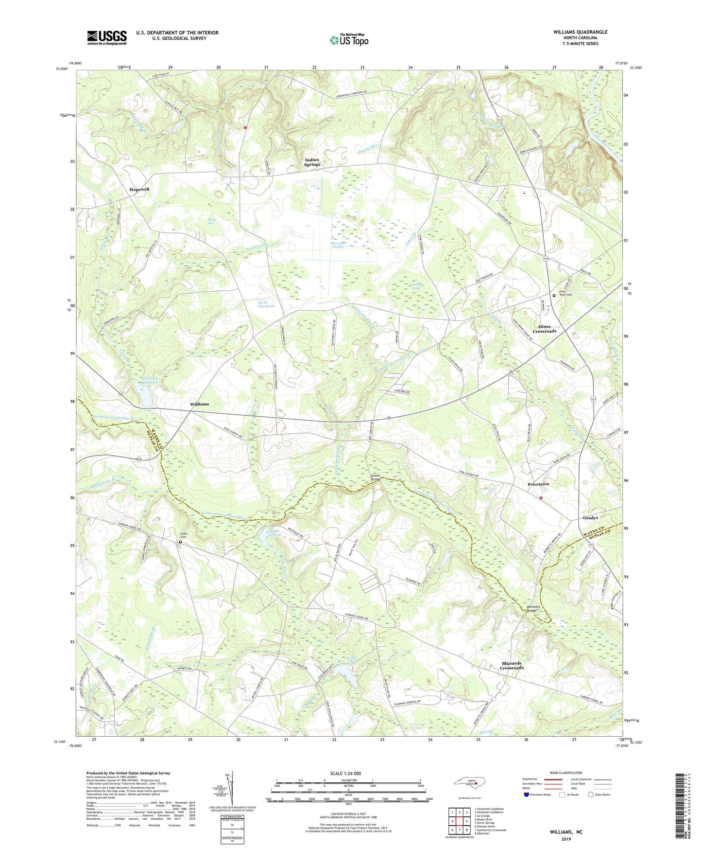
2019 topographic map quadrangle Williams in the state of North Carolina. Scale: 1:24000. Based on the newly updated USGS 7.5' US Topo map series, this map is in the following counties: Wayne, Duplin. The map contains contour data, water features, and other items you are used to seeing on USGS maps, but also has updated roads and other features. This is the next generation of topographic maps. Printed on high-quality waterproof paper with UV fade-resistant inks.
Quads adjacent to this one:
West: Mount Olive
Northwest: Southwest Goldsboro
North: Southeast Goldsboro
Northeast: La Grange
East: Seven Springs
Southeast: Albertson
South: Summerlins Crossroads
Southwest: Warsaw North
Contains the following named places: Bennetts Bridge, Best Chapel, Blizzards Crossroads, Briar Bed, Camp Eagles West, Camp Jubilee, Cliffs of the Neuse State Park, Deavers Pond, Devils Woodyard, Garners Chapel, Gradys, Grants Chapel, Green Branch, Hines Crossroads, Holly Lake Dam, Hopewell, Horsepen Branch, Horsepen Pocosin, Indian Springs, Indian Springs Volunteer Fire Department, Jones Cemetery, Jones Chapel, Jumping Juniper Branch, Jumping Run Branch, Juniper Pond, Ladds Branch, Lake Genele Dam, Lewis Branch, Pineview Cemetery, Polly Run Creek, Powell Run, Pricetown, Pricetown Volunteer Fire Department, Rattlesnake Branch, Run Branch, Shines Bridge, Smiths Chapel, Spring Creek School, Tommy Reed Creek, Township of Indian Springs, Township of Wolfscrape, Tuscarora Camp, Wayne Chapel, Whitfields Pond, Williams, Williams Millpond, Williams Millpond Dam, Wolfscrape Branch, Zion Church