MyTopo
Albertson North Carolina US Topo Map
Couldn't load pickup availability
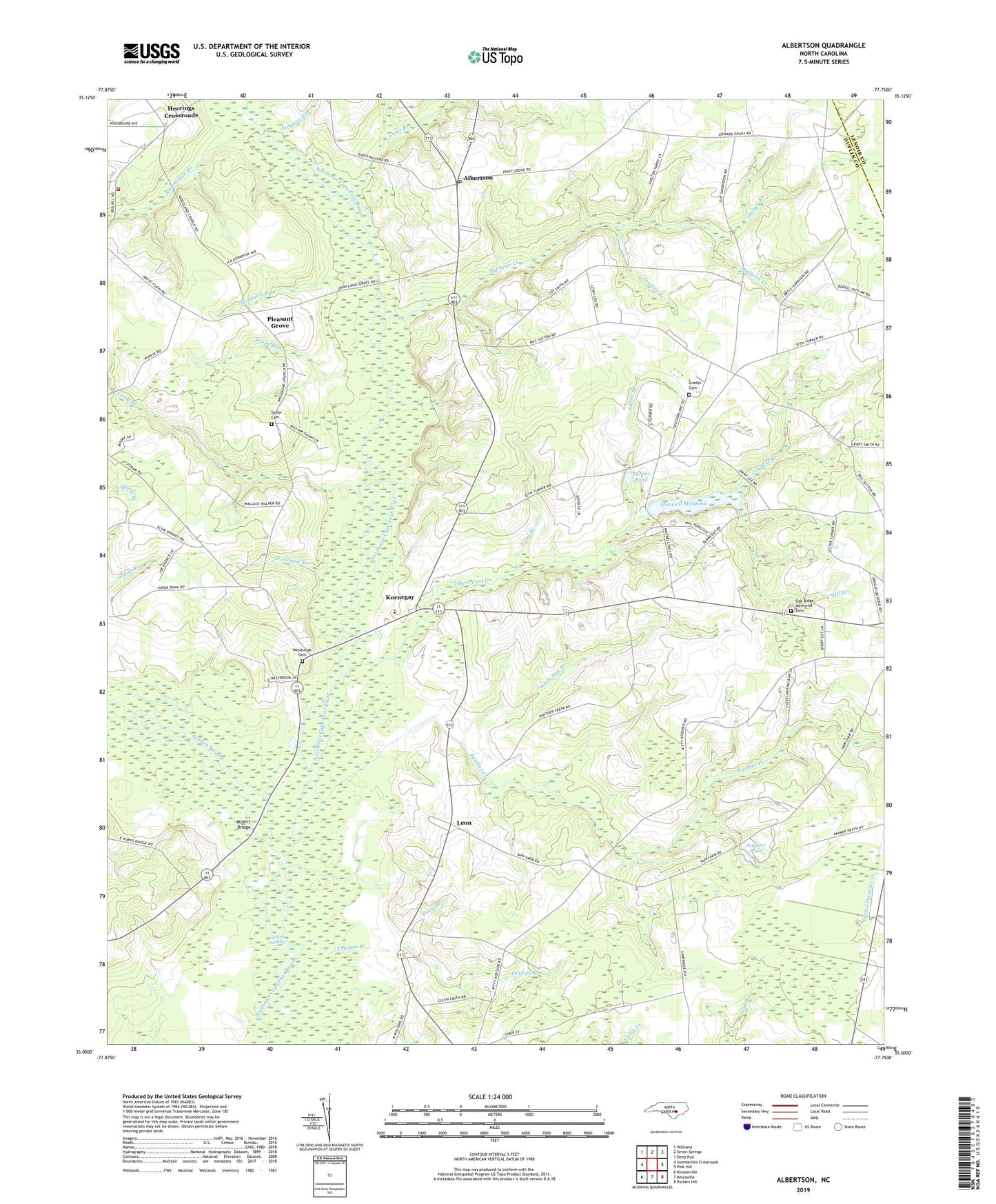
2022 topographic map quadrangle Albertson in the state of North Carolina. Scale: 1:24000. Based on the newly updated USGS 7.5' US Topo map series, this map is in the following counties: Duplin, Lenoir. The map contains contour data, water features, and other items you are used to seeing on USGS maps, but also has updated roads and other features. This is the next generation of topographic maps. Printed on high-quality waterproof paper with UV fade-resistant inks.
Quads adjacent to this one:
West: Summerlins Crossroads
Northwest: Williams
North: Seven Springs
Northeast: Deep Run
East: Pink Hill
Southeast: Potters Hill
South: Beulaville
Southwest: Kenansville
This map covers the same area as the classic USGS quad with code o35077a7.
Contains the following named places: Albertson, Albertson Adult Education Center, Albertson Post Office, Albertson Volunteer Fire Department, Beaverdam Branch, Bethany Church, Branch School, Burn Coat Creek, Camp Branch, Cowhole Branch, Deavers Chapel, Duplin County Emergency Medical Services Medic 6, Friendship Church, Goshen Swamp, Grady High School, Gradys Cemetery, Great Branch, Harper-Southerland Memorial Church, Hebron Church, Herrings Crossroads, Horsepen Branch, Housland Branch, Jenkins Pond, Jones Chapel, Jumping Run, Juniper Branch, Kornegay, Leon, Long Branch, Mathews Creek, Maxwell Millpond, Mill Branch, Millers Bridge, Oak Ridge Memorial Cemetery, Panther Creek, Piney Grove Church, Pink Hill Lookout Tower, Pleasant Grove, Pleasant Grove Volunteer Fire Department, Poley Branch, Resaca, Salem Chapel, Sandy Run, Sawyer Branch, Smiths Church, Sutton Branch, Tandam Branch, Township of Albertson, Township of Smith, Turner Pond, Westbrook Cemetery, White Oak Branch, Will Taylor Cemetery, Woodland Church, ZIP Code: 28508