MyTopo
Winstead Crossroads North Carolina US Topo Map
Couldn't load pickup availability
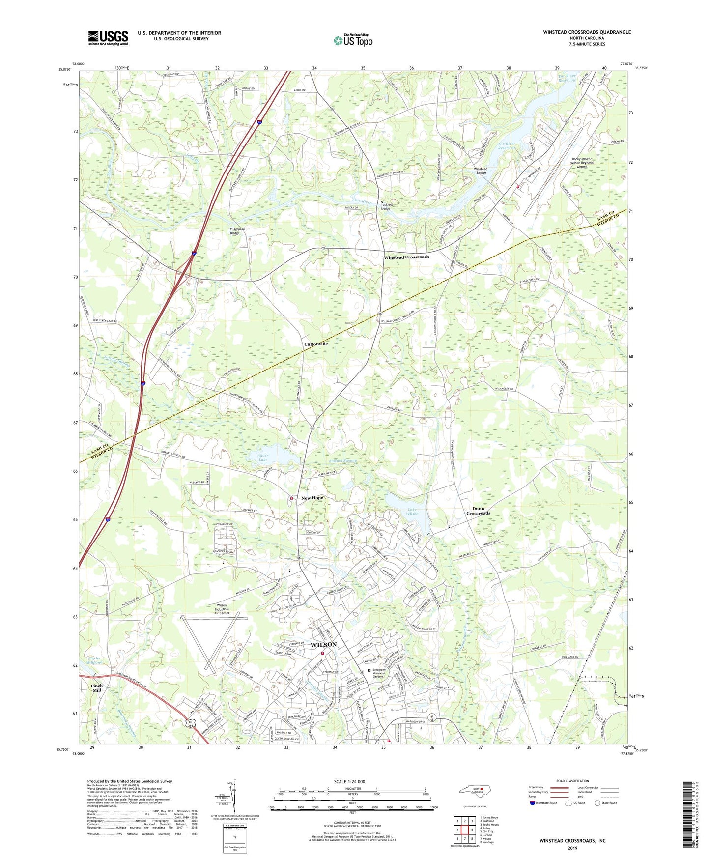
2019 topographic map quadrangle Winstead Crossroads in the state of North Carolina. Scale: 1:24000. Based on the newly updated USGS 7.5' US Topo map series, this map is in the following counties: Wilson, Nash. The map contains contour data, water features, and other items you are used to seeing on USGS maps, but also has updated roads and other features. This is the next generation of topographic maps. Printed on high-quality waterproof paper with UV fade-resistant inks.
Quads adjacent to this one:
West: Bailey
Northwest: Spring Hope
North: Nashville
Northeast: Rocky Mount
East: Elm City
Southeast: Saratoga
South: Wilson
Southwest: Lucama
Contains the following named places: Ascension Church, Branshermill, Brentwood Forest, Brentwood Shopping Center, Carters School, Carters Store, Cliftonville, Cockrell Bridge, Colonial Heights, Country Club Colony, Covenant Church, Deerfield, Dew Field, Dunn Crossroads, Elizabeth Heights, Ellis Church, Evergreen Memorial Gardens, Finch Mill, Finchs Millpond, Finchs Millpond Dam, Gethsemane Church, Jacob Branch, Jerusalem Church, Lake Wilson, Lake Wilson Dam, Long Branch, Merrimont, Mount Hermon Church, Mount Zion Church, New Hope, New Hope Elementary School, Newton Park, Northside, Oak Crest, Peace Church, Pine Haven, Pineview Acres, Ponderosa, Pridgen School, Ralph L Fike High School, Rhodes Store, Rick Grove Church, Rocky Mount Wilson Airport Rescue Fire Department, Rocky Mount-Wilson Regional Airport, Saint Matthew Church, Sandy Fork Church, Sherwood Forest, Silver Lake, Silver Lake Dam, Silver Lake Volunteer Fire Department, Spring Lake, Stoneybrook, Sugar Hill School, Tar River Church, Tar River Reservoir, Tar River School, Taylor School, Thompson Bridge, Thompson Church, Thompson Mill, Thorpshire Farm, Township of Taylors, Vaughans Church, Vaughans School, West Nash Church, Westmoreland, Westmoreland church, White Fox, Williams Church, Wilson Country Club, Wilson Industrial Air Center, Wilson Rescue Fire Department Station 4, Wilson Rescue Fire Department Station 5, Windemere Mobile Homes, Winstead Bridge, Winstead Crossroads, WLLY-AM (Wilson), Wood Airport, Wrenn Village Shopping Center, ZIP Code: 27896