MyTopo
Woodard North Carolina US Topo Map
Couldn't load pickup availability
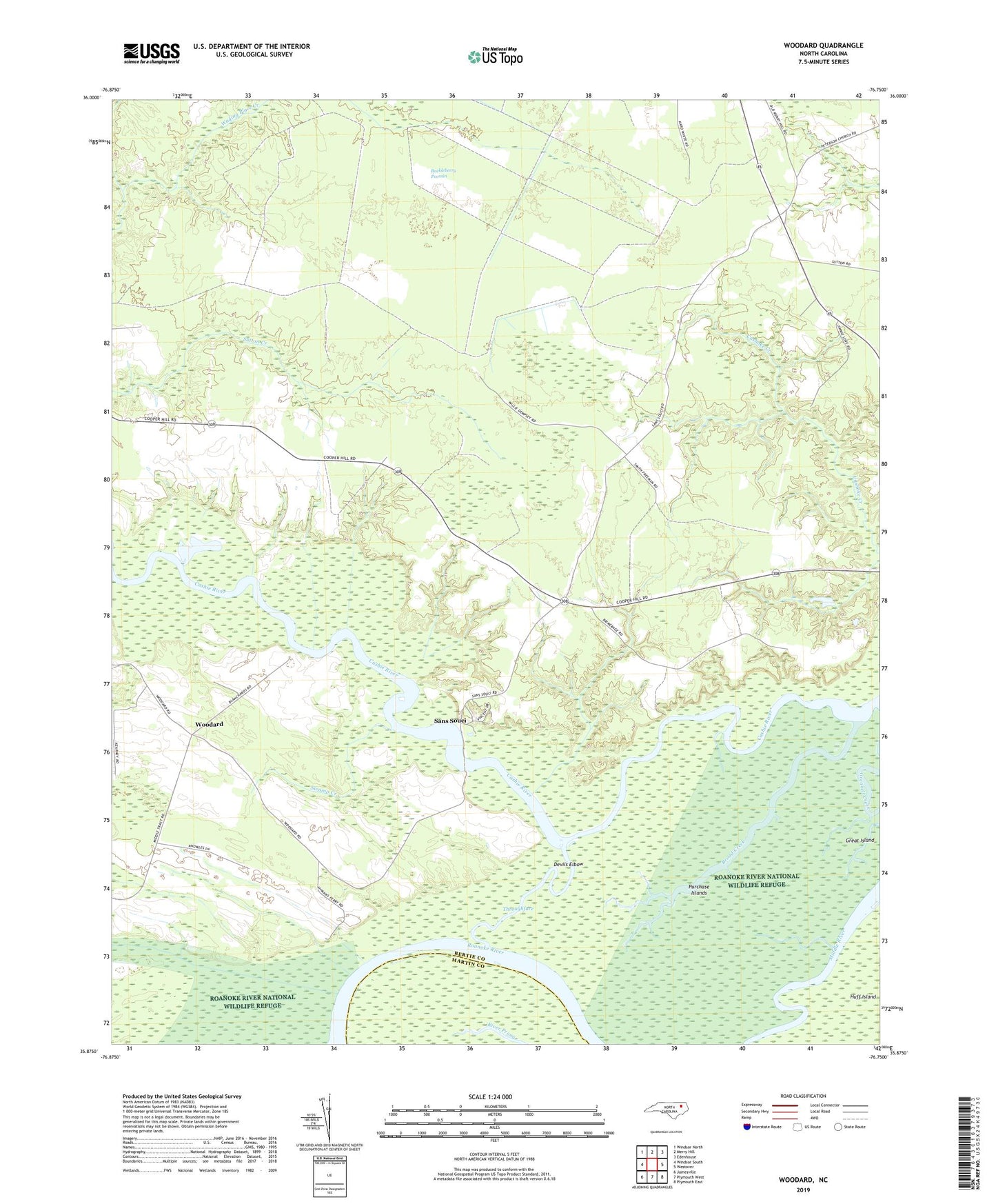
2019 topographic map quadrangle Woodard in the state of North Carolina. Scale: 1:24000. Based on the newly updated USGS 7.5' US Topo map series, this map is in the following counties: Bertie, Martin. The map contains contour data, water features, and other items you are used to seeing on USGS maps, but also has updated roads and other features. This is the next generation of topographic maps. Printed on high-quality waterproof paper with UV fade-resistant inks.
Quads adjacent to this one:
West: Windsor South
Northwest: Windsor North
North: Merry Hill
Northeast: Edenhouse
East: Westover
Southeast: Plymouth East
South: Plymouth West
Southwest: Jamesville
Contains the following named places: Broad Creek, Buckleberry Pocosin, Cashie Church, Cooper Landing, Devils Elbow, Hardens Pond, Hymans Ferry Site, Jacocks Landing, John Law School, Lawrence Church, Mount Pleasant Church, Saint Lukes Church, Saint Pauls Church, Sans Souci, Sans Souci Ferry, Smithwick Landing, Swamp Creek, Throughfare, Township of Merry Hill, Woodard