MyTopo
Robbins North Carolina US Topo Map
Couldn't load pickup availability
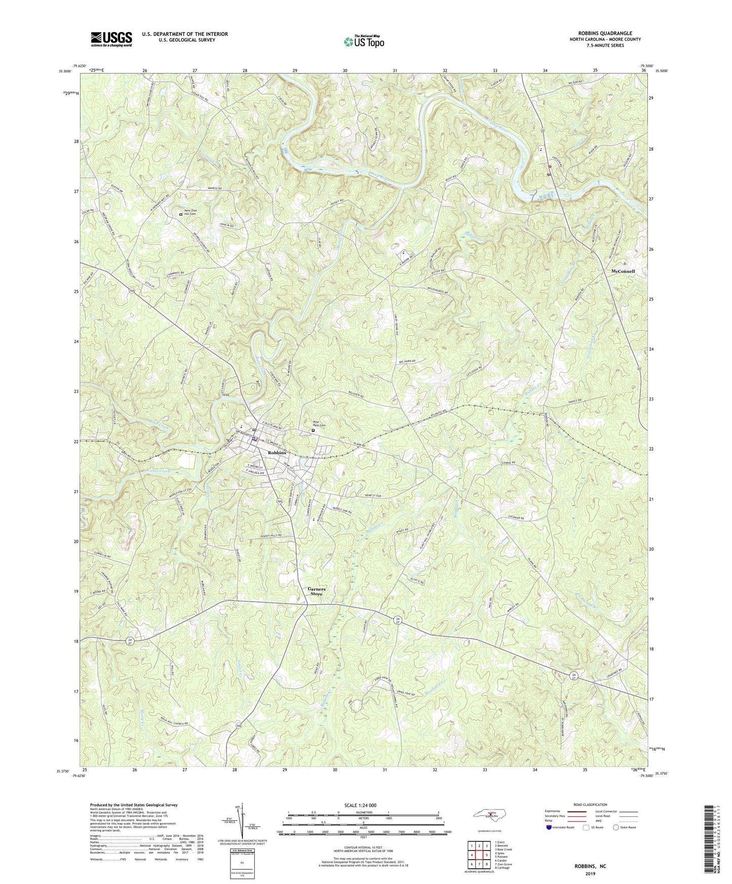
2022 topographic map quadrangle Robbins in the state of North Carolina. Scale: 1:24000. Based on the newly updated USGS 7.5' US Topo map series, this map is in the following counties: Moore. The map contains contour data, water features, and other items you are used to seeing on USGS maps, but also has updated roads and other features. This is the next generation of topographic maps. Printed on high-quality waterproof paper with UV fade-resistant inks.
Quads adjacent to this one:
West: Spies
Northwest: Erect
North: Bennett
Northeast: Bear Creek
East: Putnam
Southeast: Carthage
South: Zion Grove
Southwest: Candor
This map covers the same area as the classic USGS quad with code o35079d5.
Contains the following named places: Acorn Ridge Church, Bear Creek, Bear Creek Church, Bellview Church, Bright Light Church, Buck Branch, Buffalo Creek, Cabin Creek, Calvary Church, Camp Calvary Church, Cedar Creek, Collins Chapel, Crossroads Church, Elise School, Falls Creek, Flint Hill Church, Friends Church, Garners Store, Gold Mine Branch, Grassy Creek, High Falls, High Falls Church, High Falls Elementary School, Highfalls Fire and Rescue, Highfalls Post Office, Marleys Branch, McConnell, Meadow Creek, Moore County Emergency Medical Services Base 1, New Hope Church, New Zion Church, New Zion Hill Cemetery, North Moore School, Pine Rest Cemetery, Pleasant Hill Church, Pleasant View Church, Robbins, Robbins Elementary School, Robbins Fire and Rescue Department, Robbins Police Department, Robbins Post Office, Robbins Rescue Squad 10, Rock Hill Church, Simlin Creek, Smyrna Church, Town of Robbins, Township 4-Ritter, Unity Grove Church, ZIP Code: 27325