MyTopo
Arthur North Dakota US Topo Map
Couldn't load pickup availability
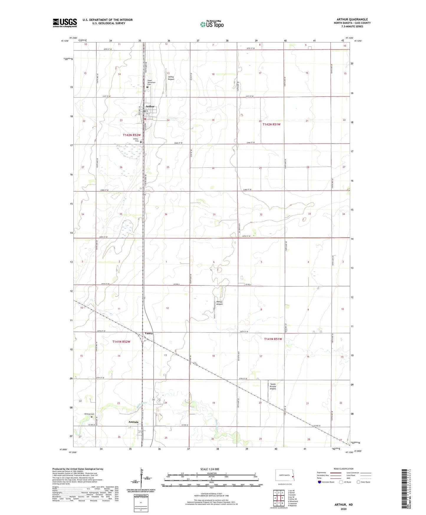
2024 topographic map quadrangle Arthur in the state of North Dakota. Scale: 1:24000. Based on the newly updated USGS 7.5' US Topo map series, this map is in the following counties: Cass. The map contains contour data, water features, and other items you are used to seeing on USGS maps, but also has updated roads and other features. This is the next generation of topographic maps. Printed on high-quality waterproof paper with UV fade-resistant inks.
Quads adjacent to this one:
West: Ayr SE
Northwest: Ayr NE
North: Hunter
Northeast: Grandin
East: Arthur SE
Southeast: Mapleton
South: Casselton
Southwest: Wheatland
This map covers the same area as the classic USGS quad with code o47097a2.
Contains the following named places: Amenia, Amenia Cemetery, Arthur, Arthur Airport, Arthur Cemetery, Arthur City Hall, Arthur Community Hall, Arthur Post Office, Arthur Rural Fire Protection District Station, City of Amenia, City of Arthur, Good Samaritan Cemetery, Good Samaritan Society-Arthur, KDSU-FM (Fargo), KFME-TV (Fargo), Nelson Airport, Smith Private Airport, Township of Gunkel, Township of Rush River, Turner Field, Vance, WDAY-FM (Fargo), WDAY-TV (Fargo), ZIP Code: 58006