MyTopo
Arvilla North Dakota US Topo Map
Couldn't load pickup availability
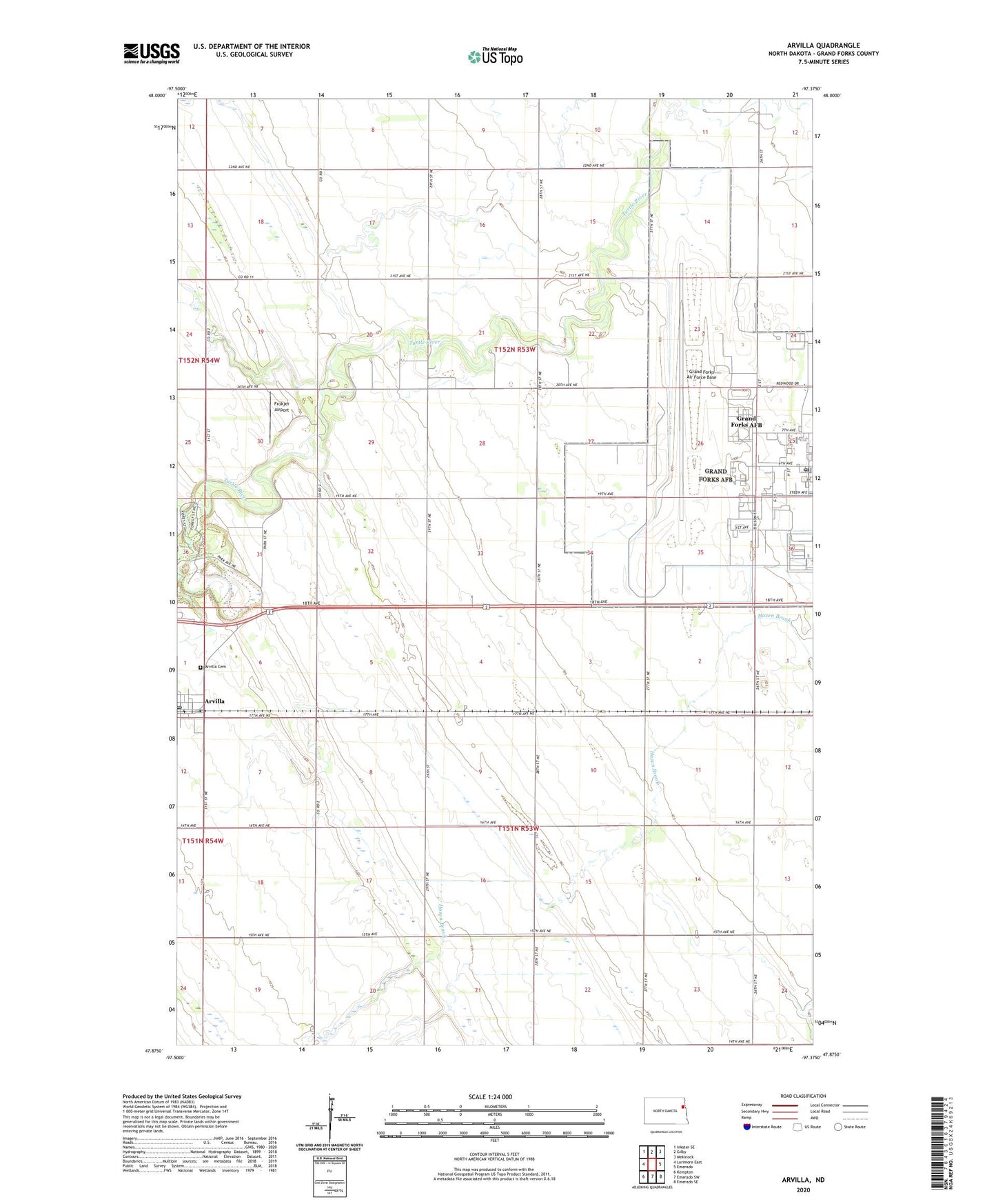
2024 topographic map quadrangle Arvilla in the state of North Dakota. Scale: 1:24000. Based on the newly updated USGS 7.5' US Topo map series, this map is in the following counties: Grand Forks. The map contains contour data, water features, and other items you are used to seeing on USGS maps, but also has updated roads and other features. This is the next generation of topographic maps. Printed on high-quality waterproof paper with UV fade-resistant inks.
Quads adjacent to this one:
West: Larimore East
Northwest: Inkster SE
North: Gilby
Northeast: Mekinock
East: Emerado
Southeast: Emerado SE
South: Emerado SW
Southwest: Kempton
This map covers the same area as the classic USGS quad with code o47097h4.
Contains the following named places: Arvilla, Arvilla Cemetery, Arvilla Community Center, Arvilla Post Office, Frokjer Airport, Grand Forks AFB Post Office, Grand Forks Air Force Base, Grand Forks Air Force Base Census Designated Place, Grand Forks County, Township of Chester, Township of Mekinock, ZIP Codes: 58204, 58205, 58214